2020s Maps of Litchfield, Minnesota
Explore 4 historic maps of Litchfield from the 2020s. These maps offer a rare glimpse into what life looked like during the 2020s — showing old roads, neighborhoods, homes, and landmarks that have changed or disappeared over time.
Whether you're researching your family's past, planning a metal detecting trip, or studying how Litchfield's landscape evolved across the 2020s, these high-resolution maps are a powerful tool for exploring the history of this region.
- Focus on a specific era: All maps on this page are from the 2020s, giving you a focused view of this time period.
- See what’s changed: Compare century-old streets, trails, and buildings to today's modern landscape using overlays and satellite layers.
- Research with precision: Use these maps for genealogy, historical research, land use analysis, or educational projects.
- View, download, or print: Maps are fully viewable online in high resolution, and can be downloaded or printed for your own records.
Start exploring Litchfield's history through authentic maps from the 2020s. This is your window into the past.
Litchfield, MN maps
(4)- 2022 Map of Forest City, 2022 Print
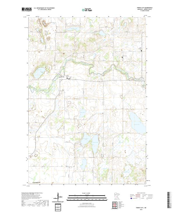 2022 Forest City2022 Print · USGSMeeker County's rural landscape is captured in the early 2020s, showing the enduring agricultural patterns of the Minnesota prairie. Genealogists can locate family sites at Saint Gertrude Cem or Forest City Cem and trace the winding North Fork Crow River.
 - 2022 Map of Litchfield South, 2022 Print
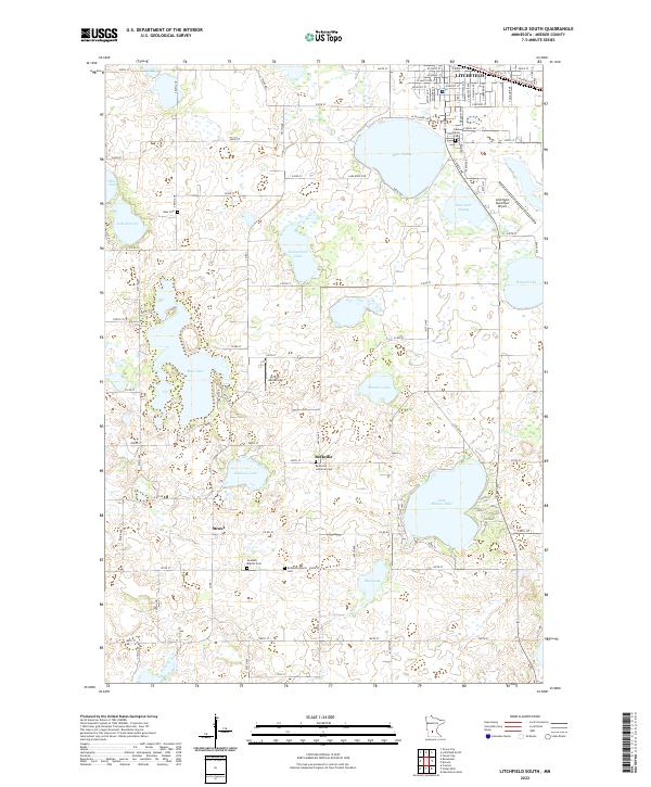 2022 Litchfield South2022 Print · USGSMeeker County south of Litchfield is a landscape of glacial lakes and small rural settlements. Genealogists and historians can trace the locations of family-named landmarks and country burial sites like Beckville Lutheran Cem and Swedish Baptist Cem.
 - 2022 Map of Litchfield North, 2022 Print
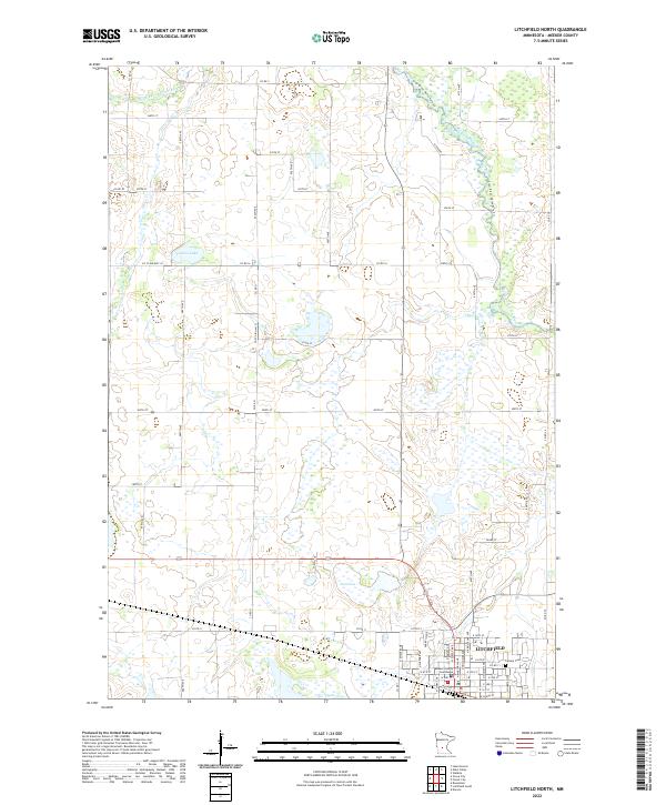 2022 Litchfield North2022 Print · USGSLitchfield and its northern lake country are surveyed here in recent years, showing the town's expansion toward the river forks. Genealogists and local historians can trace the town grid from the Meeker County Courthouse out to Calvary Cem and the banks of Stone Lake.
 - 2022 Map of Darwin, 2022 Print
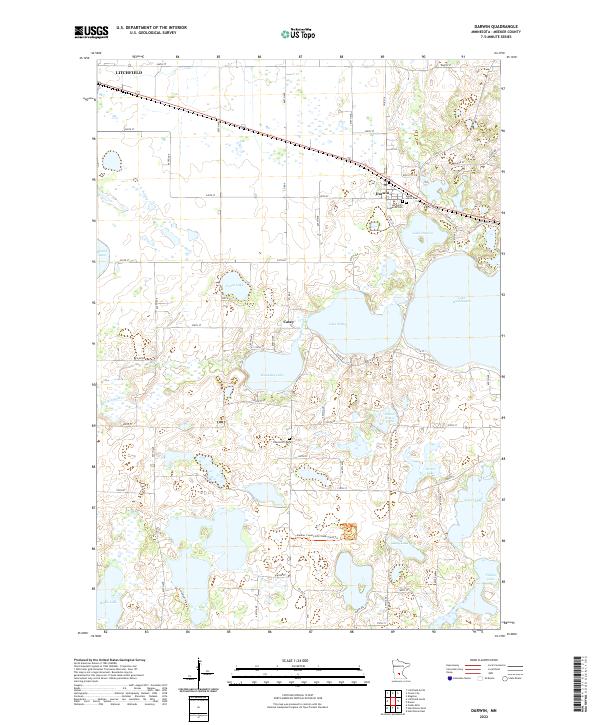 2022 Darwin2022 Print · USGSMeeker County is showcased here in the 2020s, showing the intricate lake system and rural townships surrounding Darwin. Genealogists and historians can trace local landmarks like Ellsworth Cem, the settlement of Casey, and the shores of Lake Stella.
End of results
Showing maps 1-4 of 4
Top cities near Litchfield
- Hutchinson historical maps
- Dassel historical maps
- Watkins historical maps
- Greenleaf historical maps
- Forest City historical maps
- Kimball historical maps
See more
Frequently asked questions
- What are the different types of historical maps available for Litchfield?
- What is the oldest map of Litchfield?
- Where can I purchase historical maps of Litchfield for my home or office?
- Where can I download high-res historical maps of Litchfield?
- Are there historical topographic maps available for Litchfield?
- Is there historical aerial imagery available for Litchfield?
- Where are historical maps of Litchfield sourced from?