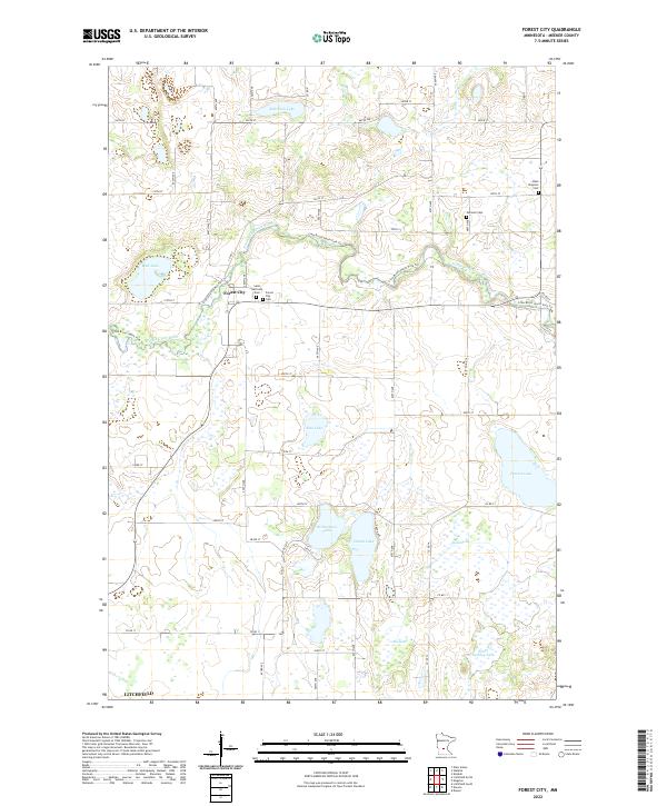
2022 Map of Forest City
USGS Topo · Published 2022About this map
The North Fork Crow River carves a winding path through this portion of Meeker County, defining the agricultural and hydrographic character of the region. The settlement of Forest City serves as a central point of interest, reflecting the early rural organization of the state through its concentration of community sites, including Saint Gertrude Cem and the Forest City Cem. This landscape is defined by its glacial heritage, evidenced by a dense network of water bodies such as Rohrbeck Lake, Richardson Lake, and Dunns Lake.
Find a feature on this map
53 named features on this map. Tap any name to fly to it.
Don’t see what you’re looking for? This feature index may not catch every label — zoom into the map to look around manually.
Map Details
Editions of this 2022 Forest City Map
This is the sole edition of this map. No revisions or reprints were ever made.
Other maps of this area

1953 · Saint Cloud
USGS Topo · 1:250,000

1957 · Saint Cloud
USGS Topo · 1:250,000

1958 · Saint Cloud
USGS Topo · 1:250,000

1958 · Dassel
USGS Topo · 1:62,500

1967 · Litchfield South
USGS Topo · 1:24,000

1967 · Litchfield North
USGS Topo · 1:24,000

1967 · Watkins
USGS Topo · 1:24,000

1967 · Kimball
USGS Topo · 1:24,000
1967 · Eden Valley
USGS Topo · 1:24,000
1982 · Dassel
USGS Topo · 1:24,000