
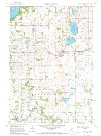
1967 Map of Watkins
USGS Topo · Published 1968About this map
Watkins serves as the primary hub of activity in this Central Minnesota landscape during the late 1960s, situated at the intersection of the Soo Line railroad and local county thoroughfares. The town’s layout, including its Sewage Disposal plant and WT (water tower), reflects a mid-century period of rural municipal development. South of the settlement, the landscape transitions into the glacial depressions of Forest Prairie, dominated by substantial water bodies like Clear Lake and the nearby Little Mud Lake.
Find a feature on this map
19 named features on this map. Tap any name to fly to it.
Don’t see what you’re looking for? This feature index may not catch every label — zoom into the map to look around manually.
Map Details
Editions of this 1967 Watkins Map
This is the sole edition of this map. No revisions or reprints were ever made.
Other maps of this area

1953 · Saint Cloud
USGS Topo · 1:250,000

1957 · Saint Cloud
USGS Topo · 1:250,000

1958 · Saint Cloud
USGS Topo · 1:250,000

1958 · Dassel
USGS Topo · 1:62,500

1967 · Cold Spring
USGS Topo · 1:24,000

1967 · Litchfield North
USGS Topo · 1:24,000

1967 · Richmond
USGS Topo · 1:24,000

1967 · Rockville
USGS Topo · 1:24,000

1967 · Kimball
USGS Topo · 1:24,000
1967 · Eden Valley
USGS Topo · 1:24,000
Featured Places
- Watkins, MN
- Watkins Mobile Home Park, Watkins
- Maine Prairie Township, MN
- Watkins Mobile Home Park, Watkins
- Luxemburg Township, MN