2020s Maps of Mower County, Minnesota
Explore 21 historic maps of Mower County from the 2020s. These maps offer a rare glimpse into what life looked like during the 2020s — showing old roads, neighborhoods, homes, and landmarks that have changed or disappeared over time.
Whether you're researching your family's past, planning a metal detecting trip, or studying how Mower County's landscape evolved across the 2020s, these high-resolution maps are a powerful tool for exploring the history of this region.
- Focus on a specific era: All maps on this page are from the 2020s, giving you a focused view of this time period.
- See what’s changed: Compare century-old streets, trails, and buildings to today's modern landscape using overlays and satellite layers.
- Research with precision: Use these maps for genealogy, historical research, land use analysis, or educational projects.
- View, download, or print: Maps are fully viewable online in high resolution, and can be downloaded or printed for your own records.
Start exploring Mower County's history through authentic maps from the 2020s. This is your window into the past.
Mower County, MN maps
(21)- 2022 Map of High Forest, 2022 Print
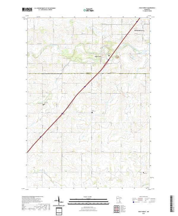 2022 High Forest2022 Print · USGSStewartville and the rural townships of Olmsted and Mower counties are documented here in the early twenty-first century. Researchers can locate several burial grounds including High Forest Cem, Pleasant Valley Cem, and Saint Johns Cem along the Robinson Cr corridor.
 - 2022 Map of High Forest SW, 2022 Print
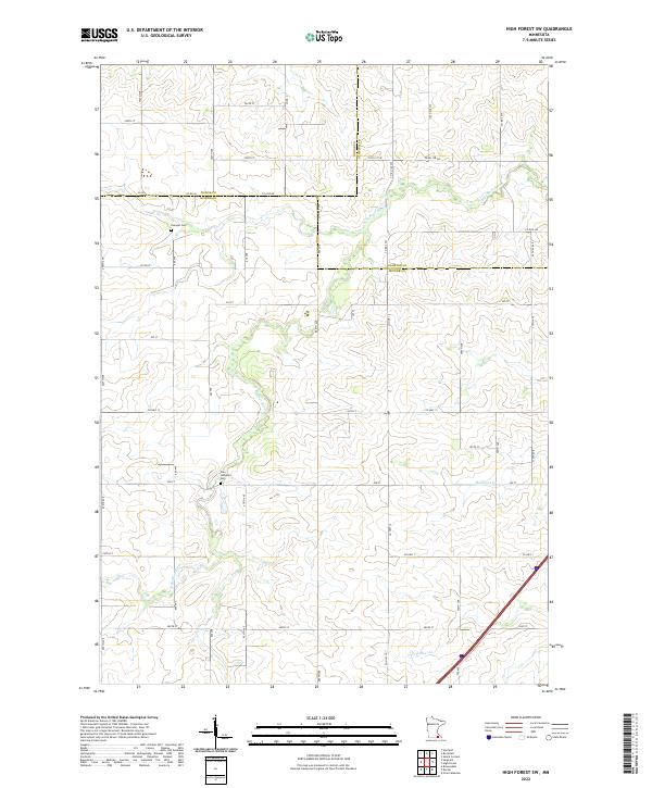 2022 High Forest SW2022 Print · USGSCrossing the intersection of Dodge, Mower, and Olmsted counties, this recent survey shows the deeply rural character of the Minnesota prairie. Genealogists can trace family connections at Evanger Cem and Zion Lutheran Cem near the banks of the N Br Root River.
 - 2022 Map of Ostrander, 2022 Print
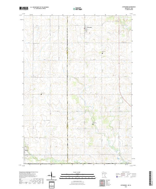 2022 Ostrander2022 Print · USGSThe Minnesota-Iowa state line defines this rural landscape at the turn of the 2020s, where the towns of Ostrander and Chester sit among the headwaters of the Upper Iowa River. Local researchers can trace family roots through sites like Bloomfield Cem and Bethany Cem.
 - 2022 Map of Lyle, 2022 Print
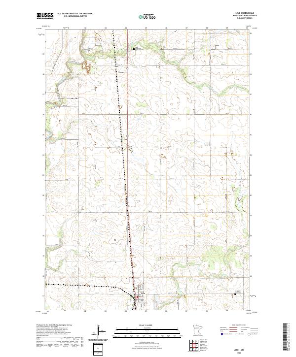 2022 Lyle2022 Print · USGSMower County farmland near the Iowa border is captured here in the early 2020s, centered on the settlement of Lyle. Researchers can trace the rural landscape through Rose Creek Cem, the small hamlet of Varco, and the winding banks of the Cedar River.
 - 2022 Map of Grand Meadow, 2022 Print
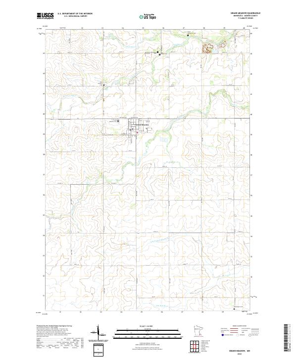 2022 Grand Meadow2022 Print · USGSGrand Meadow and its surrounding prairie are documented here in the early twenty-first century, showcasing a landscape defined by deep-rooted family history. Genealogists can locate several historic burial sites, such as the Methodist Norwegian Cem and Saint Finbarrs Cem, alongside the headwaters of the S Br Root River.
 - 2022 Map of Spring Valley, 2022 Print
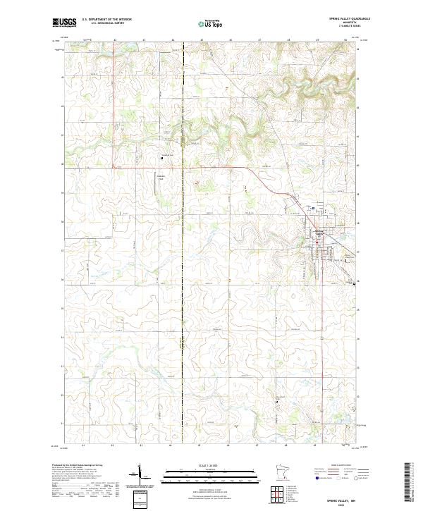 2022 Spring Valley2022 Print · USGSSpring Valley and the surrounding townships are captured in this modern survey of the Mower and Fillmore County line. Researchers can trace rural lineages through local landmarks like Frankford Cem, Bloomfield Cem, and the waters of Spring Valley Cr.
 - 2022 Map of Dexter, 2022 Print
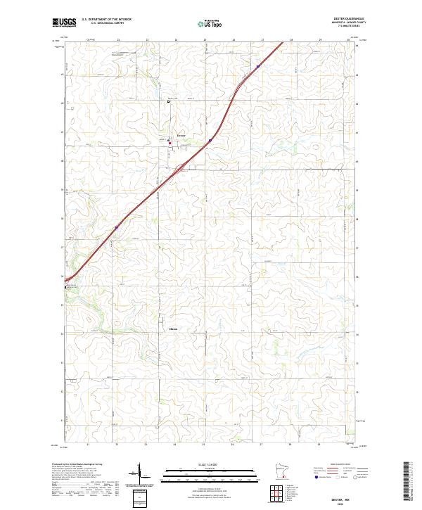 2022 Dexter2022 Print · USGSMower County farming communities like Dexter and Elkton are captured here in the early twenty-first century. Genealogists can locate family plots at Saint John's Lutheran Cemetery or trace the winding paths of Rose Creek and Deer Creek.
 - 2022 Map of Rose Creek, 2022 Print
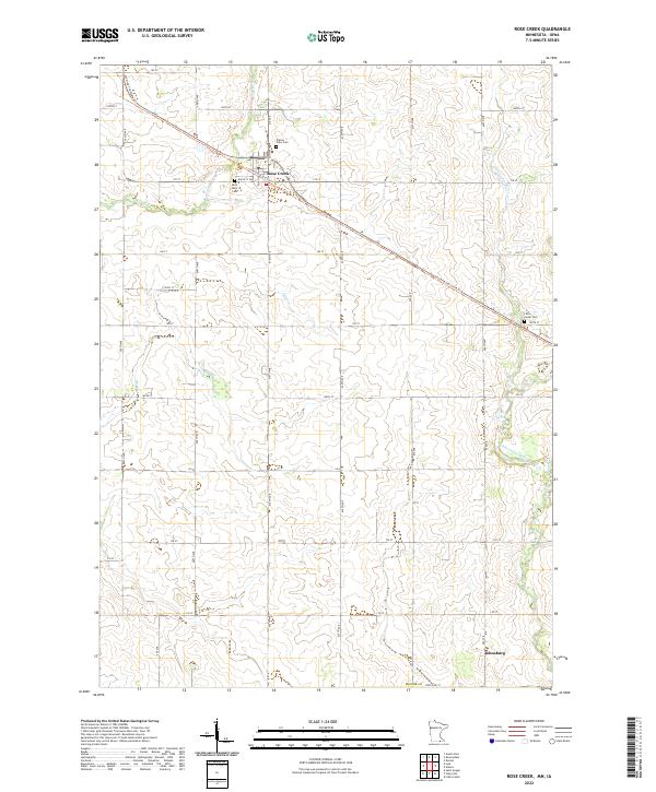 2022 Rose Creek2022 Print · USGSSouthern Minnesota agricultural life is captured here in the early twenty-first century as the landscape transitions along the Iowa border. Family historians and researchers can locate Saint Peter Cem, the settlement of Johnsburg, and the repurposed path of the Shooting Star State Trl.
 - 2022 Map of Waltham, 2022 Print
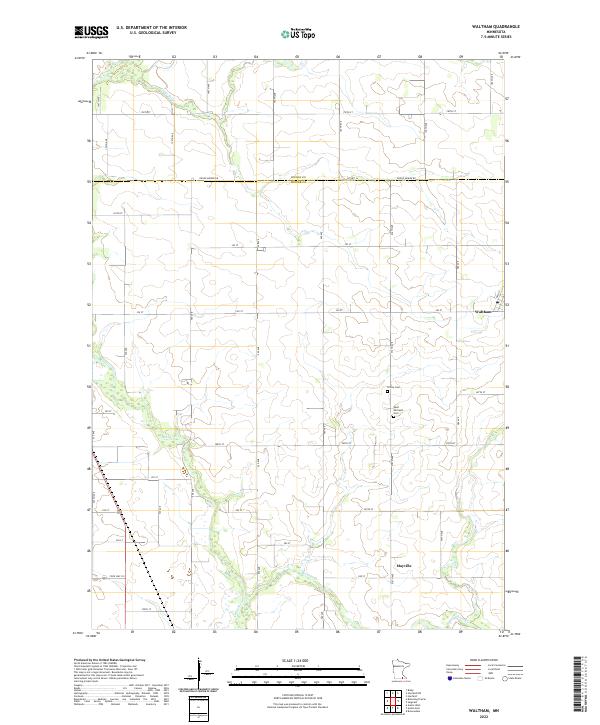 2022 Waltham2022 Print · USGSThe rural borderlands of Mower and Dodge counties are captured here in the early twenty-first century, showcasing a landscape of structured prairie agriculture. Genealogists and local historians can trace the foundations of the community at Trinity Cem and explore the layouts of Waltham and Mayville.
 - 2022 Map of Austin East, 2022 Print
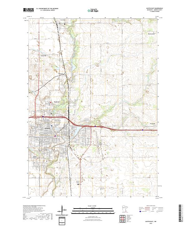 2022 Austin East2022 Print · USGSIn the early 2020s, the eastern outskirts of Austin, Minnesota, show a complex network of suburban expansion and historical burial grounds. Genealogists can trace family records across Oakwood Cem, Lansing Cem, and the Grand View Memorial Gardens.
 - 2022 Map of Austin West, 2022 Print
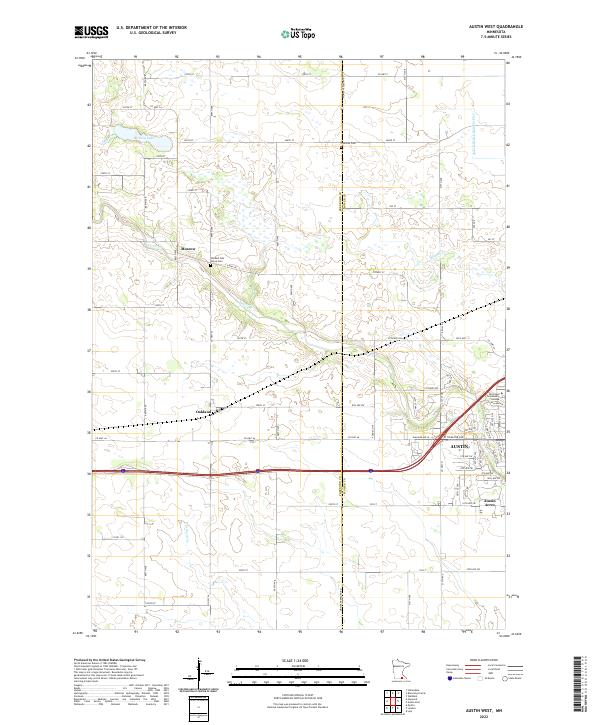 2022 Austin West2022 Print · USGSThe western outskirts of Austin and the surrounding Freeborn County prairie are captured here in the early twenty-first century. Genealogists and local historians can pinpoint Old Red Oak Grove Cem, trace the path of Turtle Cr, or locate the rural crossroads of Moscow.
 - 2022 Map of Le Roy, 2022 Print
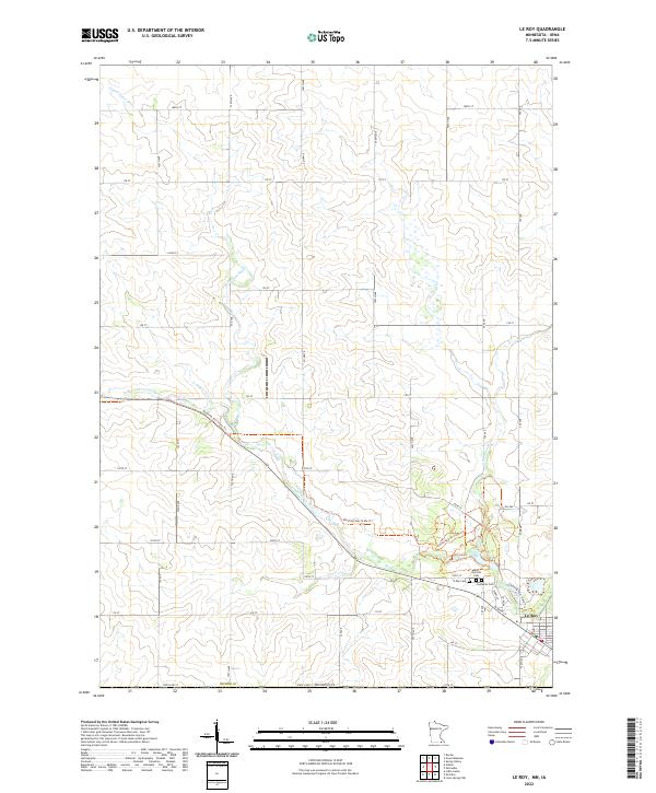 2022 Le Roy2022 Print · USGSThe southern border of Mower County and the town of Le Roy are documented here in the early 2020s. Trace the path of the Upper Iowa River and locate historic burial sites like Saint Patricks Cem and the Lutheran Cem.
 - 2022 Map of London, 2022 Print
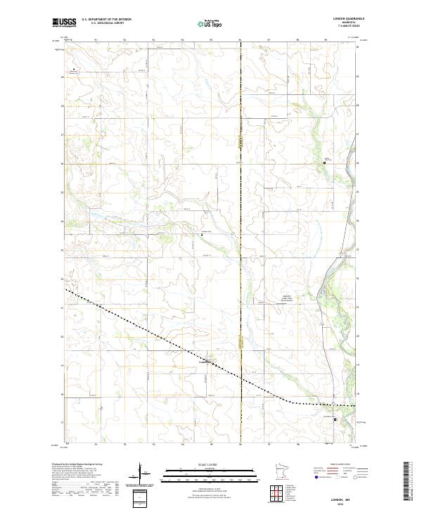 2022 London2022 Print · USGSThe Freeborn and Mower County border comes alive in this contemporary survey of the London area. Genealogists and local historians can locate several rural burial sites, such as the Kennevan Family Cem, and trace the path of the Cedar River.
 - 2022 Map of Sargeant, 2022 Print
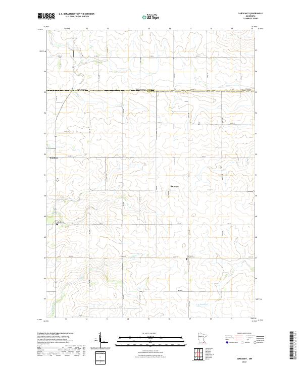 2022 Sargeant2022 Print · USGSDodge and Mower counties are shown here in the 2020s, highlighting the grid-based rural landscape between Sargeant and Waltham. Researchers can trace local lineage at Saint John's Lutheran Cem or follow the path of the Cedar River.
 - 2022 Map of Stewartville, 2022 Print
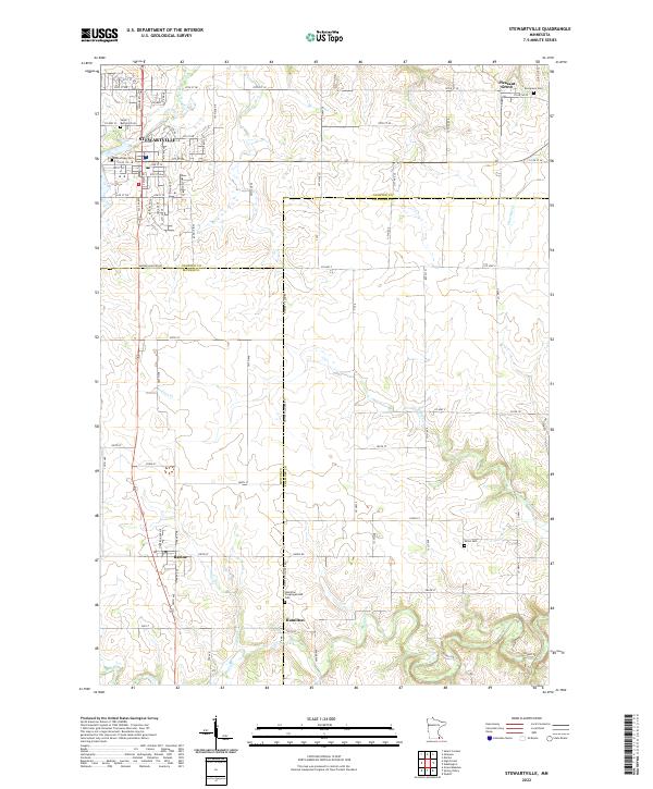 2022 Stewartville2022 Print · USGSSouthern Minnesota's agricultural heartland is documented here at the intersection of Olmsted, Fillmore, and Mower counties. Genealogists can trace local roots at the Hamilton Congregational Cem, Woodlawn Cem, and Evergreen Cem near Stewartville.
 - 2022 Map of Adams, 2022 Print
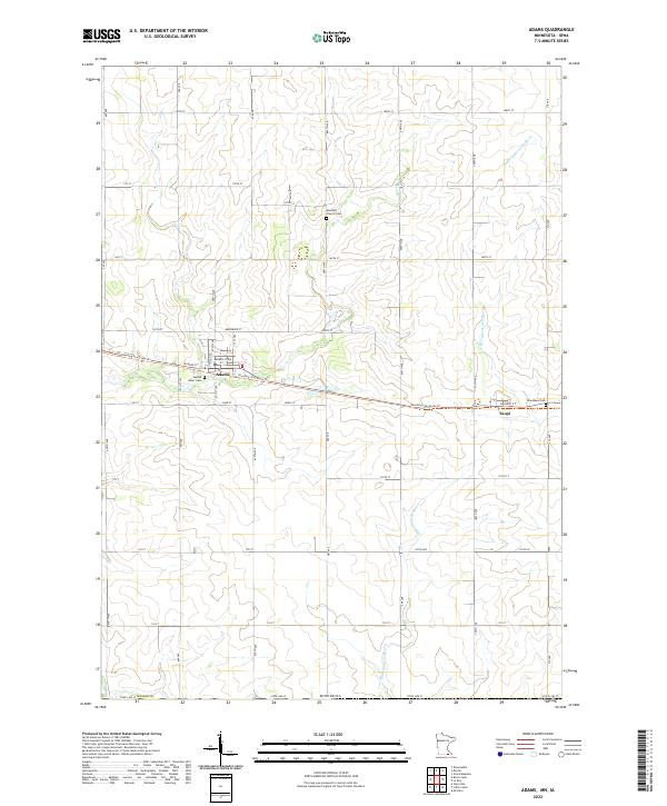 2022 Adams2022 Print · USGSSouthern Mower County is captured here in the early twenty-first century, showing the rural landscape around the Iowa border. Genealogists and local historians can trace family plots at Sacred Heart Cem and Marshall Church Cem or follow the Shooting Star State Trl through Adams and Taopi.
 - 2022 Map of Brownsdale, 2022 Print
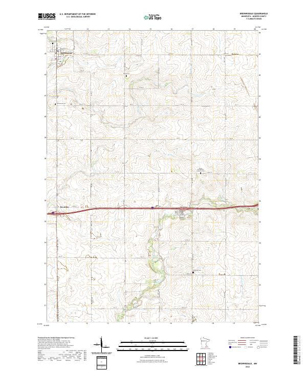 2022 Brownsdale2022 Print · USGSMower County's rural landscape is documented here in the early twenty-first century, showing the enduring agricultural layout around Brownsdale. Researchers can locate several distinct family and church burial grounds, including Tanner Cem, Hoflanda Cem, and the Trinity Evangelical Lutheran Cem.
 - 2022 Map of Blooming Prairie, 2022 Print
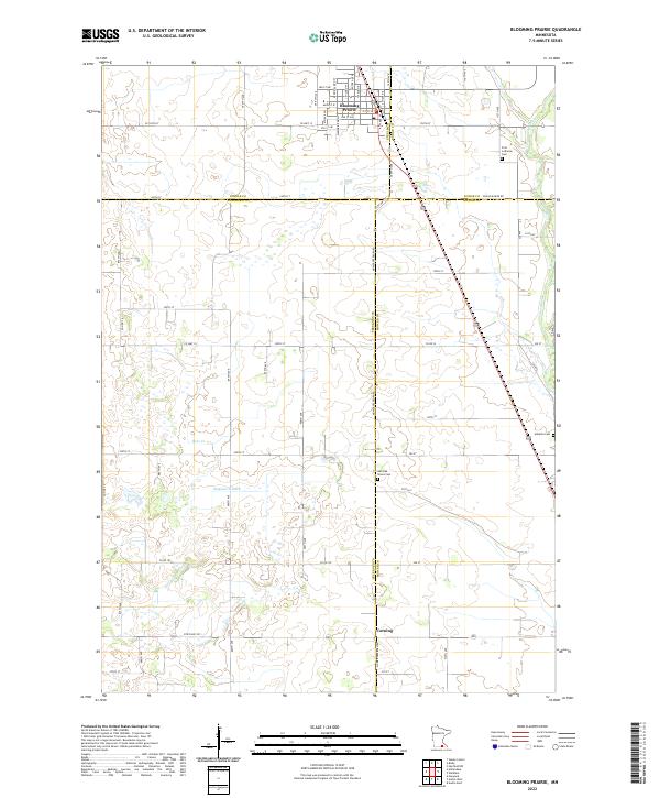 2022 Blooming Prairie2022 Print · USGSSouthern Minnesota's agricultural heartland is documented here in the early 2020s, centered on the border of four counties. Genealogists can trace family footprints at First Lutheran Cem, Red Oak Grove Cem, and the quiet crossroads of Corning.
 - 2022 Map of Saint Ansgar, 2022 Print
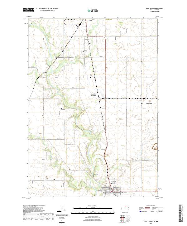 2022 Saint Ansgar2022 Print · USGSMitchell County, Iowa, and the Minnesota borderlands are mapped here in the early twenty-first century as the agricultural and river-linked communities continue to thrive. Genealogists can trace family plots across several sites, including Mona Cem, Saint Peter Cem, and the streets of St. Ansgar.
 - 2022 Map of Carpenter, 2022 Print
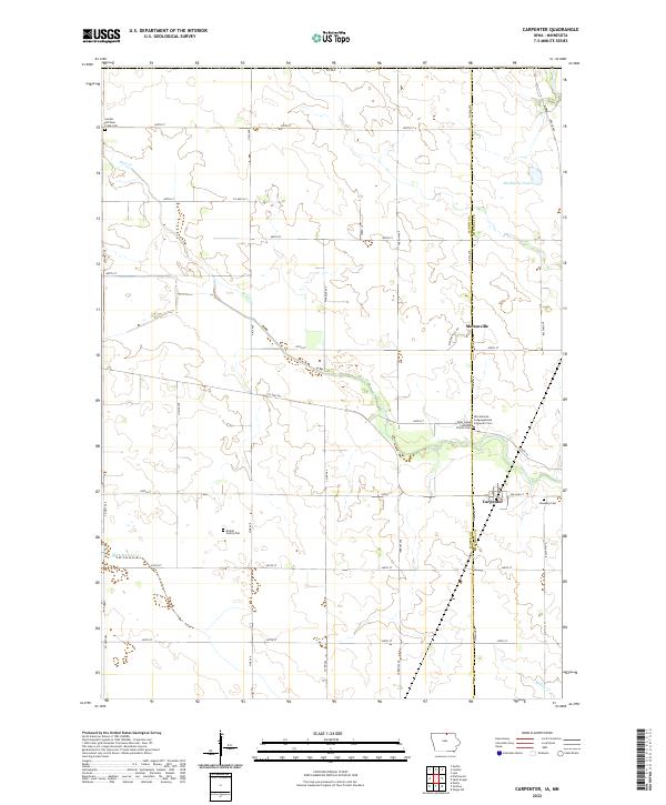 2022 Carpenter2022 Print · USGSWorth and Mitchell counties appear in this contemporary survey of northern Iowa's agricultural heartland. Genealogists can trace family heritage at the Birdsal Family Plot, Newburg Cem, and the Lutheran communities of Meltonville and Carpenter.
 - 2022 Map of Stacyville, 2022 Print
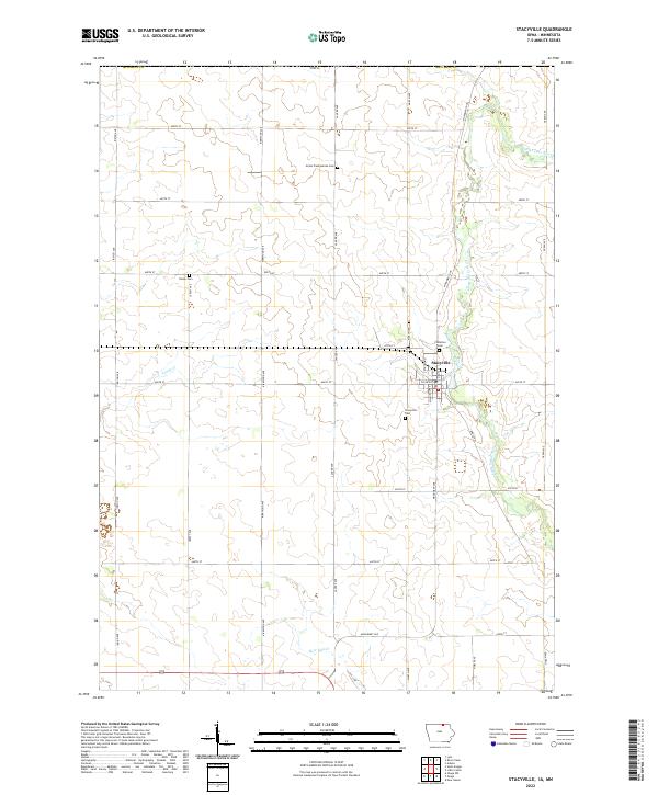 2022 Stacyville2022 Print · USGSStacyville and the fertile plains of northern Mitchell County are documented here in the early twenty-first century. Researchers can locate local landmarks like Visitation Cem, trace the course of the Little Cedar River, and see the rural grid along Lancer Ave.
End of results
Showing maps 1-21 of 21
Top cities of Mower County
- Austin historical maps
- Lansing historical maps
- Grand Meadow historical maps
- Le Roy historical maps
- Adams historical maps
- Brownsdale historical maps
See more
Frequently asked questions
- What are the different types of historical maps available for Mower County?
- What is the oldest map of Mower County?
- Where can I purchase historical maps of Mower County for my home or office?
- Where can I download high-res historical maps of Mower County?
- Are there historical topographic maps available for Mower County?
- Is there historical aerial imagery available for Mower County?
- Where are historical maps of Mower County sourced from?