Old Maps of Mower County, Minnesota for Genealogy
Trace your family roots with 137 historic maps of Mower County. These high-res maps reveal old neighborhoods, homesites, landmarks, and streets — helping you uncover where your ancestors lived and how the area evolved over time.
- Explore historic neighborhoods: Identify where your relatives may have lived in the 1800s or 1900s.
- Compare maps over time: Trace the changes in streets, buildings, and landmarks for multi-generational research.
- Perfect for genealogy & ancestry research: Used by family historians and researchers to map out lineage and migration.
These maps are an incredible resource for exploring your personal connection to Mower County's past.
Mower County, MN maps
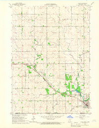
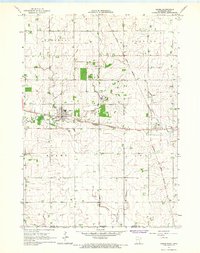
(137)- 1954 Map of Hayward, 1956 Print
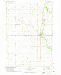
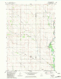
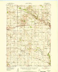 1954 Hayward1956 Print · USGSSouthern Freeborn County and the Iowa borderlands thrive in the mid-1950s as a landscape of railroads and rural parishes. Genealogists can trace family footprints at Trondhjem Ch, Danish Cem, and dozens of district schools like Benesh Sch.2 unique versions available
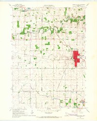
 - 1954 Map of Austin, 1956 Print
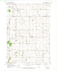
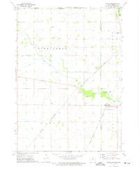
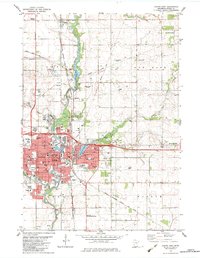
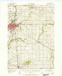 1954 Austin1956 Print · USGSPost-war Mower County thrives as a rail and agricultural center during the mid-fifties. Researchers can locate numerous country schools and churches, from School No 101 to Hoffanda Ch, and trace the rail lines serving Austin and Rose Creek.2 unique versions available
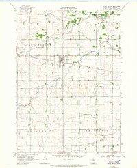
 - 1954 Map of Mason City, 1967 Print
 1954 Mason City1967 Print · USGSSouthern Minnesota and northern Iowa are shown here at the height of the mid-century rail era, centered on the regional hubs of Mason City and Rochester. Researchers can trace the vanished paths of the Chicago Great Western and find local landmarks like Pilot Knob and Bear Lake.2 unique versions available
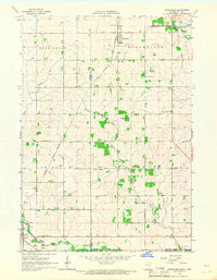
 - 1955 Map of Stewartville, 1956 Print
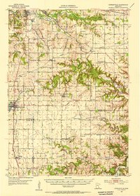 1955 Stewartville1956 Print · USGSSouthern Minnesota's farming country and river valleys are shown in the mid-fifties as rural life revolved around local rail depots and school districts. Researchers can find numerous country schools like Little Red Sch and St Bridget Sch, plus family-named cemeteries such as Holy Redeemer Cem and Jerusalem Cem.2 unique versions available
 - 1955 Map of High Forest, 1957 Print
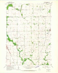
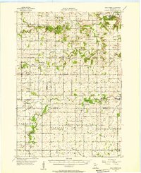 1955 High Forest1957 Print · USGSSoutheast Minnesota's agricultural heartland is captured here in the mid-fifties, showing the rural township structure before modern highway expansion. Researchers can trace the legacy of early Norwegian and German settlers through sites like East St Olaf Ch, Shanty Town, and Folkestad Sch.
 - 1957 Map of Mason City
 1957 Mason City1957 Print · USGSThe Minnesota-Iowa border region comes alive in this mid-century survey, from the industrial plants of Mason City to the medical hub of Rochester. Researchers can trace the rail-and-river economy through the Chicago Great Western Railway and the Shell Rock River.
 - 1958 Map of Mason City
 1958 Mason City1958 Print · USGSSouthern Minnesota and northern Iowa are shown during the mid-fifties when railroads still anchored the regional economy. Genealogists and historians can trace the intricate rail networks of the Illinois Central and find local landmarks in Mason City, Albert Lea, and Austin.
 - 1965 Map of Le Roy, 1966 Print
 1965 Le Roy1966 Print · USGSLe Roy was a bustling rail hub in the mid-1960s, situated at the junction of two major lines near the Iowa border. Genealogists and historians can trace local families through St Patricks Cem or explore the early layout of Lake Louise State Park.
 - 1965 Map of Dexter, 1966 Print
 1965 Dexter1966 Print · USGSMower County in the mid-1960s reveals a landscape where traditional rail hubs like Dexter and Elkton begin to adapt to the arrival of Interstate 90. Genealogists and historians can locate the Dexter Cemetery and St John Church, or trace the diverging routes of the Chicago Great Western and Milwaukee railroads.
 - 1965 Map of Spring Valley, 1966 Print
 1965 Spring Valley1966 Print · USGSSpring Valley and the surrounding townships in the mid-1960s reveal a landscape shaped by a major railroad junction and rural industry. Researchers can trace historic family burial sites like Frankford Cem and Bloomfield Cem or locate old infrastructure like the Townhall.
 - 1965 Map of Grand Meadow, 1966 Print
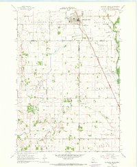
 1965 Grand Meadow1966 Print · USGSMower County farming and rail life are detailed here during the mid-1960s, centered on the village of Grand Meadow. Genealogists and local historians can locate St Finbarrs Cem, Bear Creek Ch, and the winding South Branch Root River.
 - 1965 Map of Ostrander, 1966 Print
 1965 Ostrander1966 Print · USGSThe borderlands of Fillmore County and Iowa are captured here in the mid-sixties, dominated by rail lines and winding river branches. Researchers can pinpoint early landmarks like Bloomfield Cem, the Ostrander rail corridor, and various Quarry sites.
 - 1965 Map of Adams, 1967 Print
 1965 Adams1967 Print · USGSSoutheast Minnesota's prairie border is shown here in the mid-1960s, where the grain-hauling rail lines of the era intersect at the village of Adams. Genealogists and researchers can trace the vicinity of Taopi, local churches like Marshall Ch, and the Woodlawn Cem.2 unique versions available
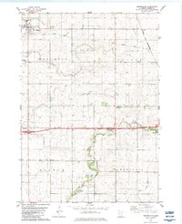
 - 1966 Map of Waltham, 1967 Print
 1966 Waltham1967 Print · USGSSouthern Minnesota's agricultural heartland is documented here during the mid-1960s, showing the vital rail links and small townships of Mower and Dodge Counties. Researchers can trace local genealogy and land use through landmarks like St Michaels Ch, the village of Waltham, and the Chicago Great Western tracks.
 - 1966 Map of Sargeant, 1967 Print
 1966 Sargeant1967 Print · USGSSoutheastern Minnesota farmland near the Dodge and Mower county line is captured here in the mid-sixties. Genealogists and local historians can trace the Chicago Great Western rail line and locate community landmarks like St Johns Ch and the Waltham Cem.
 - 1967 Map of Blooming Prairie, 1968 Print
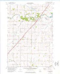
 1967 Blooming Prairie1968 Print · USGSThe fertile farmlands surrounding Blooming Prairie were captured in the late sixties, showing the vital link between the Chicago Milwaukee St Paul and Pacific rail line and the prairie economy. Local historians can trace family-named landmarks and rural hubs like Red Oak Grove Ch and Selstad Landing Field.
 - 1972 Map of St. Ansgar, 1974 Print
 1972 St. Ansgar1974 Print · USGSMitchell County and the Minnesota border come into focus in the 1970s as the rail-and-river economy centers on the Cedar River. Genealogists can trace family names through rural landmarks like Rustad Cem, Ogden Cem, and the small settlement of Toeterville.
 - 1972 Map of Stacyville, 1974 Print
 1972 Stacyville1974 Print · USGSStacyville and the surrounding Mitchell County townships are captured here in the early seventies as the local agricultural and rail economy thrived. Researchers can trace family history at Toeter Cem, locate the Union Ch, and follow the Illinois Central Gulf railroad tracks through the heart of town.
 - 1972 Map of Carpenter, 1975 Print
 1972 Carpenter1975 Print · USGSThe Iowa-Minnesota border region is captured here in the early 1970s as a thriving rail and agricultural corridor. Genealogists and local historians can trace the rural landscape through landmarks like Newburg Cem, the village of Meltonville, and Deer Creek Ch.
 - 1974 Map of High Forest, 1976 Print
 1974 High Forest1976 Print · USGSHigh Forest and the surrounding townships of Olmsted and Mower counties are shown here during the mid-seventies. Genealogists can trace family landmarks like the Pleasant Valley Ch and St Johns Cem, while tracing the course of the North Branch Root River.
 - 1974 Map of Stewartville, 1976 Print
 1974 Stewartville1976 Print · USGSStewartville and the surrounding townships are documented in the mid-seventies, showing the intersection of heavy industry and small-town life. Genealogists and historians can trace the Chicago and North Western corridor and locate St Bernard Cem or Sumner Center Ch.
 - 1974 Map of High Forest SW, 1976 Print
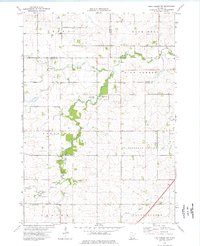 1974 High Forest SW1976 Print · USGSMower County and the surrounding townships are captured in the mid-seventies, showing a landscape defined by the winding Root River. Researchers can trace rural community life through landmarks like Evanger Ch, Zion Ch, and the local Townhall.
 - 1982 Map of Austin East, 1983 Print
 1982 Austin East1983 Print · USGSAustin and its surrounding Mower County townships are captured here in the early 1980s, centered on the busy Cedar River corridor. Researchers can trace local landmarks like Oakwood Cem, the Drive-in Theater, and the Austin Municipal Airport.
 - 1982 Map of London, 1983 Print
 1982 London1983 Print · USGSSouthern Minnesota prairie and borderlands are captured here in the early eighties, showing the agricultural grids of London and Myrtle. Researchers can locate several family and community landmarks like London Cem, Woodbury Cem, and the Trondhjem Ch.
 - 1982 Map of Brownsdale, 1983 Print
 1982 Brownsdale1983 Print · USGSMower County farming and rail history are preserved here during the early eighties. Genealogists can locate family landmarks such as Brown Cem and Hoflanda Ch, or trace the path of the Chicago and North Western through Renova.
Showing maps 1-25 of 137
Top cities of Mower County
- Austin historical maps
- Lansing historical maps
- Grand Meadow historical maps
- Le Roy historical maps
- Adams historical maps
- Brownsdale historical maps
See more
Frequently asked questions
- What are the different types of historical maps available for Mower County?
- What is the oldest map of Mower County?
- Where can I purchase historical maps of Mower County for my home or office?
- Where can I download high-res historical maps of Mower County?
- Are there historical topographic maps available for Mower County?
- Is there historical aerial imagery available for Mower County?
- Where are historical maps of Mower County sourced from?