1970s Maps of Murray County, Minnesota
Explore 6 historic maps of Murray County from the 1970s. These maps offer a rare glimpse into what life looked like during the 1970s — showing old roads, neighborhoods, homes, and landmarks that have changed or disappeared over time.
Whether you're researching your family's past, planning a metal detecting trip, or studying how Murray County's landscape evolved across the 1970s, these high-resolution maps are a powerful tool for exploring the history of this region.
- Focus on a specific era: All maps on this page are from the 1970s, giving you a focused view of this time period.
- See what’s changed: Compare century-old streets, trails, and buildings to today's modern landscape using overlays and satellite layers.
- Research with precision: Use these maps for genealogy, historical research, land use analysis, or educational projects.
- View, download, or print: Maps are fully viewable online in high resolution, and can be downloaded or printed for your own records.
Start exploring Murray County's history through authentic maps from the 1970s. This is your window into the past.
Murray County, MN maps
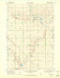
(6)- 1970 Map of Heron Lake NW, 1972 Print
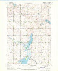 1970 Heron Lake NW1972 Print · USGSCottonwood and Murray Counties in the early 1970s are defined by the winding Des Moines River and a series of glacial lakes. Genealogists and local historians can trace burial sites like Rosehill Cem and Emanuel Cem or locate the Townhall near Oaks Lake.
 - 1970 Map of Dundee, 1972 Print
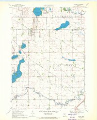 1970 Dundee1972 Print · USGSDundee and Kinbrae thrive at the junction of two major rail lines in this early 1970s landscape of the Minnesota prairie. Genealogists and local historians can trace family ties at St Marys Cemetery or Kinbrae Cemetery and explore the early wildlife management areas surrounding Talcot Lake and Graham Lake.2 unique versions available
 - 1970 Map of Fulda, 1972 Print
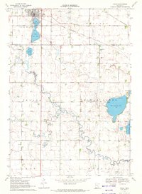 1970 Fulda1972 Print · USGSIn the early 1970s, the prairie town of Fulda remained a vital rail crossroads where the Chicago and North Western met the Milwaukee Road. Local historians can trace the development of the High School and the recreational lands surrounding West Graham Lake and Fulda Second Lake.
 - 1970 Map of Fulda SW, 1972 Print
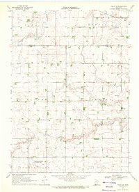 1970 Fulda SW1972 Print · USGSNobles and Murray Counties appear here in the early 1970s, showcasing a landscape of prairie townships and agricultural drainage. Researchers can locate the Seward Cem, the rural settlement at Pfingsten, and the path of the Chicago Milwaukee St Paul and Pacific railroad.
 - 1970 Map of Lime Creek, 1972 Print
 1970 Lime Creek1972 Print · USGSMurray County in the early seventies is defined by its prairie wetlands and the rail-side growth of Fulda. Genealogists and local historians can map out old property lines near Prairie Hill Cem, the small settlement of Lime Creek, and the Townhall.
 - 1970 Map of Avoca, 1972 Print
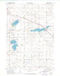 1970 Avoca1972 Print · USGSMurray County prairie life in the early seventies centers on the rail hubs and glacial lakes of the Buffalo Ridge region. Genealogists can locate specific family plots at St Rose Cem, Faith Swedish Cem, and Restland Memory Gardens near Slayton.
End of results
Showing maps 1-6 of 6
Top cities of Murray County
- Slayton historical maps
- Fulda historical maps
- Chandler historical maps
- Lake Wilson historical maps
- Currie historical maps
- Iona historical maps
See more
Frequently asked questions
- What are the different types of historical maps available for Murray County?
- What is the oldest map of Murray County?
- Where can I purchase historical maps of Murray County for my home or office?
- Where can I download high-res historical maps of Murray County?
- Are there historical topographic maps available for Murray County?
- Is there historical aerial imagery available for Murray County?
- Where are historical maps of Murray County sourced from?