Old Maps of Murray County, Minnesota for Metal Detecting
Plan your next treasure hunt with 158 historic maps of Murray County. Find old homesites, ghost towns, trails, and gathering spots that may be lost to time — perfect for identifying promising metal detecting locations.
- Locate forgotten sites: Uncover places like long-lost settlements, abandoned rail lines, or gathering spots.
- Plan better hunts: Use map overlays combined with LiDAR or satellite views to narrow in on historically rich areas.
- Made for detectorists: Thousands of hobbyists use these maps to discover relics, coins, and hidden history.
Use these historic maps to boost your research and find new opportunities beneath the surface of Murray County.
Murray County, MN maps
(158)- 1953 Map of Watertown, 1968 Print
 1953 Watertown1968 Print · USGSEastern South Dakota and the Minnesota borderlands are captured here during the mid-twentieth century as the region's agricultural and rail-service centers thrived. Genealogists and local historians can trace family-named sites across the Coteau des Prairies and find landmarks in Watertown, De Smet, and Brookings.3 unique versions available
 - 1953 Map of New Ulm, 1968 Print
 1953 New Ulm1968 Print · USGSSouthern Minnesota in the mid-1950s is defined by its deep river valleys and the expanding reach of the Great Northern and Chicago and North Western railroads. Researchers can trace rural lineages through landmarks like the Milford State Monument, St. John's Ch, and the Upper Sioux Indian Res.3 unique versions available
 - 1954 Map of Fairmont, 1967 Print
 1954 Fairmont1967 Print · USGSThe prairie landscape of southern Minnesota and northern Iowa comes alive in this mid-century survey of the Coteau des Prairies. Genealogists and historians can trace the rail-connected growth of Fairmont and Blue Earth or locate family roots near St Kilian Ch and Union Slough National Wildlife Refuge.3 unique versions available
 - 1955 Map of Sioux Falls, 1967 Print
 1955 Sioux Falls1967 Print · USGSThe eastern South Dakota and western Minnesota borderlands come alive in the mid-fifties, showing the vital rail-to-river connections of the era. Genealogists can trace family footprints across townships like Madison and Pipestone, while following the paths of the Big Sioux River and the Chicago and North Western line.3 unique versions available
 - 1957 Map of New Ulm
 1957 New Ulm1957 Print · USGSCentral Minnesota in the mid-fifties remains a landscape of river-valley commerce and prairie agriculture defined by its historic mission sites and rail towns. Genealogists and local historians can trace the development of New Ulm and Montevideo, or locate specific landmarks like the Milford State Monument and Minnesota Falls.
 - 1958 Map of New Ulm
 1958 New Ulm1958 Print · USGSSouth-central Minnesota’s river valleys and prairie towns are captured here in the mid-fifties, during the height of the region's rail-and-river economy. Genealogists and historians can trace the legacy of the Upper Sioux Indian Mission or locate early rail stops along the Chicago and North Western Ry in towns like Redwood Falls and Glencoe.
 - 1958 Map of Sioux Falls
 1958 Sioux Falls1958 Print · USGSThe tri-state borderlands of South Dakota, Minnesota, and Iowa are captured here during the mid-century peak of the regional rail network. Genealogists and historians can trace local landmarks like Augustana Academy, the St Marys Cem, and the path of the Illinois Central through Rock Rapids.
 - 1958 Map of Fairmont
 1958 Fairmont1958 Print · USGSThe borderlands of southern Minnesota and northern Iowa come alive in the mid-1950s, showing a landscape defined by glacial lakes and rail-line commerce. Researchers can trace historic landmarks like Lakeside Laboratory, Gridley Station, and the Bancroft Wildlife Refuge across the prairie.
 - 1958 Map of Watertown
 1958 Watertown1958 Print · USGSThe eastern South Dakota prairie and the Minnesota borderlands are captured here in the late fifties, showcasing a landscape of terminal moraine lakes and burgeoning rail hubs. Genealogists and historians can trace the early paths of the Chicago and North Western railroad or locate family roots in Watertown, Clark, or the Sisseton Indian Reservation.2 unique versions available
 - 1967 Map of New Ulm
 1967 New Ulm1967 Print · USGSSouthern Minnesota in the mid-fifties is captured here as a landscape of river-valley missions and busy prairie rail towns. Researchers can trace the Yellow Medicine Trail and locate historic sites like the Morton Indian Mission and Milford State Monument.
 - 1967 Map of Slayton SW, 1968 Print
 1967 Slayton SW1968 Print · USGSThe rural prairie of Nobles County is captured in the late sixties, showing the vital rail corridor of the Chicago Rock Island and Pacific as it served Lismore. Researchers can trace the drainage patterns of Champepadan Creek and locate several early Gravel Pits and the local Gaging Station.
 - 1967 Map of Balaton, 1968 Print
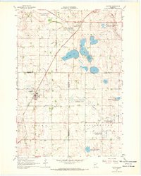
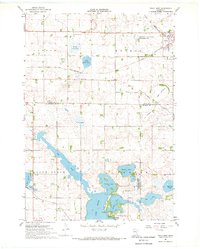
 1967 Balaton1968 Print · USGSSouthwestern Minnesota prairie and glacial lakes define this landscape in the late sixties, where the railroad connects small rural hubs. Trace the historical footprints of Balaton and Garvin along the Chicago and North Western line near the shores of Lake Sarah.2 unique versions available
 - 1967 Map of Edgerton NE, 1968 Print
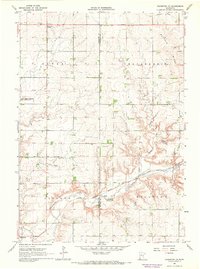 1967 Edgerton NE1968 Print · USGSSouthwestern Minnesota's prairie highlands come to life in the late sixties as agricultural townships and rail lines define the rural landscape. Researchers can locate the Woodstock Cemetery, trace the Milwaukee Road tracks, and find early landmarks like Diamond Corner.
 - 1967 Map of Ruthton, 1968 Print
 1967 Ruthton1968 Print · USGSThe rail-and-river landscape of the Minnesota prairie comes into focus in the mid-1960s, centered on the settlements of Ruthton and Florence. Researchers can trace old family burial sites at Opdal Cem and Peace Cem or follow the path of the Great Northern railroad.
 - 1967 Map of Slayton, 1968 Print
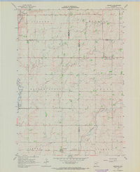
 1967 Slayton1968 Print · USGSMurray County at the height of the 1960s shows a landscape defined by the intersection of the Chicago and North Western and the Milwaukee Road. Genealogists can locate family landmarks like St Columba Cem, West Sch, and the village of Hadley.
 - 1967 Map of Balaton SW, 1968 Print
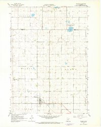
 1967 Balaton SW1968 Print · USGSMurray County prairie lands are shown here in the late sixties, highlighting a landscape of managed wildlife areas and intensive drainage systems. Genealogists and local historians can locate Ellsborough Ch, the C & N W rail line, and the expansive Great Oasis Lakebed.
 - 1967 Map of Walnut Grove, 1968 Print
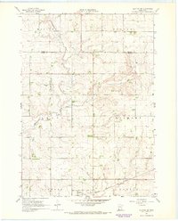
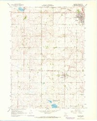
 1967 Walnut Grove1968 Print · USGSWalnut Grove and the surrounding prairie townships are documented here in the late sixties as the local rail and agricultural systems remained central to the community. Genealogists and researchers can trace local family landmarks such as St Olaf Ch, Calvary Cem, and the path of the famed Plum Creek.
 - 1967 Map of Tracy East, 1968 Print
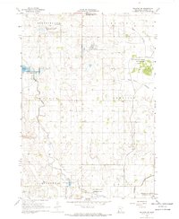
 1967 Tracy East1968 Print · USGSMurray and Redwood Counties are shown in detail during the late sixties as agricultural development shaped the Minnesota prairie. Researchers can locate family landmarks like Tracy Cemetery, follow the Plum Creek drainage, and find rural hubs such as Holly Ch.
 - 1967 Map of Kenneth, 1968 Print
 1967 Kenneth1968 Print · USGSAcross the prairie townships of southwest Minnesota in the 1960s, this survey shows the rail-and-road network connecting Kenneth and Leota. Genealogists and researchers can trace the Chicago Rock Island and Pacific rail line and locate the Leota Cem.
 - 1967 Map of Wilmont, 1968 Print
 1967 Wilmont1968 Print · USGSThe agricultural heart of Nobles County is captured here in the late sixties as the Chicago Rock Island and Pacific railroad still serves Wilmont. Researchers can trace old property lines across Bloom and Larkin townships or locate the St Kilian settlement and Wilmont Cem.
 - 1967 Map of Woodstock, 1968 Print
 1967 Woodstock1968 Print · USGSPipestone County's agricultural and conservation lands are captured here in the late sixties, centered on the village of Woodstock. Researchers can trace the path of the Old Railroad Grade and locate rural landmarks like School No 126 and the local Townhall.2 unique versions available
 - 1967 Map of Hadley, 1968 Print
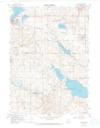
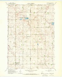
 1967 Hadley1968 Print · USGSMurray County prairie life in the late sixties is centered on the rail village of Hadley and the surrounding townships. Researchers can trace family roots at Highland Home Cem, locate the local Townhall, or follow the old Chicago and North Western rail line.3 unique versions available
 - 1967 Map of Current Lake, 1968 Print
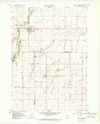
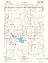 1967 Current Lake1968 Print · USGSThe rural borderlands of Lyon and Murray Counties are shown here during the late 1960s, centered on the diverse wetlands of the western prairie. Genealogists and local historians can trace the foundations of these farming townships through sites like Stillerud Ch, the C & N W rail line in Balaton, and several named lakebeds.
 - 1967 Map of Tracy West, 1968 Print
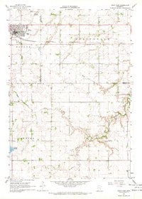
 1967 Tracy West1968 Print · USGSSouthwestern Minnesota's prairie and lake country is captured here in the late sixties as the city of Tracy thrives along the railroad. Researchers can locate rural landmarks like Holland Cem, the Rialson Cem, and various shoreline features around Lake Sarah.2 unique versions available
 - 1967 Map of Dovray, 1969 Print
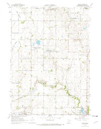
 1967 Dovray1969 Print · USGSMurray County prairie life in the late sixties centers on the rail siding at Dovray and the winding Des Moines River. Trace family history and rural infrastructure through School No 1204, Willow Lake Ch, and the Old German Cem.
Showing maps 1-25 of 158
Top cities of Murray County
- Slayton historical maps
- Fulda historical maps
- Chandler historical maps
- Lake Wilson historical maps
- Currie historical maps
- Iona historical maps
See more
Frequently asked questions
- What are the different types of historical maps available for Murray County?
- What is the oldest map of Murray County?
- Where can I purchase historical maps of Murray County for my home or office?
- Where can I download high-res historical maps of Murray County?
- Are there historical topographic maps available for Murray County?
- Is there historical aerial imagery available for Murray County?
- Where are historical maps of Murray County sourced from?