1900s (20th Century) Maps of Lismore, Minnesota
Explore 5 historic maps of Lismore from the 1900s (20th Century). These maps offer a rare glimpse into what life looked like during the 1900s — showing old roads, neighborhoods, homes, and landmarks that have changed or disappeared over time.
Whether you're researching your family's past, planning a metal detecting trip, or studying how Lismore's landscape evolved across the 1900s, these high-resolution maps are a powerful tool for exploring the history of this region.
- Focus on a specific era: All maps on this page are from the 1900s, giving you a focused view of this time period.
- See what’s changed: Compare century-old streets, trails, and buildings to today's modern landscape using overlays and satellite layers.
- Research with precision: Use these maps for genealogy, historical research, land use analysis, or educational projects.
- View, download, or print: Maps are fully viewable online in high resolution, and can be downloaded or printed for your own records.
Start exploring Lismore's history through authentic maps from the 1900s. This is your window into the past.
Lismore, MN maps
(5)- 1954 Map of Fairmont, 1967 Print
 1954 Fairmont1967 Print · USGSThe prairie landscape of southern Minnesota and northern Iowa comes alive in this mid-century survey of the Coteau des Prairies. Genealogists and historians can trace the rail-connected growth of Fairmont and Blue Earth or locate family roots near St Kilian Ch and Union Slough National Wildlife Refuge.3 unique versions available
 - 1958 Map of Fairmont
 1958 Fairmont1958 Print · USGSThe borderlands of southern Minnesota and northern Iowa come alive in the mid-1950s, showing a landscape defined by glacial lakes and rail-line commerce. Researchers can trace historic landmarks like Lakeside Laboratory, Gridley Station, and the Bancroft Wildlife Refuge across the prairie.
 - 1967 Map of Slayton SW, 1968 Print
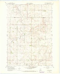 1967 Slayton SW1968 Print · USGSThe rural prairie of Nobles County is captured in the late sixties, showing the vital rail corridor of the Chicago Rock Island and Pacific as it served Lismore. Researchers can trace the drainage patterns of Champepadan Creek and locate several early Gravel Pits and the local Gaging Station.
 - 1967 Map of Adrian, 1969 Print
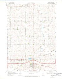 1967 Adrian1969 Print · USGSNobles County's agricultural and rail heartland is captured here in the late 1960s as a vital crossroads. Researchers can trace the dual rail lines of the Chicago and North Western and locate family plots at St Adrian Cem and Lismore Cem.
 - 1985 Map of Worthington
 1985 Worthington1985 Print · USGSSouthwestern Minnesota and northwestern Iowa are captured in the mid-1980s, showcasing the high-water mark of the region's agricultural and rail-line infrastructure. Researchers can trace the path of the Chicago and North Western through prairie towns like Adrian, Wilmont, and Lakefield.2 unique versions available
End of results
Showing maps 1-5 of 5
Top cities near Lismore
- Adrian historical maps
- Edgerton historical maps
- Ellsworth historical maps
- Leota historical maps
- Rushmore historical maps
- Wilmont historical maps
See more
Frequently asked questions
- What are the different types of historical maps available for Lismore?
- What is the oldest map of Lismore?
- Where can I purchase historical maps of Lismore for my home or office?
- Where can I download high-res historical maps of Lismore?
- Are there historical topographic maps available for Lismore?
- Is there historical aerial imagery available for Lismore?
- Where are historical maps of Lismore sourced from?