Old Maps of Redwood County, Minnesota for Genealogy
Trace your family roots with 182 historic maps of Redwood County. These high-res maps reveal old neighborhoods, homesites, landmarks, and streets — helping you uncover where your ancestors lived and how the area evolved over time.
- Explore historic neighborhoods: Identify where your relatives may have lived in the 1800s or 1900s.
- Compare maps over time: Trace the changes in streets, buildings, and landmarks for multi-generational research.
- Perfect for genealogy & ancestry research: Used by family historians and researchers to map out lineage and migration.
These maps are an incredible resource for exploring your personal connection to Redwood County's past.
Redwood County, MN maps
(182)- 1952 Map of Morton, 1954 Print
 1952 Morton1954 Print · USGSRenville County farmland meets the deep Minnesota River valley in the early fifties, showing a landscape shaped by granite quarrying and river transport. Researchers can locate numerous country schools and churches like Swedlanda Ch, the Lower Sioux Indian Community, and the grounds of Fort Ridgely.2 unique versions available
 - 1952 Map of Redwood Falls, 1954 Print
 1952 Redwood Falls1954 Print · USGSRedwood Falls and the Minnesota River valley are captured in detail during the early fifties, showing the area's deep agricultural and river-town roots. Researchers can trace rural school districts, the Chicago and North Western rail line, and the Lower Sioux Indian Community.2 unique versions available
 - 1953 Map of Morgan, 1955 Print
 1953 Morgan1955 Print · USGSRedwood and Brown Counties are shown at their agricultural peak in the early fifties, anchored by the rail hub at Morgan. Genealogists and historians can trace dozens of rural schoolhouses and country churches like Brookville Church or Immanuel Church.
 - 1953 Map of New Ulm, 1968 Print
 1953 New Ulm1968 Print · USGSSouthern Minnesota in the mid-1950s is defined by its deep river valleys and the expanding reach of the Great Northern and Chicago and North Western railroads. Researchers can trace rural lineages through landmarks like the Milford State Monument, St. John's Ch, and the Upper Sioux Indian Res.3 unique versions available
 - 1957 Map of New Ulm
 1957 New Ulm1957 Print · USGSCentral Minnesota in the mid-fifties remains a landscape of river-valley commerce and prairie agriculture defined by its historic mission sites and rail towns. Genealogists and local historians can trace the development of New Ulm and Montevideo, or locate specific landmarks like the Milford State Monument and Minnesota Falls.
 - 1958 Map of New Ulm
 1958 New Ulm1958 Print · USGSSouth-central Minnesota’s river valleys and prairie towns are captured here in the mid-fifties, during the height of the region's rail-and-river economy. Genealogists and historians can trace the legacy of the Upper Sioux Indian Mission or locate early rail stops along the Chicago and North Western Ry in towns like Redwood Falls and Glencoe.
 - 1962 Map of School Grove Lake, 1964 Print
 1962 School Grove Lake1964 Print · USGSThe prairie townships of Yellow Medicine and Redwood counties are captured here in the early sixties as drainage networks reshaped the land. Genealogists can locate family farmstead sites near St Lukes Sch, the local Townhall, and along the banks of School Grove Lake.
 - 1962 Map of Milroy SE, 1964 Print
 1962 Milroy SE1964 Print · USGSSouthwestern Minnesota prairie lands are captured here in the early sixties, showing the agricultural heart of the Redwood and Lyon county line. Researchers can locate family roots at several burial sites including Gales Cem, Luther Cem, and Swedish Cem.
 - 1962 Map of Milroy, 1964 Print
 1962 Milroy1964 Print · USGSThe prairie landscape around Milroy is captured here in the early sixties, showing a region defined by its rail-and-river economy. Researchers can locate family landmarks like Danish Cem and St Michael Cem or trace the Chicago And North Western rail line.
 - 1965 Map of Echo, 1966 Print
 1965 Echo1966 Print · USGSYellow Medicine and Redwood counties meet here in the mid-sixties, where rail-line towns served a landscape of engineered prairie. Genealogists and local historians can trace the Chicago and North Western tracks to Echo, locate Vesta Cem, or study the wetlands of Curtis Lake.
 - 1965 Map of Belview, 1966 Print
 1965 Belview1966 Print · USGSBelview and the surrounding prairie townships were defined by the rail and agricultural drainage systems of the mid-sixties. Genealogists can locate family landmarks like St Johns Ch and Belview Cem alongside the Chicago and North Western tracks.
 - 1965 Map of Iverson Lake, 1966 Print
 1965 Iverson Lake1966 Print · USGSThe Minnesota River valley in the mid-sixties reveals a landscape of wooded bluffs and agricultural plains along the Renville and Redwood county line. Genealogists and local historians can trace landmarks like Opdal Ch, Middag Knutea, and the Joseph R Brown Wayside Park.
 - 1967 Map of New Ulm
 1967 New Ulm1967 Print · USGSSouthern Minnesota in the mid-fifties is captured here as a landscape of river-valley missions and busy prairie rail towns. Researchers can trace the Yellow Medicine Trail and locate historic sites like the Morton Indian Mission and Milford State Monument.
 - 1967 Map of Wanda, 1968 Print
 1967 Wanda1968 Print · USGSRedwood County was a landscape of rail corridors and prairie wetlands in the late sixties, centered on the village of Wanda. Genealogists and researchers can locate the Trinity Ch Cem, Wanda Cem, and the path of the Chicago and North Western railroad.
 - 1967 Map of Sanborn, 1968 Print
 1967 Sanborn1968 Print · USGSSouthwestern Minnesota in the late sixties reveals a landscape of river-valley agriculture and rail-tied commerce. Genealogists and local historians can trace family locations near Sanborn, the Germantown Ch, and the banks of Dutch Charley Creek.
 - 1967 Map of Clements, 1968 Print
 1967 Clements1968 Print · USGSRedwood County agriculture and rail transport intersect in the late sixties near the village of Clements. Family historians can locate several local landmarks, including St Joseph Cem, New Avon Ch, and the extensive drainage of the Three Lakes area.
 - 1967 Map of Wabasso SE, 1968 Print
 1967 Wabasso SE1968 Print · USGSRedwood County agriculture and conservation are captured here in the late sixties, just as modern wildlife management areas were being established. Genealogists and local historians can locate St Matthews Cem, the Townhall, and old Gravel Pits along the Cottonwood River.2 unique versions available
 - 1967 Map of Wabasso, 1968 Print
 1967 Wabasso1968 Print · USGSRedwood County in the late sixties reveals a landscape of prairie agriculture and river-bound townships. Genealogists and researchers can trace the rail-side growth of Wabasso and Seaforth or locate family sites near St Marys Cem and Daubs Lake.2 unique versions available
 - 1967 Map of Clements SE, 1968 Print
 1967 Clements SE1968 Print · USGSRedwood and Brown Counties are captured in the late sixties, showing a landscape shaped by rural townships and agricultural drainage. Genealogists can locate family landmarks like Sundown Ch, School No 1242, and the North Star Cem.
 - 1967 Map of Walnut Grove, 1968 Print
 1967 Walnut Grove1968 Print · USGSWalnut Grove and the surrounding prairie townships are documented here in the late sixties as the local rail and agricultural systems remained central to the community. Genealogists and researchers can trace local family landmarks such as St Olaf Ch, Calvary Cem, and the path of the famed Plum Creek.
 - 1967 Map of Rowena, 1968 Print
 1967 Rowena1968 Print · USGSThe Redwood County prairie comes to life in the late 1960s as a thriving rail and agricultural corridor. Genealogists can trace family footprints at St Anns Cem, the settlement of Wabasso, and the rural New Avon Ch Cem.
 - 1967 Map of Tracy East, 1968 Print
 1967 Tracy East1968 Print · USGSMurray and Redwood Counties are shown in detail during the late sixties as agricultural development shaped the Minnesota prairie. Researchers can locate family landmarks like Tracy Cemetery, follow the Plum Creek drainage, and find rural hubs such as Holly Ch.
 - 1967 Map of Lucan, 1968 Print
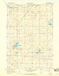 1967 Lucan1968 Print · USGSRedwood County agriculture and rail transport intersect in the late sixties at the village of Lucan. Genealogists and historians can trace the intricate drainage system of Judicial Ditch No 31 and explore local landmarks like Westline State Wildlife Management Area.
 - 1967 Map of Sanborn NE, 1968 Print
 1967 Sanborn NE1968 Print · USGSSouthwestern Brown County during the late 1960s is characterized by its prairie river valleys and railroad corridors. Genealogists and historians can trace the rural infrastructure of Charlestown and Staley, including the Sanborn rail junction, Christ Ch, and the local Townhall.
 - 1967 Map of Lamberton, 1969 Print
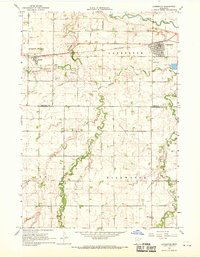 1967 Lamberton1969 Print · USGSThe rail-and-river landscape of Redwood and Cottonwood Counties comes into focus in the late sixties. Researchers can trace the Chicago and North Western line through Lamberton and Revere, or locate Highwater Ch and St Joseph Cem.
Showing maps 1-25 of 182
Top cities of Redwood County
- Redwood Falls historical maps
- Morgan historical maps
- Lamberton historical maps
- Wabasso historical maps
- Walnut Grove historical maps
- Belview historical maps
See more
Frequently asked questions
- What are the different types of historical maps available for Redwood County?
- What is the oldest map of Redwood County?
- Where can I purchase historical maps of Redwood County for my home or office?
- Where can I download high-res historical maps of Redwood County?
- Are there historical topographic maps available for Redwood County?
- Is there historical aerial imagery available for Redwood County?
- Where are historical maps of Redwood County sourced from?