1970s Maps of Bassett Township, Minnesota
Explore 6 historic maps of Bassett Township from the 1970s. These maps offer a rare glimpse into what life looked like during the 1970s — showing old roads, neighborhoods, homes, and landmarks that have changed or disappeared over time.
Whether you're researching your family's past, planning a metal detecting trip, or studying how Bassett Township's landscape evolved across the 1970s, these high-resolution maps are a powerful tool for exploring the history of this region.
- Focus on a specific era: All maps on this page are from the 1970s, giving you a focused view of this time period.
- See what’s changed: Compare century-old streets, trails, and buildings to today's modern landscape using overlays and satellite layers.
- Research with precision: Use these maps for genealogy, historical research, land use analysis, or educational projects.
- View, download, or print: Maps are fully viewable online in high resolution, and can be downloaded or printed for your own records.
Start exploring Bassett Township's history through authentic maps from the 1970s. This is your window into the past.
Bassett Township, MN maps
(6)- 1976 Map of Markham SE, 1979 Print
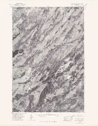 1976 Markham SE1979 Print · USGSThe northern forests of St. Louis County are captured in high detail during the mid-seventies in this aerial orthophoto. Trace the winding hydrology of the North Branch Whiteface River and South Branch Whiteface River.
 - 1976 Map of Brimson SW, 1979 Print
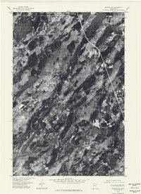 1976 Brimson SW1979 Print · USGSSt. Louis County is captured from above in the mid-1970s, revealing a landscape defined by forest and water. Researchers can trace the winding West Branch Cloquet River and the pristine shorelines of Wolf Lake.
 - 1976 Map of Markham NE, 1979 Print
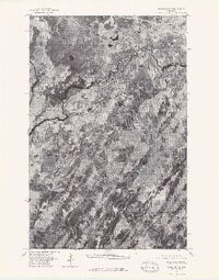 1976 Markham NE1979 Print · USGSNortheastern Minnesota's boreal landscape is captured in this mid-seventies aerial survey of St. Louis County. Researchers can trace the winding course of the St Louis River and examine the natural drainage patterns and forest cover of the era.
 - 1976 Map of Brimson NW, 1979 Print
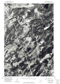 1976 Brimson NW1979 Print · USGSThe Iron Range backcountry of northeastern Minnesota is captured in mid-1976, showing the remote landscape of St. Louis County. Genealogists and researchers can trace the rail corridor near Skibo and the winding course of the St Louis River past Bassett Lake.
 - 1976 Map of Two Harbors, 1994 Print
 1976 Two Harbors1994 Print · USGSThe North Shore of Lake Superior comes alive in this mid-seventies survey of the Minnesota timber and iron country. Trace the Duluth Missabe and Iron Range RR from Two Harbors past Split Rock Lighthouse State Park to the industrial port at Silver Bay.
 - 1977 Map of Hibbing, 1994 Print
 1977 Hibbing1994 Print · USGSThe Iron Range of northern Minnesota comes into sharp focus during the late seventies, detailing the massive mining works and rail networks of St. Louis County. Researchers can trace family roots in Hibbing, Chisholm, and Virginia, or locate old post offices like Leoneth and Iron.
End of results
Showing maps 1-6 of 6
Top cities near Bassett Township
Top neighborhoods of Bassett Township
Frequently asked questions
- What are the different types of historical maps available for Bassett Township?
- What is the oldest map of Bassett Township?
- Where can I purchase historical maps of Bassett Township for my home or office?
- Where can I download high-res historical maps of Bassett Township?
- Are there historical topographic maps available for Bassett Township?
- Is there historical aerial imagery available for Bassett Township?
- Where are historical maps of Bassett Township sourced from?