Old Maps of Palmers, Duluth Township for Hiking & Exploration
Hike through history with 10 historic maps of Palmers. Explore old trails, ghost towns, and forgotten backroads — perfect for outdoor adventurers and local explorers.
- Rediscover forgotten places: Map out old mining camps, roads, and footpaths that no longer exist on modern maps.
- Layer with modern tools: Combine with LiDAR or satellite views to plan hikes through historical terrain.
- Made for exploration: Popular among hikers, overlanders, and local history lovers.
Use these maps to find adventure and explore the hidden past of Palmers.
Palmers, Duluth Township maps
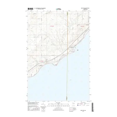
(10)- 1953 Map of Knife River, 1955 Print
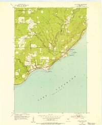 1953 Knife River1955 Print · USGSThe Lake Superior shoreline comes alive in the mid-fifties as the railroad and old highway wind through coastal settlements. Researchers can trace the industrial corridor of the Duluth Missabe and Iron Range Railroad and locate local sites like Lake View Cem and Palmers.4 unique versions available
 - 1953 Map of Ashland, 1964 Print
 1953 Ashland1964 Print · USGSNorthern Wisconsin's lakefront and timberlands are seen here in the mid-1950s, showing the intersection of industrial rail lines and vast wilderness. Genealogists and historians can trace the Soo Line through rail towns like Mellen or locate family roots in the Apostle Islands and Bad River Indian Reservation.3 unique versions available
 - 1958 Map of Ashland
 1958 Ashland1958 Print · USGSCoastal Wisconsin and the Michigan borderlands meet here in the late fifties, dominated by the timbered expanses and iron-rich ranges. Genealogists can trace family footprints in settlements like Odanah and Montreal, or locate landmarks such as the Coast Guard Station and Agricultural Experiment Station.
 - 1980 Map of Port Wing
 1980 Port Wing1980 Print · USGSThe Lake Superior shoreline and the deep forests of Bayfield and Douglas counties are captured here in the early eighties. Genealogists and historians can trace the rail lines through Iron River or locate the lakeside landings at Cornucopia and Port Wing.
 - 1992 Map of Knife River, 1995 Print
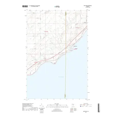
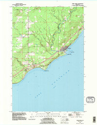 1992 Knife River1995 Print · USGSThe Lake Superior shoreline northeast of Duluth is captured here in the early nineties, showing the transition from lakeside settlements to inland forest. Trace family sites near Palmers and the Lake View Cem, or follow the course of the Knife River to Granite Point.
 - 2010 Map of Knife River, 2010 Print
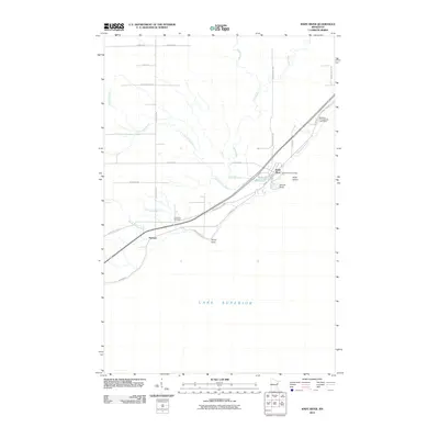 2010 Knife River2010 Print · USGSCovers Palmers, including Knife River, Lake No. 2, and other nearby areas
 - 2013 Map of Knife River, 2013 Print
 2013 Knife River2013 Print · USGSCovers Palmers, including Knife River, Lake No. 2, and other nearby areas
 - 2016 Map of Knife River, 2016 Print
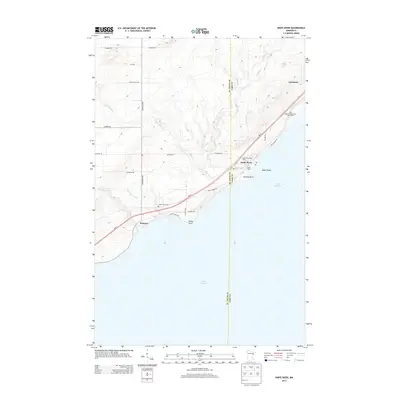
 2016 Knife River2016 Print · USGSCovers Palmers, including Knife River, Lake No. 2, and other nearby areas
 - 2019 Map of Knife River, 2019 Print
 2019 Knife River2019 Print · USGSCovers Palmers, including Knife River, Lake No. 2, and other nearby areas
 - 2022 Map of Knife River, 2022 Print
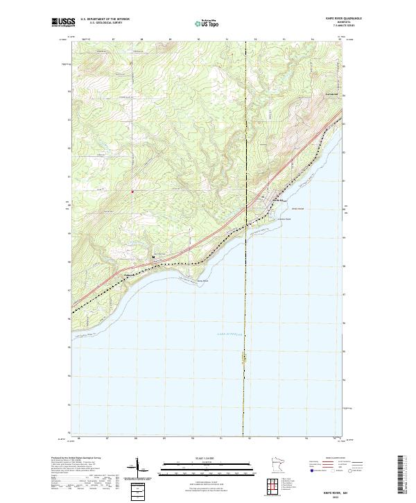 2022 Knife River2022 Print · USGSThe North Shore comes alive in this contemporary view of the Lake Superior coastline between Palmers and Larsmont. Genealogists and historians can trace local landmarks like Lake View Cem and coastal features including Stony Point and Knife Island.
End of results
Showing maps 1-10 of 10
Top cities near Palmers
- Duluth historical maps
- Superior historical maps
- Two Harbors historical maps
- Lakewood historical maps
- Cloverland historical maps
Frequently asked questions
- What are the different types of historical maps available for Palmers?
- What is the oldest map of Palmers?
- Where can I purchase historical maps of Palmers for my home or office?
- Where can I download high-res historical maps of Palmers?
- Are there historical topographic maps available for Palmers?
- Is there historical aerial imagery available for Palmers?
- Where are historical maps of Palmers sourced from?