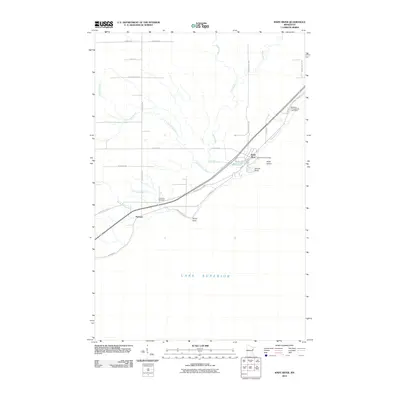
2010 Map of Knife River
USGS Topo · Published 2010About this map
Knife River sits at the convergence of several waterways on the North Shore of Lake Superior, serving as a focal point for the surrounding rural area in Lake County. The landscape is defined by the drainage patterns of the Little Knife River and Knife River, which meet near the shoreline by Granite Point. The settlement of Palmers is situated further southwest along the coast, connected to the larger community by Old North Shore Rd and N Shore Dr. This area's transition from a waterway-dependent economy to one supported by highway access is evident in the alignment of these coastal routes. For those researching local roots, the Lake View Cemetery and the Knife River Post Office provide fixed points of community identity, while the presence of the Big Blaze Campground and Cabins reflects the region's enduring appeal for seasonal visitors and outdoor recreation.
Find a feature on this map
30 named features on this map. Tap any name to fly to it.
Don’t see what you’re looking for? This feature index may not catch every label — zoom into the map to look around manually.
Map Details
Editions of this 2010 Knife River Map
This is the sole edition of this map. No revisions or reprints were ever made.
Other maps of this area

1953 · Lakewood
USGS Topo · 1:24,000

1953 · French River
USGS Topo · 1:24,000

1953 · Knife River
USGS Topo · 1:24,000

1953 · Ashland
USGS Topo · 1:250,000

1954 · Barrs Lake
USGS Topo · 1:24,000

1954 · Mc Carthy Creek
USGS Topo · 1:24,000

1954 · Two Harbors
USGS Topo · 1:250,000

1957 · Two Harbors
USGS Topo · 1:250,000

1957 · Two Harbors
USGS Topo · 1:62,500

1957 · Two Harbors
USGS Topo · 1:24,000