1950s Maps of Duluth, Minnesota
Explore 14 historic maps of Duluth from the 1950s. These maps offer a rare glimpse into what life looked like during the 1950s — showing old roads, neighborhoods, homes, and landmarks that have changed or disappeared over time.
Whether you're researching your family's past, planning a metal detecting trip, or studying how Duluth's landscape evolved across the 1950s, these high-resolution maps are a powerful tool for exploring the history of this region.
- Focus on a specific era: All maps on this page are from the 1950s, giving you a focused view of this time period.
- See what’s changed: Compare century-old streets, trails, and buildings to today's modern landscape using overlays and satellite layers.
- Research with precision: Use these maps for genealogy, historical research, land use analysis, or educational projects.
- View, download, or print: Maps are fully viewable online in high resolution, and can be downloaded or printed for your own records.
Start exploring Duluth's history through authentic maps from the 1950s. This is your window into the past.
Duluth, MN maps
(14)- 1953 Map of Lakewood, 1955 Print
 1953 Lakewood1955 Print · USGSThe North Shore of Lake Superior comes alive in the mid-1950s, showing the early residential and transit corridor north of Duluth. You can trace the Duluth Missabe and Iron Range rail line past Lakewood and the North Shore Chapel.4 unique versions available
 - 1953 Map of French River, 1955 Print
 1953 French River1955 Print · USGSThe North Shore of Lake Superior comes alive in the early fifties as timberlands met the burgeoning iron-and-rail industry. Genealogists and local historians can trace the foundations of Bloomingdale, Normanna Cem, and the path of the Duluth Missabe and Iron Range railroad.4 unique versions available
 - 1953 Map of Arnold, 1955 Print
 1953 Arnold1955 Print · USGSThe rural countryside north of Duluth is shown here in the mid-1950s, characterized by growing townships and a dense network of glacial lakes. Local historians can trace early community sites like Arnold, the Exeter Farms Ch, and the Gnesen Sch.5 unique versions available
 - 1953 Map of Duluth, 1955 Print
 1953 Duluth1955 Print · USGSMid-century Duluth shows a bustling maritime and academic center along the rocky shores of Lake Superior. Trace family roots and city history at Calvary Cemetery, the University of Minnesota Duluth Branch, and the Ship Canal.7 unique versions available
 - 1953 Map of Duluth Heights, 1955 Print
 1953 Duluth Heights1955 Print · USGSThe plateau above Lake Superior comes into focus in the early 1950s as Hermantown and Duluth Heights expand into their modern forms. Genealogists and local historians can trace rural schools and family plots at Gethsemane Ch, Hermantown Cem, and the Jewish Cem.5 unique versions available
 - 1953 Map of Duluth, 1959 Print
 1953 Duluth1959 Print · USGSThe port city of Duluth and its timber-and-iron hinterlands are captured here in the early 1950s. Genealogists and historians can locate family landmarks from Minnesota Point to the Duluth Municipal Airport, including Calvary Cem and Lakewood Sch.
 - 1953 Map of Ashland, 1964 Print
 1953 Ashland1964 Print · USGSNorthern Wisconsin's lakefront and timberlands are seen here in the mid-1950s, showing the intersection of industrial rail lines and vast wilderness. Genealogists and historians can trace the Soo Line through rail towns like Mellen or locate family roots in the Apostle Islands and Bad River Indian Reservation.3 unique versions available
 - 1953 Map of Duluth, 1964 Print
 1953 Duluth1964 Print · USGSNortheastern Minnesota and northwestern Wisconsin are shown here during a period of industrial maturity and expanding conservation. Genealogists and historians can trace rail-connected towns like McGrath and Wahkon, or locate heritage sites within the Fond du Lac Indian Reservation.2 unique versions available
 - 1954 Map of West Duluth, 1955 Print
 1954 West Duluth1955 Print · USGSThe industrial waterfronts of the Twin Ports are captured here during the mid-fifties, showing the dense rail networks and residential neighborhoods of the St. Louis River valley. Researchers can trace family sites and local landmarks from Morgan Park to the Oneota Cemetery and the height of Bardon Peak.9 unique versions available
 - 1954 Map of Superior, 1955 Print
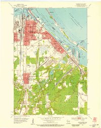 1954 Superior1955 Print · USGSThe industrial waterfront of Superior at mid-century is captured in this survey, showing a landscape defined by shipping and rail. Researchers can trace family roots through numerous sites like St Francis Cem, Wisconsin State College, and South Itasca.6 unique versions available
 - 1954 Map of Esko, 1955 Print
 1954 Esko1955 Print · USGSThe St. Louis River valley and the community of Esko are shown here in the mid-1950s as the region's rail and park systems were fully established. Genealogists and local historians can trace the early footprints of Fond du Lac, the Finnish Ch, and the winding Duluth Missabe and Iron Range railroad.5 unique versions available
 - 1954 Map of Superior, 1959 Print
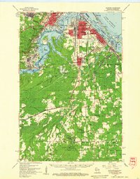 1954 Superior1959 Print · USGSThe Twin Ports and Douglas County are captured in the mid-fifties, showing the industrial waterfronts and rail yards at their peak. Researchers can locate vanished landmarks like the Concrete Sch or trace family roots at St Joseph Orphanage and Morgan Park.
 - 1958 Map of Ashland
 1958 Ashland1958 Print · USGSCoastal Wisconsin and the Michigan borderlands meet here in the late fifties, dominated by the timbered expanses and iron-rich ranges. Genealogists can trace family footprints in settlements like Odanah and Montreal, or locate landmarks such as the Coast Guard Station and Agricultural Experiment Station.
 - 1958 Map of Duluth
 1958 Duluth1958 Print · USGSNortheastern Minnesota and the Wisconsin borderlands are shown in detail during the late 1950s, centered on the bustling rail yards and ports of Duluth. You can trace the historic routes of the Soo Line and Duluth Missabe & Iron Range through small towns like McGrath, Bruno, and Wrenshall.
End of results
Showing maps 1-14 of 14
Top cities near Duluth
- Superior historical maps
- Hermantown historical maps
- Proctor historical maps
- Lakewood historical maps
- Parkland historical maps
- Fredenberg historical maps
See more
Top neighborhoods of Duluth
- Central Hillside historical maps
- North Shore historical maps
- Duluth Heights historical maps
- Lakeside-Lester Park historical maps
- Cody historical maps
- Oneota historical maps
See more
Frequently asked questions
- What are the different types of historical maps available for Duluth?
- What is the oldest map of Duluth?
- Where can I purchase historical maps of Duluth for my home or office?
- Where can I download high-res historical maps of Duluth?
- Are there historical topographic maps available for Duluth?
- Is there historical aerial imagery available for Duluth?
- Where are historical maps of Duluth sourced from?