Old Maps of Glendale, Minnesota
Explore 11 old maps of Glendale, spanning from 1954 to today. These high-resolution historic maps reveal how streets, neighborhoods, landmarks, and natural features evolved over time — perfect for genealogy, metal detecting, research, and local history exploration.
What you can do with these maps:
- See how Glendale changed over time: Compare historical maps to modern-day views to trace roads, homesites, rail lines & more.
- View detailed metadata: Each map includes creators, publishers, year, scale, and archive source.
- Overlay maps with satellite & LiDAR: Visualize the past alongside modern tools to explore terrain & human change.
- Trusted historical sources: Maps sourced from the USGS, Library of Congress, and other archives.
- Access maps your way: View online, download high-res files, or order prints for personal or research use.
Start exploring old maps of Glendale to uncover forgotten places, hidden landmarks, and the deep history beneath your feet.
Glendale, MN maps
(11)- 1954 Map of International Falls, 1980 Print
 1954 International Falls1980 Print · USGSThe Minnesota-Ontario borderlands come alive in this mid-century survey of the Rainy River region and the interconnected waterways that now form Voyageurs National Park. Genealogists and local historians can trace the rail-and-timber era through settlements like Littlefork, the Nett Lake Indian Reservation, and the Canadian National rail lines.
 - 1957 Map of International Falls
 1957 International Falls1957 Print · USGSThe Minnesota-Ontario borderlands come alive in the mid-fifties, showing the industrial nodes of International Falls and Fort Frances. Genealogists and historians can trace rail-tied settlements like Aylsworth and Littlefork or locate ancestral lands within the Nett Lake Indian Reservation.
 - 1958 Map of International Falls
 1958 International Falls1958 Print · USGSThe borderlands of northern Minnesota and Ontario are mapped here during the mid-fifties, centered on the river-and-rail hubs of the Northwoods. Researchers can trace the path of the Northern Pacific through Big Falls or locate early settlements like Ericsburg and Ranier.2 unique versions available
 - 1968 Map of Orr, 1987 Print
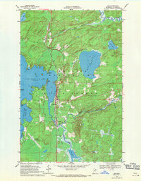
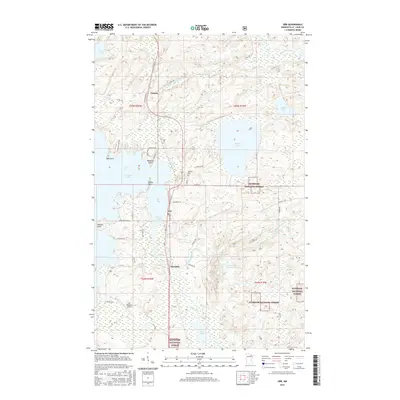
 1968 Orr1987 Print · USGSThe northern lake country of St. Louis County is captured here in the late sixties, centered on the waterfront settlement of Orr. Genealogists and historians can trace the Duluth Winnipeg and Pacific rail line through Cusson and locate the Leiding Cem and local High Sch.
 - 1969 Map of Orr, 1971 Print
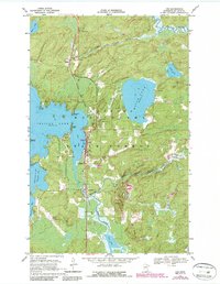
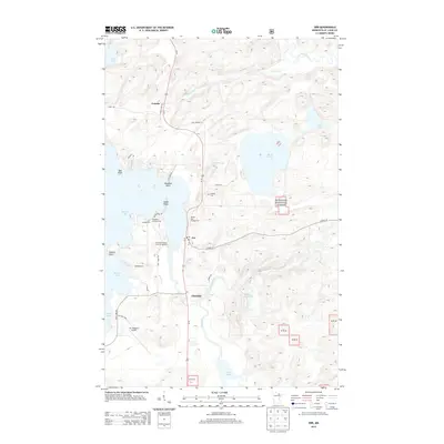
 1969 Orr1971 Print · USGSNorthern Minnesota timber country and the shores of Pelican Lake are captured here in the late sixties. Researchers can trace the Duluth Winnipeg and Pacific rail line through Orr, Glendale, and the Leiding Cem.
 - 1978 Map of Crane Lake, 1994 Print
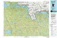 1978 Crane Lake1994 Print · USGSThe Minnesota-Ontario borderlands remained a dense wilderness of lakes and timber late into the twentieth century. Genealogists and historians can trace the route of the Duluth Winnipeg and Pacific through Orr and locate remote landmarks like Cemetery Island or the Beatty Portage.
 - 2011 Map of Orr, 2011 Print
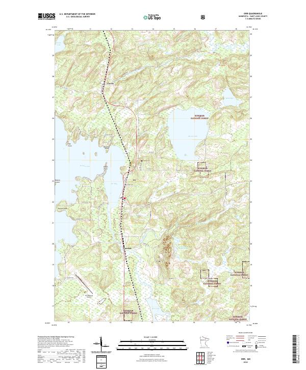
 2011 Orr2011 Print · USGSCovers Glendale, including Orr, Cusson, and other nearby areas
 - 2013 Map of Orr, 2013 Print
 2013 Orr2013 Print · USGSCovers Glendale, including Orr, Cusson, and other nearby areas
 - 2016 Map of Orr, 2016 Print
 2016 Orr2016 Print · USGSCovers Glendale, including Orr, Cusson, and other nearby areas
 - 2019 Map of Orr, 2019 Print
 2019 Orr2019 Print · USGSCovers Glendale, including Orr, Cusson, and other nearby areas
 - 2022 Map of Orr, 2022 Print
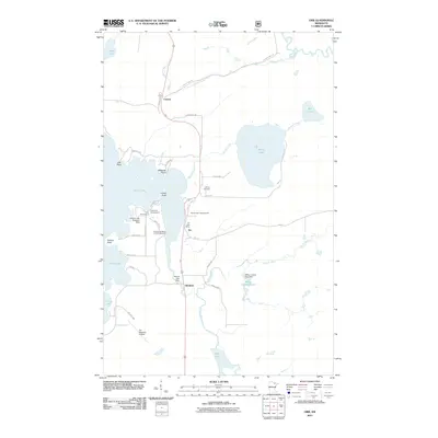
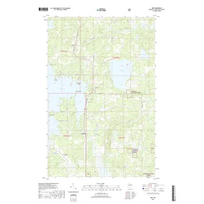
 2022 Orr2022 Print · USGSOrr and the surrounding timberlands of St. Louis County are documented here in the early 2020s, centered on the shores of Pelican Lake. Researchers can trace local landmarks like Leiding Cem, the settlement of Cusson, and the runways of Orr Regional Airport.
End of results
Showing maps 1-11 of 11
Top cities near Glendale
- Cook historical maps
- Gheen historical maps
- Orr historical maps
- Linden Grove historical maps
- Willow Valley Township historical maps
Frequently asked questions
- What are the different types of historical maps available for Glendale?
- What is the oldest map of Glendale?
- Where can I purchase historical maps of Glendale for my home or office?
- Where can I download high-res historical maps of Glendale?
- Are there historical topographic maps available for Glendale?
- Is there historical aerial imagery available for Glendale?
- Where are historical maps of Glendale sourced from?