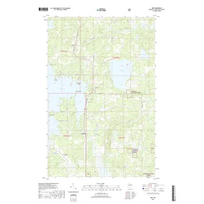
2019 Map of Orr
USGS Topo · Published 2019About this map
Orr and the surrounding timberlands of the Superior National Forest define this landscape on the shores of Pelican Lake. The settlement pattern follows the Highway 53 corridor, connecting the community of Glendale to the southern tip of Orr Bay and reaching north toward Cusson. This area is defined by its complex hydrology, where the Pelican River and Elbow River wind through extensive wetlands and smaller water bodies like Moose Lake and Rice Lake. Cultural landmarks include the Leiding Cem and the Orr Regional Airport, while the shoreline is marked by distinctive features such as Bessette Point and Indian Point. The road network, including Cusson Loop Rd and Sugar Bush Trl, provides access to the lakefront and the deep forest interior of northern Saint Louis County.
Find a feature on this map
46 named features on this map. Tap any name to fly to it.
Don’t see what you’re looking for? This feature index may not catch every label — zoom into the map to look around manually.
Map Details
Editions of this 2019 Orr Map
This is the sole edition of this map. No revisions or reprints were ever made.
Other maps of this area

1954 · Hibbing
USGS Topo · 1:250,000

1954 · International Falls
USGS Topo · 1:250,000

1957 · Hibbing
USGS Topo · 1:250,000

1957 · International Falls
USGS Topo · 1:250,000

1958 · International Falls
USGS Topo · 1:250,000

1958 · Hibbing
USGS Topo · 1:250,000

1964 · Hibbing
USGS Topo · 1:250,000

1964 · Haley
USGS Topo · 1:24,000

1964 · Gheen NW
USGS Topo · 1:24,000

1964 · Gheen
USGS Topo · 1:24,000