
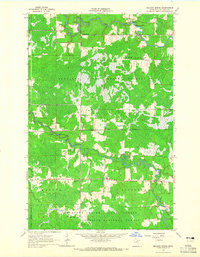
1964 Map of Gheen NW
USGS Topo · Published 1965About this map
The vast Kabetogama State Forest dominates this mid-1960s landscape in St. Louis County, where the dense timberlands are interrupted only by a network of waterways and early resource extraction sites. In the southern reaches of the quadrangle, the Little Fork River meanders sharply, marked by a series of rapids near the settlement of Linden Grove. The drainage pattern is defined by the Willow River and Beaver Creek, which cut through the low-lying Willow Valley. This survey, field-checked in 1964, shows a landscape primarily dedicated to conservation and forestry, with numerous gravel pits indicating the localized industrial activity required for maintaining the forest road network within the Leiding township area and along the defined State Forest Boundary.
Find a feature on this map
10 named features on this map. Tap any name to fly to it.
Don’t see what you’re looking for? This feature index may not catch every label — zoom into the map to look around manually.
Map Details
Editions of this 1964 Gheen NW Map
This is the sole edition of this map. No revisions or reprints were ever made.
Other maps of this area

1954 · Hibbing
USGS Topo · 1:250,000

1954 · International Falls
USGS Topo · 1:250,000

1957 · Hibbing
USGS Topo · 1:250,000

1957 · International Falls
USGS Topo · 1:250,000

1958 · International Falls
USGS Topo · 1:250,000

1958 · Hibbing
USGS Topo · 1:250,000

1964 · Hibbing
USGS Topo · 1:250,000

1964 · Linden Grove
USGS Topo · 1:24,000

1964 · Gheen
USGS Topo · 1:24,000
1964 · Meadow Brook
USGS Topo · 1:24,000