
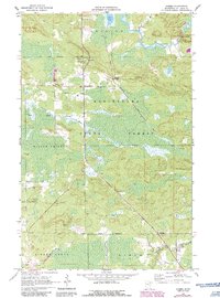
1964 Map of Gheen
USGS Topo · Published 1965About this map
The Duluth Winnipeg and Pacific railroad cuts a diagonal line through the wooded landscape of northern St. Louis County, anchoring the small settlements of Gheen and Gheen Corner. This mid-century survey captures the region during a period when the timber industry and localized mining, evidenced by several Gravel Pits, shaped the local economy. The terrain is defined by the Kabetogama State Forest, where the Elbow River flows through the northeast, punctuated by Elbow Rapids and the waters of Rice Lake.
Find a feature on this map
19 named features on this map. Tap any name to fly to it.
Don’t see what you’re looking for? This feature index may not catch every label — zoom into the map to look around manually.
Map Details
Editions of this 1964 Gheen Map
2 editions found
Other maps of this area

1954 · Hibbing
USGS Topo · 1:250,000

1954 · International Falls
USGS Topo · 1:250,000

1957 · Hibbing
USGS Topo · 1:250,000

1957 · International Falls
USGS Topo · 1:250,000

1958 · International Falls
USGS Topo · 1:250,000

1958 · Hibbing
USGS Topo · 1:250,000

1964 · Hibbing
USGS Topo · 1:250,000

1964 · Linden Grove
USGS Topo · 1:24,000

1964 · Haley
USGS Topo · 1:24,000

1964 · Gheen NW
USGS Topo · 1:24,000