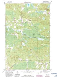
1964 Map of Gheen
USGS Topo · Published 1986About this map
Kabetogama State Forest dominates this northern Minnesota landscape, characterized by the dense wetlands and timbered tracts of the Willow Valley and Leiding districts. The settlement of Gheen and its nearby namesake, Gheen Corner, serve as the primary hubs along the Duluth Winnipeg and Pacific railroad line, which bisects the quadrangle. A network of hydrological features including the Elbow River with its Elbow Rapids, Rice Lake, and the winding Willow River define the local topography. Historical transport patterns are evident in the Old Railroad Grade and numerous Gravel Pits scattered throughout the terrain, suggesting a landscape shaped by both natural waterways and the needs of industrial infrastructure. Local landmarks like the Lookout Tower and Willow Valley Cem offer specific points of interest for genealogists and regional historians studying the settlement patterns of St. Louis County in the mid-1960s.
Find a feature on this map
20 named features on this map. Tap any name to fly to it.
Don’t see what you’re looking for? This feature index may not catch every label — zoom into the map to look around manually.
Map Details
Editions of this 1964 Gheen Map
2 editions found

Other maps of this area

1954 · Hibbing
USGS Topo · 1:250,000

1954 · International Falls
USGS Topo · 1:250,000

1957 · Hibbing
USGS Topo · 1:250,000

1957 · International Falls
USGS Topo · 1:250,000

1958 · International Falls
USGS Topo · 1:250,000

1958 · Hibbing
USGS Topo · 1:250,000

1964 · Hibbing
USGS Topo · 1:250,000

1964 · Linden Grove
USGS Topo · 1:24,000

1964 · Haley
USGS Topo · 1:24,000

1964 · Gheen NW
USGS Topo · 1:24,000