2020s Maps of Hibbing, Minnesota
Explore 8 historic maps of Hibbing from the 2020s. These maps offer a rare glimpse into what life looked like during the 2020s — showing old roads, neighborhoods, homes, and landmarks that have changed or disappeared over time.
Whether you're researching your family's past, planning a metal detecting trip, or studying how Hibbing's landscape evolved across the 2020s, these high-resolution maps are a powerful tool for exploring the history of this region.
- Focus on a specific era: All maps on this page are from the 2020s, giving you a focused view of this time period.
- See what’s changed: Compare century-old streets, trails, and buildings to today's modern landscape using overlays and satellite layers.
- Research with precision: Use these maps for genealogy, historical research, land use analysis, or educational projects.
- View, download, or print: Maps are fully viewable online in high resolution, and can be downloaded or printed for your own records.
Start exploring Hibbing's history through authentic maps from the 2020s. This is your window into the past.
Hibbing, MN maps
(8)- 2022 Map of Buhl, 2022 Print
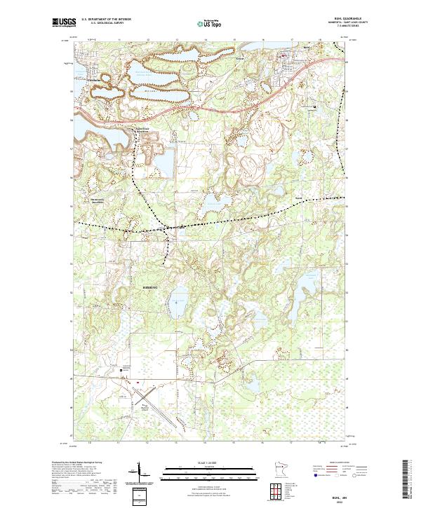 2022 Buhl2022 Print · USGSThe Mesabi Range iron mining district is well-defined in this recent survey of St. Louis County. Researchers can trace local lineage and infrastructure through Lake View Cem, the Range Regional Airport, and junctions like Wilpen.
 - 2022 Map of Dewey Lake, 2022 Print
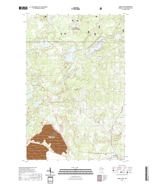 2022 Dewey Lake2022 Print · USGSThe iron country of the Mesabi Range meets the southern edge of the Superior National Forest in this recent survey. Local historians can trace the industrial landscape of the Hibbing Taconite Tailings Basin and locate the Calvary Cem near the town of Chisholm.
 - 2022 Map of Keewatin, 2022 Print
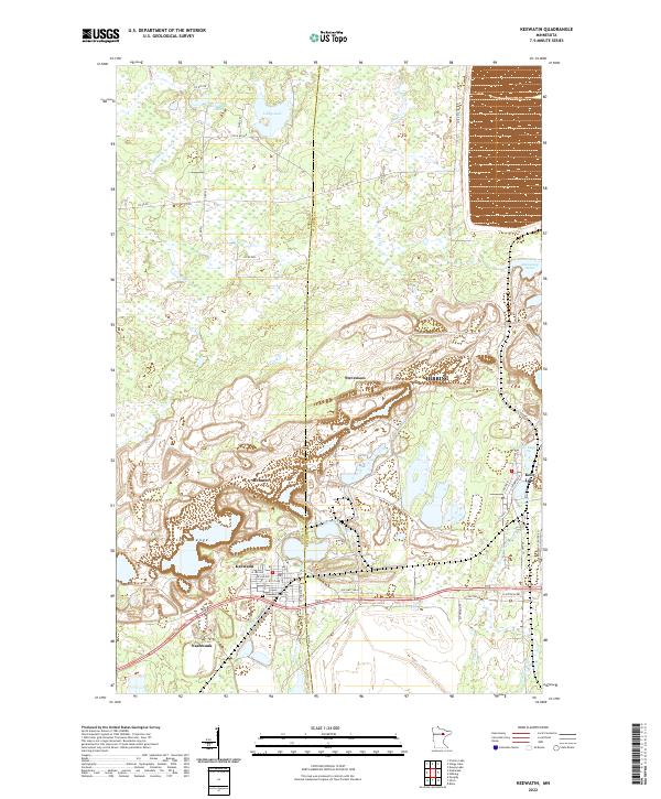 2022 Keewatin2022 Print · USGSThe Mesabi Range iron-mining landscape is revealed in this modern survey, showing the deep integration of industry and community in Itasca County. Genealogists and historians can trace the streets of Keewatin, find the Keewatin Cem, and locate smaller settlements like Stevenson or Clayton Acres.
 - 2022 Map of Little Swan, 2022 Print
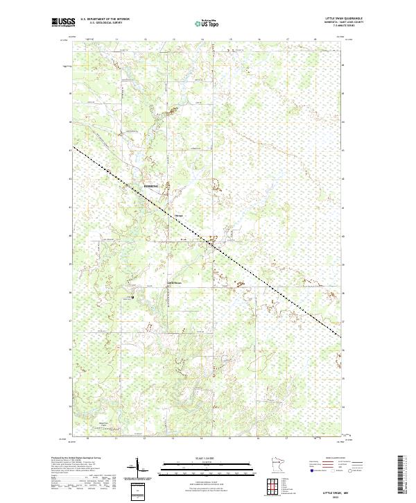 2022 Little Swan2022 Print · USGSSaint Louis County's quiet wetlands and timberlands are captured here in the early 2020s, just south of the Iron Range. Genealogists and local historians can locate the Little Swan Cem and trace the paths of the E Swan River and W Swan River.
 - 2022 Map of Stingy Lake, 2022 Print
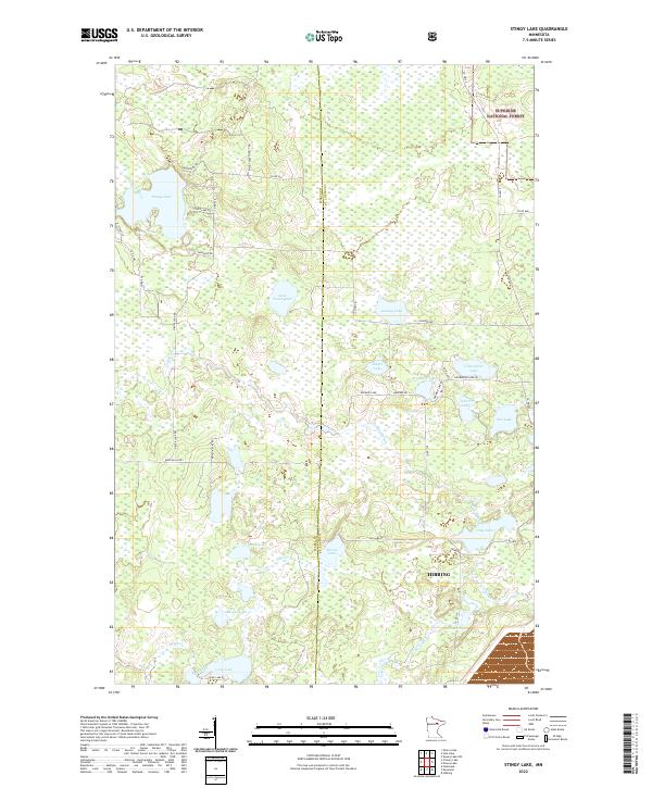 2022 Stingy Lake2022 Print · USGSThe Itasca and St. Louis county line comes alive in this 2020s study of the northern Minnesota forest and the periphery of the Mesabi Range. Researchers can trace the water systems of Prairie River and Moose Lake or locate recreational landmarks like Mickelson Trl.
 - 2022 Map of Riley, 2022 Print
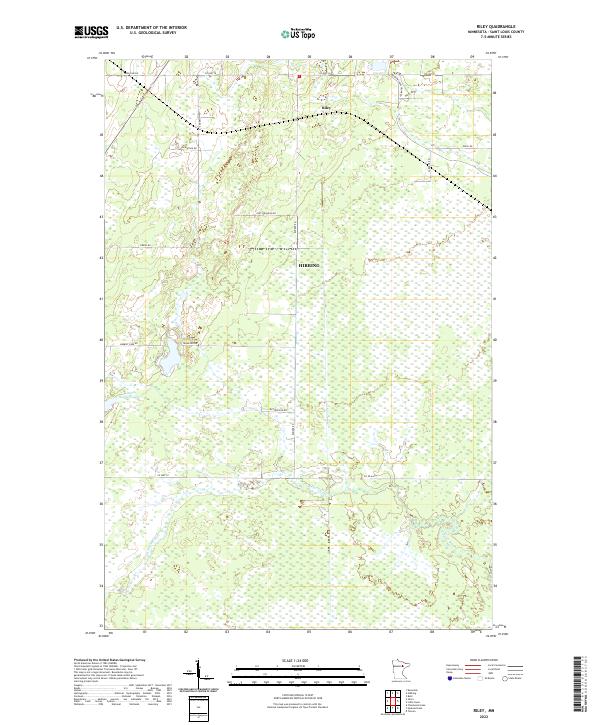 2022 Riley2022 Print · USGSSaint Louis County's rural landscape is documented here in the early 2020s, showing the intersection of local family history and the Iron Range. Genealogists and historians can trace family-named routes like Koivu Rd and Anderson Rd near Riley.
 - 2022 Map of Hibbing, 2022 Print
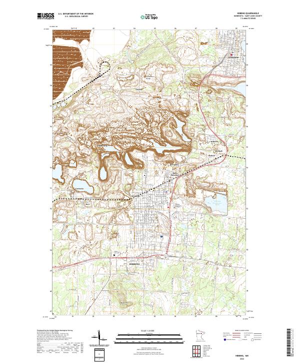 2022 Hibbing2022 Print · USGSIron Range history comes alive in this 2022 survey of Hibbing and Chisholm, capturing the industrial landscape of the Mesabi Range. Local researchers can locate family sites at North Hibbing Cem or trace the development of settlements like Scranton and Ruby Junction.
 - 2022 Map of Silica, 2022 Print
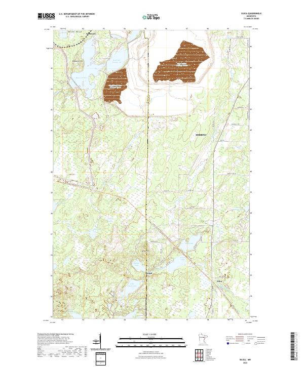 2022 Silica2022 Print · USGSMining infrastructure and northern wetlands meet along the St. Louis and Itasca county line in the early twenty-first century. Researchers can trace the Alborn-Pengilly Railroad Trail and locate small settlements like Bengal and Silica.
End of results
Showing maps 1-8 of 8
Top cities near Hibbing
- Chisholm historical maps
- Keewatin historical maps
- Buhl historical maps
- Nashwauk historical maps
- Kinney historical maps
Top neighborhoods of Hibbing
- Kelly Lake historical maps
- Onega historical maps
- Kitzville historical maps
- Lavinia historical maps
- Leetonia historical maps
- Mitchell historical maps
See more
Frequently asked questions
- What are the different types of historical maps available for Hibbing?
- What is the oldest map of Hibbing?
- Where can I purchase historical maps of Hibbing for my home or office?
- Where can I download high-res historical maps of Hibbing?
- Are there historical topographic maps available for Hibbing?
- Is there historical aerial imagery available for Hibbing?
- Where are historical maps of Hibbing sourced from?