1900s (20th Century) Maps of Hush Lake, Minnesota
Explore 14 historic maps of Hush Lake from the 1900s (20th Century). These maps offer a rare glimpse into what life looked like during the 1900s — showing old roads, neighborhoods, homes, and landmarks that have changed or disappeared over time.
Whether you're researching your family's past, planning a metal detecting trip, or studying how Hush Lake's landscape evolved across the 1900s, these high-resolution maps are a powerful tool for exploring the history of this region.
- Focus on a specific era: All maps on this page are from the 1900s, giving you a focused view of this time period.
- See what’s changed: Compare century-old streets, trails, and buildings to today's modern landscape using overlays and satellite layers.
- Research with precision: Use these maps for genealogy, historical research, land use analysis, or educational projects.
- View, download, or print: Maps are fully viewable online in high resolution, and can be downloaded or printed for your own records.
Start exploring Hush Lake's history through authentic maps from the 1900s. This is your window into the past.
Hush Lake, MN maps
(14)- 1954 Map of Hibbing, 1966 Print
 1954 Hibbing1966 Print · USGSNorthern Minnesota's Iron Range thrives during the mid-1960s, showing the industrial landscape between the Mesabi Range and the Mississippi River. Genealogists and historians can trace the rail lines of the Great Northern RR through mining hubs like Hibbing and Virginia.3 unique versions available
 - 1957 Map of Hibbing
 1957 Hibbing1957 Print · USGSNorthern Minnesota's Iron Range is shown at its industrial peak in the mid-fifties, dominated by the massive iron pits and rail corridors of the Mesabi Range. Researchers can trace the rail networks of the Duluth Missabe and Iron Range and locate mining hubs like Hibbing, Virginia, and Bovey.
 - 1957 Map of Markham, 1958 Print
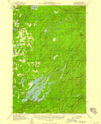 1957 Markham1958 Print · USGSSt. Louis County in the late fifties was a landscape of dense state forests and critical waterways supporting the regional Iron Range. Researchers can locate the settlement of Markham and trace the paths of the Duluth Missabe and Iron Range railroad and the sprawling Whiteface Reservoir.2 unique versions available
 - 1958 Map of Hibbing
 1958 Hibbing1958 Print · USGSThe Mesabi Iron Range reached its mid-century height during this era, defining the landscape between Grand Rapids and Virginia. Genealogists and historians can trace the mining-town networks of Hibbing and Chisholm or locate numerous iron mines and rail spurs.
 - 1964 Map of Hibbing
 1964 Hibbing1964 Print · USGSNorthern Minnesota’s iron-rich corridor is captured here during a peak era of mid-century industrial activity. Researchers can trace the rail-to-mine connections through Mesabi Range towns like Hibbing and Virginia or locate lakefront settlements near Pokegama Lake.
 - 1976 Map of Markham SE, 1979 Print
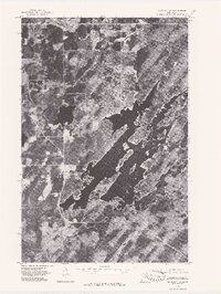
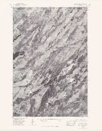 1976 Markham SE1979 Print · USGSThe northern forests of St. Louis County are captured in high detail during the mid-seventies in this aerial orthophoto. Trace the winding hydrology of the North Branch Whiteface River and South Branch Whiteface River.
 - 1976 Map of Markham NW, 1979 Print
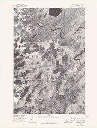 1976 Markham NW1979 Print · USGSSt. Louis County is captured from above in the mid-1970s, showing the intersection of waterway and woodland. Local historians can trace the exact 1976 path of the St Louis River and the rural surroundings of Whitewater Lake.
 - 1976 Map of Markham NE, 1979 Print
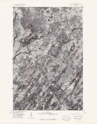 1976 Markham NE1979 Print · USGSNortheastern Minnesota's boreal landscape is captured in this mid-seventies aerial survey of St. Louis County. Researchers can trace the winding course of the St Louis River and examine the natural drainage patterns and forest cover of the era.
 - 1976 Map of Markham SW, 1979 Print
 1976 Markham SW1979 Print · USGSThe northern Minnesota woods and the complex shoreline of the Whiteface Reservoir are captured here in the mid-1970s. Researchers can trace the rural layout of Markham and the winding course of the Whiteface River through the timberland.
 - 1977 Map of Hibbing, 1994 Print
 1977 Hibbing1994 Print · USGSThe Iron Range of northern Minnesota comes into sharp focus during the late seventies, detailing the massive mining works and rail networks of St. Louis County. Researchers can trace family roots in Hibbing, Chisholm, and Virginia, or locate old post offices like Leoneth and Iron.
 - 1981 Map of Turpela Lake, 1982 Print
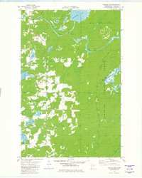 1981 Turpela Lake1982 Print · USGSIron Range wetlands and the Superior National Forest define this landscape during the early 1980s. Researchers can trace family-named landmarks like Hautala Lake and Kumpula Lake or locate industrial sites like the Gaging Station and various Gravel Pits.2 unique versions available
 - 1981 Map of Bird Lake, 1982 Print
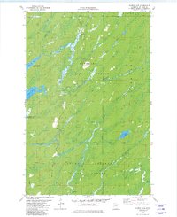
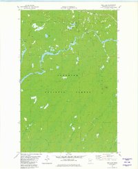 1981 Bird Lake1982 Print · USGSThe Superior National Forest remains a wild landscape of timber and wetlands in the early 1980s, shaped by the winding St Louis River. Local historians can trace the Duluth Missabe and Iron Range railroad or locate landmarks like Skibo Vista and Hush Lake.2 unique versions available
 - 1981 Map of Whiteface Reservoir, 1982 Print
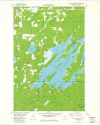 1981 Whiteface Reservoir1982 Print · USGSSt. Louis County is shown in the early eighties as a hub for northern forestry and recreation. Researchers can trace land use patterns across the Superior National Forest and locate specific sites like the Markham Cem or the Cloquet Valley Lookout Tower.2 unique versions available
 - 1981 Map of Harris Lake, 1982 Print
 1981 Harris Lake1982 Print · USGSThe St. Louis County woods were heavily managed for timber and recreation during the early eighties. Researchers can trace seasonal routes like the Snowmobile Trail and Winter Trail near Harris Lake and the Whiteface Reservoir.3 unique versions available
End of results
Showing maps 1-14 of 14
Top cities near Hush Lake
- Hoyt Lakes historical maps
- Aurora historical maps
- Babbitt historical maps
- Biwabik historical maps
- Fairbanks historical maps
Frequently asked questions
- What are the different types of historical maps available for Hush Lake?
- What is the oldest map of Hush Lake?
- Where can I purchase historical maps of Hush Lake for my home or office?
- Where can I download high-res historical maps of Hush Lake?
- Are there historical topographic maps available for Hush Lake?
- Is there historical aerial imagery available for Hush Lake?
- Where are historical maps of Hush Lake sourced from?