2020s Maps of Morse Township, Minnesota
Explore 6 historic maps of Morse Township from the 2020s. These maps offer a rare glimpse into what life looked like during the 2020s — showing old roads, neighborhoods, homes, and landmarks that have changed or disappeared over time.
Whether you're researching your family's past, planning a metal detecting trip, or studying how Morse Township's landscape evolved across the 2020s, these high-resolution maps are a powerful tool for exploring the history of this region.
- Focus on a specific era: All maps on this page are from the 2020s, giving you a focused view of this time period.
- See what’s changed: Compare century-old streets, trails, and buildings to today's modern landscape using overlays and satellite layers.
- Research with precision: Use these maps for genealogy, historical research, land use analysis, or educational projects.
- View, download, or print: Maps are fully viewable online in high resolution, and can be downloaded or printed for your own records.
Start exploring Morse Township's history through authentic maps from the 2020s. This is your window into the past.
Morse Township, MN maps
(6)- 2022 Map of Kangas Bay, 2022 Print
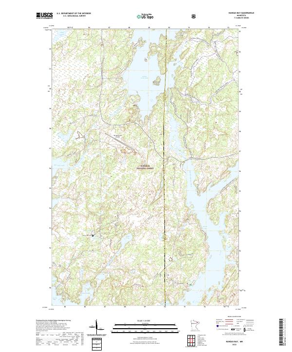 2022 Kangas Bay2022 Print · USGSThe Arrowhead Region of St. Louis County is documented here in the early twenty-first century, showcasing a landscape of interconnected lakes and national forest. Researchers can locate the Birch Lake Cem, Ely Municipal Airport, and several family-named roads like Latva Road.
 - 2022 Map of Shagawa Lake, 2022 Print
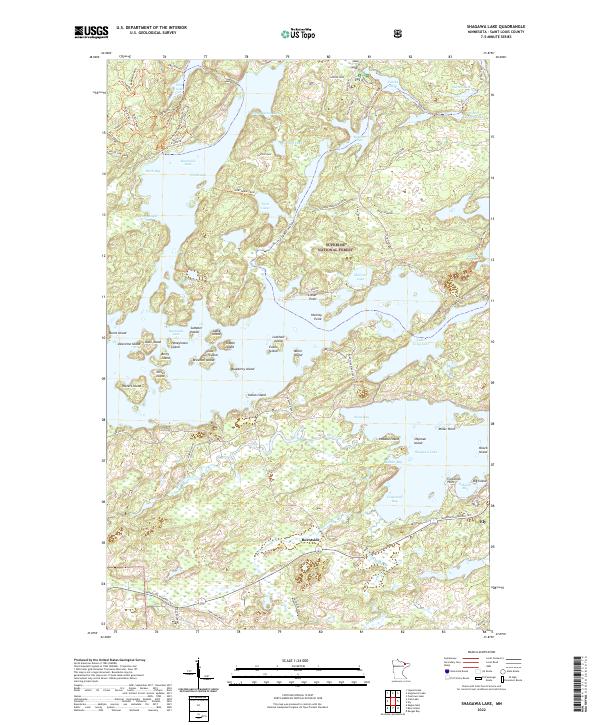 2022 Shagawa Lake2022 Print · USGSThe Iron Range wilderness near Ely is captured here in the early 2020s, showing a landscape defined by the sprawling, island-filled waters of Burntside Lake. Researchers can trace the layout of northern settlements like Burntside or locate specific island landmarks including Hoodoo Island and Blueberry Island.
 - 2022 Map of Bear Island, 2022 Print
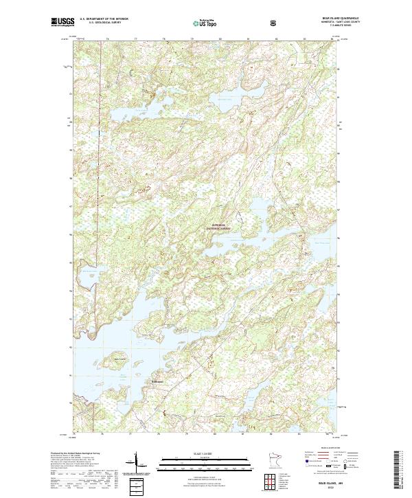 2022 Bear Island2022 Print · USGSSt. Louis County is depicted here in the early 2020s, showing a landscape defined by the iron industry and the lake-strewn woods of the Superior National Forest. Researchers can trace local routes like Birch Sled and find landmarks such as Rothman and the industrial site at Taconite.
 - 2022 Map of Eagles Nest, 2022 Print
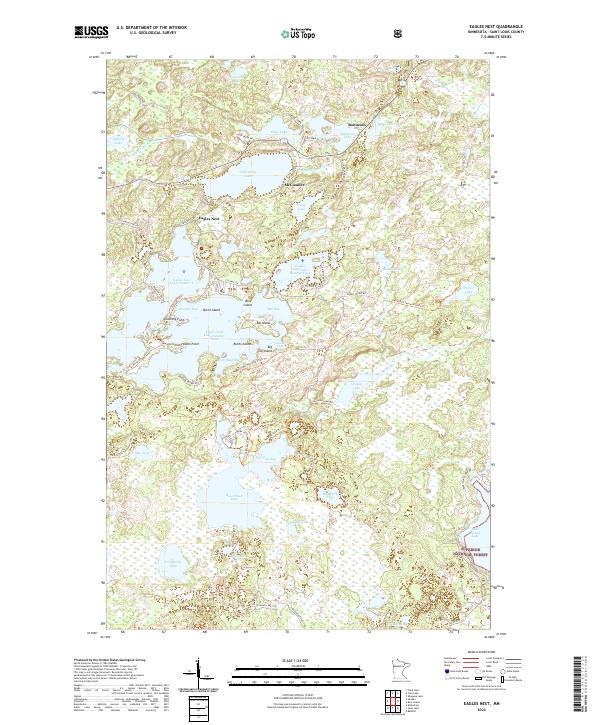 2022 Eagles Nest2022 Print · USGSNear the edge of the Iron Range in the early 2020s, this area shows a dense network of lakes and forest trails north of the Mesabi. Researchers can trace the layout of small communities like McComber and Robinson or locate specific shoreline landmarks such as Stocking Point and Ruths Island.
 - 2022 Map of Crab Lake, 2022 Print
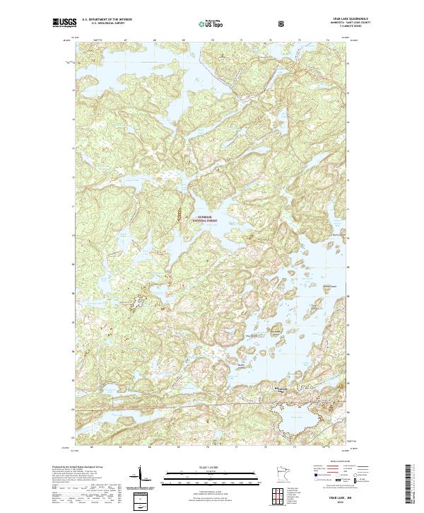 2022 Crab Lake2022 Print · USGSThe northern wilderness of Saint Louis County is mapped here in recent detail, focusing on the intricate island chains of Burntside Lake. Trace the network of backcountry paths like Cummings Trl or locate local landmarks such as Snellman Island and School Section Bay.
 - 2022 Map of Ely, 2022 Print
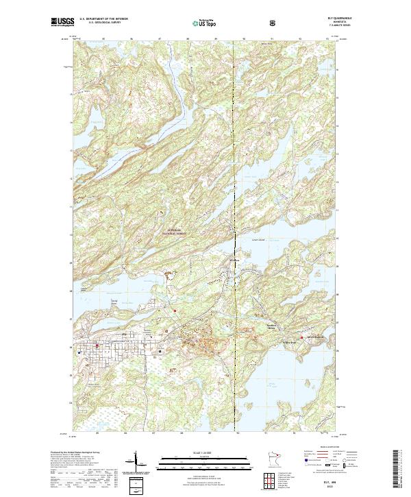 2022 Ely2022 Print · USGSNear the boundary of the Superior National Forest, this modern survey shows the area around Ely and Winton at the start of the 2020s. Genealogists and historians can trace local landmarks like Ely Cem, Vermilion Community College, and the small settlement at Section Thirty.
End of results
Showing maps 1-6 of 6
Top cities near Morse Township
Top neighborhoods of Morse Township
- Robinson historical maps
- Burntside historical maps
- Burntside Lake historical maps
- Winton historical maps
Frequently asked questions
- What are the different types of historical maps available for Morse Township?
- What is the oldest map of Morse Township?
- Where can I purchase historical maps of Morse Township for my home or office?
- Where can I download high-res historical maps of Morse Township?
- Are there historical topographic maps available for Morse Township?
- Is there historical aerial imagery available for Morse Township?
- Where are historical maps of Morse Township sourced from?