1960s Maps of Stearns County, Minnesota
Explore 33 historic maps of Stearns County from the 1960s. These maps offer a rare glimpse into what life looked like during the 1960s — showing old roads, neighborhoods, homes, and landmarks that have changed or disappeared over time.
Whether you're researching your family's past, planning a metal detecting trip, or studying how Stearns County's landscape evolved across the 1960s, these high-resolution maps are a powerful tool for exploring the history of this region.
- Focus on a specific era: All maps on this page are from the 1960s, giving you a focused view of this time period.
- See what’s changed: Compare century-old streets, trails, and buildings to today's modern landscape using overlays and satellite layers.
- Research with precision: Use these maps for genealogy, historical research, land use analysis, or educational projects.
- View, download, or print: Maps are fully viewable online in high resolution, and can be downloaded or printed for your own records.
Start exploring Stearns County's history through authentic maps from the 1960s. This is your window into the past.
Stearns County, MN maps
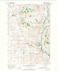
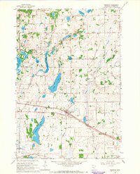
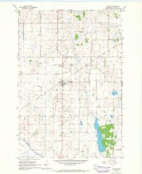
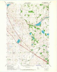
(33)- 1965 Map of Albany, 1966 Print
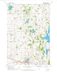 1965 Albany1966 Print · USGSStearns County is captured here in the mid-sixties, showcasing a landscape defined by small glacial lakes and a developing drainage network. Researchers can trace the Great Northern rail corridor through Albany or locate local landmarks like St Johns Cem and St. Anthony.2 unique versions available
 - 1965 Map of St Stephen, 1966 Print
 1965 St Stephen1966 Print · USGSStearns County townships like Brockway and St Wendel are shown here in the mid-sixties as the rural school system remained highly localized. Genealogists can trace family footprints near Mt Carmel Cem or identify the specific district buildings like School No 1920 and School No 1915.2 unique versions available
 - 1965 Map of Westport, 1966 Print
 1965 Westport1966 Print · USGSWestport and the surrounding Pope County lake country are captured here in the mid-sixties, highlighting a landscape shaped by rail and water. You can trace the Northern Pacific line through Westport or locate local landmarks like Swan Lake and the Radio Tower (KCMT).
 - 1965 Map of Farming, 1966 Print
 1965 Farming1966 Print · USGSStearns County in the mid-sixties reveals a landscape of family-named glacial lakes and a vanishing network of rural schoolhouses. Researchers can trace the Great Northern tracks and locate several community centers including Farming and Immanuel Ch.2 unique versions available
 - 1965 Map of Greenwald, 1966 Print
 1965 Greenwald1966 Print · USGSStearns County farmland was well-established by the mid-sixties, centered on rail transport and river drainage. Genealogists and local researchers can trace family lands near Greenwald, Spring Hill, and several historic school sites like School No 2013.
 - 1965 Map of Sauk Centre, 1966 Print
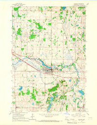
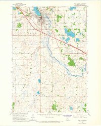 1965 Sauk Centre1966 Print · USGSSauk Centre at the mid-point of the sixties is a bustling rail hub where the Great Northern and Northern Pacific meet. Trace family roots at St Pauls Cem or Bohemian Cem, and locate landmarks like the State School for Girls.2 unique versions available
 - 1965 Map of Melrose, 1966 Print
 1965 Melrose1966 Print · USGSMelrose and its surrounding townships are captured in the mid-1960s as the regional rail and river network supported a thriving agricultural community. Genealogists can locate family landmarks like St Marys Cem, Oak Hill Cem, and rural schoolhouses including School No 2047.3 unique versions available
 - 1965 Map of Holdingford, 1966 Print
 1965 Holdingford1966 Print · USGSStearns County in the mid-1960s shows a landscape of small farming communities and a dense network of country schools. Researchers can trace the Soo Line rail corridor through Holdingford or locate rural landmarks like St Anna and Sacred Heart Mission.
 - 1965 Map of Freeport, 1966 Print
 1965 Freeport1966 Print · USGSStearns County in the mid-sixties is a landscape of prairie lakes and developing rail corridors centered on the village of Freeport. Genealogists can locate family landmarks like Ebenezer Cem, the Immaculate Conception Ch, and rural schoolhouses including School No 1991.3 unique versions available
 - 1965 Map of Padua, 1966 Print
 1965 Padua1966 Print · USGSStearns County was a landscape of managed wetlands and quiet crossroads in the mid-1960s. Genealogists and local historians can locate the Big Grove Ch, old rural schoolhouses like School No 1963, and the early footprints of Padua and Brooten.
 - 1965 Map of Sedan, 1966 Print
 1965 Sedan1966 Print · USGSThe prairie and wetlands of Pope and Stearns counties come into focus during the mid-sixties as the railroad drives local life. Genealogists and historians can trace family-named landmarks and rural hubs like Grove Lake Church, Trinity Cemetery, and the Soo Line corridor.
 - 1965 Map of Raymond Lake, 1966 Print
 1965 Raymond Lake1966 Print · USGSStearns County townships were still dominated by a network of one-room district schools and rail-side industry in the mid-sixties. Genealogists can locate family landmarks like Lyman Prairie Cem, St Johns Cem, and School No 1990 along the Northern Pacific line.
 - 1965 Map of Elrosa, 1966 Print
 1965 Elrosa1966 Print · USGSElrosa and the surrounding Stearns County townships are captured here in the mid-sixties, showcasing a landscape of prairie agriculture and rail-side settlement. Genealogists and local historians can locate St Paul Ch, trace the Soo Line railway, and explore the wetlands around George Lake.
 - 1965 Map of St Martin, 1966 Print
 1965 St Martin1966 Print · USGSMid-century Stearns County is captured here as a landscape of river-bend villages and rural school districts. Researchers can trace the legacy of family farms near St Martin, identify old church sites like Immanuel Cem, and locate former schoolhouses such as School No 2017.
 - 1965 Map of St Joseph, 1967 Print
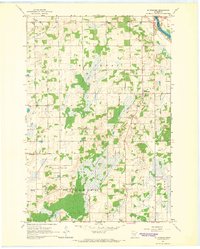
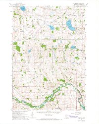
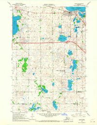
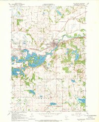
 1965 St Joseph1967 Print · USGSStearns County life in the mid-1960s is centered on the railway and the river as the area transitions from rural townships to growing communities. Genealogists and historians can trace family locations near St Joseph, several rural schoolhouses, and the Staples Cem.5 unique versions available
 - 1965 Map of Avon, 1967 Print
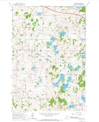
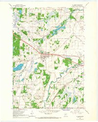
 1965 Avon1967 Print · USGSIn the mid-1960s, this lake-rich region of Stearns County shows the expansion of the St Johns University campus alongside the established town of Avon. Genealogists and local historians can trace family-named sites like Dullinger Lake and Schmid Lake or locate vanished rural landmarks such as School No 2029.3 unique versions available
 - 1966 Map of West Union, 1967 Print
 1966 West Union1967 Print · USGSThe West Union area was a patchwork of prairie lakes and rail-side settlements in the mid-sixties. Genealogists and local historians can trace rural school districts like School No 2331 and quiet landmarks such as Elim Ch or Silver Creek Cem.
 - 1966 Map of Osakis, 1967 Print
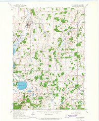
 1966 Osakis1967 Print · USGSThe lakeside community of Osakis thrived as a transportation and recreation hub in the mid-sixties. Researchers can trace the town's layout near Lake Osakis, locating St Agnes Sch, the Great Northern rail line, and numerous rural burial grounds like English Grove Cem.2 unique versions available
 - 1966 Map of Sauk Lake, 1967 Print
 1966 Sauk Lake1967 Print · USGSTodd County's lake-rich landscape is captured here in the mid-1960s, showing the rural communities and schools that define the region. Researchers can trace the Great Northern rail line and locate landmarks like Little Sauk Church or the Minnesota Home School.
 - 1966 Map of Ward Springs, 1968 Print
 1966 Ward Springs1968 Print · USGSCentral Minnesota lake country is captured here in the 1960s as a landscape of small villages and lakeside woods. Genealogists and local historians can trace the Northern Pacific rail line through Ward Springs, Spaulding, and Grey Eagle.
 - 1967 Map of Cold Spring, 1963 Print
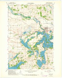
 1967 Cold Spring1963 Print · USGSThe Sauk River valley and its complex chain of lakes are captured here in the late sixties. Genealogists and local researchers can trace family landmarks like St Boniface Cem, Assumption Chapel, and the rural School No 1926 near St Nicholas.2 unique versions available
 - 1967 Map of Paynesville, 1968 Print
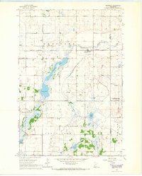
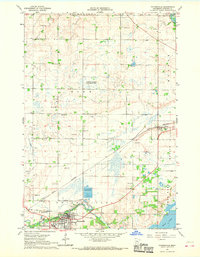 1967 Paynesville1968 Print · USGSStearns County was a landscape of rail junctions and prairie lakes during the late sixties, centered on the growing town of Paynesville. Researchers can locate rural landmarks like Salem Ch and School No 2028, or trace the paths of the SOO LINE and GREAT NORTHERN railroads.
 - 1967 Map of Lake Koronis, 1968 Print
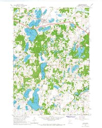
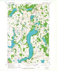
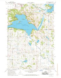 1967 Lake Koronis1968 Print · USGSThe Lake Koronis area at the Stearns and Meeker county line shows a landscape defined by resort living and rural education in the late 1960s. Researchers can trace the grounds of the Lake Koronis Assembly Ground, find the Ebenezer Ch, and locate numerous historic rural schoolhouses.2 unique versions available
 - 1967 Map of Belgrade, 1968 Print
 1967 Belgrade1968 Print · USGSCentral Minnesota's prairie and wetlands are mapped here in the late sixties, highlighting the agrarian development between Brooten and Belgrade. Genealogists can trace local roots through sites like St Donatus Cem, Crow Lake Ch, and the Soo Line rail corridor.2 unique versions available
 - 1967 Map of Richmond, 1968 Print
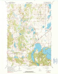
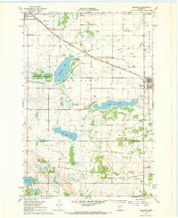
 1967 Richmond1968 Print · USGSStearns County lake country is captured here in the late sixties, centering on the interconnected waters of the Sauk River valley. Genealogists and historians can trace the Great Northern tracks through Richmond and locate landmarks like the local Cem and the village of Roscoe.2 unique versions available
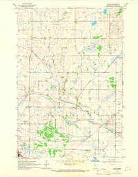
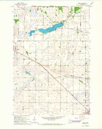
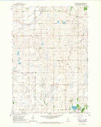
Showing maps 1-25 of 33
Top cities of Stearns County
- Sartell historical maps
- Waite Park historical maps
- Sauk Centre historical maps
- Cold Spring historical maps
- Melrose historical maps
- Rockville historical maps
See more
Frequently asked questions
- What are the different types of historical maps available for Stearns County?
- What is the oldest map of Stearns County?
- Where can I purchase historical maps of Stearns County for my home or office?
- Where can I download high-res historical maps of Stearns County?
- Are there historical topographic maps available for Stearns County?
- Is there historical aerial imagery available for Stearns County?
- Where are historical maps of Stearns County sourced from?