
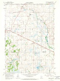
1965 Map of Elrosa
USGS Topo · Published 1966About this map
Elrosa sits at the center of this Stearns County landscape, where the agricultural grid is defined by an extensive network of drainage projects including County Ditch No 44 and County Ditch No 9. The village is situated along the Soo Line, which cuts diagonally across the prairie, providing a vital transportation link for the surrounding townships of Getty, Grove, and Lake George. Local social and spiritual life is anchored by St Paul Ch, located north of the town center.
Find a feature on this map
14 named features on this map. Tap any name to fly to it.
Don’t see what you’re looking for? This feature index may not catch every label — zoom into the map to look around manually.
Map Details
Editions of this 1965 Elrosa Map
This is the sole edition of this map. No revisions or reprints were ever made.
Other maps of this area

1953 · Saint Cloud
USGS Topo · 1:250,000

1957 · Saint Cloud
USGS Topo · 1:250,000

1958 · Saint Cloud
USGS Topo · 1:250,000

1965 · Greenwald
USGS Topo · 1:24,000

1965 · Sauk Centre
USGS Topo · 1:24,000

1965 · Melrose
USGS Topo · 1:24,000

1965 · Padua
USGS Topo · 1:24,000

1965 · Raymond Lake
USGS Topo · 1:24,000

1967 · Belgrade
USGS Topo · 1:24,000
1967 · Georgeville
USGS Topo · 1:24,000