
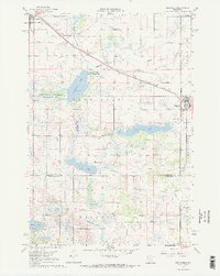
1967 Map of Belgrade
USGS Topo · Published 1968About this map
The Soo Line railroad cuts through the prairie of central Minnesota, connecting the agricultural hubs of Brooten and Belgrade during the late 1960s. This survey illustrates a landscape meticulously managed for water drainage, evidenced by a complex network including Skunk Line Ditch and numerous county ditches that support the local farming economy. Between these settlements, the Tamarack State Wildlife Management Area and National Wildlife Management Area preserve natural wetland habitats around Tamarack Lake and Crow Lake. The map reveals the rural social fabric of the era through scattered landmarks like Crow Lake Ch, St Donatus Cem, and the Brooten Municipal Airport. This record is particularly valuable for tracing historical church locations and cemeteries across the Stearns and Kandiyohi county line.
Find a feature on this map
39 named features on this map. Tap any name to fly to it.
Don’t see what you’re looking for? This feature index may not catch every label — zoom into the map to look around manually.
Map Details
Editions of this 1967 Belgrade Map
2 editions found
Other maps of this area

1953 · Saint Cloud
USGS Topo · 1:250,000

1957 · Saint Cloud
USGS Topo · 1:250,000

1958 · Saint Cloud
USGS Topo · 1:250,000

1965 · Padua
USGS Topo · 1:24,000

1965 · Sedan
USGS Topo · 1:24,000

1965 · Elrosa
USGS Topo · 1:24,000

1967 · Mount Tom
USGS Topo · 1:24,000

1967 · Sunburg
USGS Topo · 1:24,000

1967 · Lake Johanna
USGS Topo · 1:24,000
1967 · Georgeville
USGS Topo · 1:24,000