
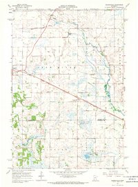
1965 Map of Greenwald
USGS Topo · Published 1966About this map
The agricultural landscape of central Stearns County unfolds along the Sauk River and the Soo Line railroad. This mid-1960s survey records a highly organized rural grid defined by section lines, property boundaries, and drainage efforts like County Ditch No 44. The village of Greenwald serves as a local hub near the St Andrews Cem, while the settlement of Spring Hill is situated further south along a bend in the river near a Gaging Station. The map captures a transition in rural education, preserving the locations of scattered one-room schoolhouses such as School No 2048 and School No 1977. These small institutions, along with numerous gravel pits and established farmsteads, document the mid-century infrastructure supporting this dairy and farming region.
Find a feature on this map
22 named features on this map. Tap any name to fly to it.
Don’t see what you’re looking for? This feature index may not catch every label — zoom into the map to look around manually.
Map Details
Editions of this 1965 Greenwald Map
This is the sole edition of this map. No revisions or reprints were ever made.
Other maps of this area

1953 · Saint Cloud
USGS Topo · 1:250,000

1957 · Saint Cloud
USGS Topo · 1:250,000

1958 · Saint Cloud
USGS Topo · 1:250,000

1965 · Sauk Centre
USGS Topo · 1:24,000

1965 · Melrose
USGS Topo · 1:24,000

1965 · Freeport
USGS Topo · 1:24,000

1965 · Elrosa
USGS Topo · 1:24,000

1965 · St Martin
USGS Topo · 1:24,000

1967 · Paynesville
USGS Topo · 1:24,000
1967 · Georgeville
USGS Topo · 1:24,000