1900s (20th Century) Maps of Attala County, Mississippi
Explore 38 historic maps of Attala County from the 1900s (20th Century). These maps offer a rare glimpse into what life looked like during the 1900s — showing old roads, neighborhoods, homes, and landmarks that have changed or disappeared over time.
Whether you're researching your family's past, planning a metal detecting trip, or studying how Attala County's landscape evolved across the 1900s, these high-resolution maps are a powerful tool for exploring the history of this region.
- Focus on a specific era: All maps on this page are from the 1900s, giving you a focused view of this time period.
- See what’s changed: Compare century-old streets, trails, and buildings to today's modern landscape using overlays and satellite layers.
- Research with precision: Use these maps for genealogy, historical research, land use analysis, or educational projects.
- View, download, or print: Maps are fully viewable online in high resolution, and can be downloaded or printed for your own records.
Start exploring Attala County's history through authentic maps from the 1900s. This is your window into the past.
Attala County, MS maps
(38)- 1953 Map of Meridian, 1966 Print
 1953 Meridian1966 Print · USGSEast Central Mississippi and the Alabama borderlands are captured here during a period of steady growth and infrastructure expansion. Genealogists and historians can trace rail-town development along the Gulf Mobile & Ohio Railroad and find early settlements like Scooba, Pelahatchie, and De Kalb.2 unique versions available
 - 1953 Map of West Point, 1973 Print
 1953 West Point1973 Print · USGSNorth-Central Mississippi and the Alabama borderlands are captured here during the mid-twentieth century as new reservoirs and national forests transformed the landscape. Researchers can trace the path of the Mississippi & Skuna Valley railroad or locate old landings along the Tombigbee River and Schooner Creek.3 unique versions available
 - 1957 Map of Meridian
 1957 Meridian1957 Print · USGSEast Central Mississippi and parts of Western Alabama come alive in the mid-1950s, centered on the transit hub of Meridian. Researchers can trace old rail lines like the Illinois Central and find historic sites such as the Choctaw Indian Reservation and Roosevelt State Park.
 - 1958 Map of West Point
 1958 West Point1958 Print · USGSNortheastern Mississippi and western Alabama are shown in the late 1950s, highlighting a region defined by its river-and-rail economy. Researchers can trace family roots through numerous settlements like Artesia and Vardaman or explore the corridor of the Tombigbee River.
 - 1962 Map of Edinburg, 1964 Print
 1962 Edinburg1964 Print · USGSCentral Mississippi's rural river country comes to life in the early sixties, showing the intersection of four counties along the Pearl River. Genealogists can trace family roots through numerous sites like Battleground Cemetery, Coughlin Mound, and the settlement at Edinburg.
 - 1962 Map of Thomastown, 1964 Print
 1962 Thomastown1964 Print · USGSLeake County was a landscape of creek-side settlements and rural parishes in the early sixties. Genealogists can trace family footprints through dozens of local landmarks like Ellington Cem, Greer High Sch, and Cedar Grove Ch.
 - 1963 Map of West Point
 1963 West Point1963 Print · USGSEastern Mississippi and western Alabama are captured in the early sixties as industrial centers and rail lines connected the Black Prairie to the hills. Genealogists and historians can trace family-named watercourses and the early footprints of Starkville, Columbus, and the Noxubee National Wildlife Refuge.2 unique versions available
 - 1964 Map of West, 1965 Print
 1964 West1965 Print · USGSCentral Mississippi hill country and river bottomlands come alive in the 1960s. Genealogists can trace family names through landmarks like Whellin Cem, Brister Cem, and rural congregations at Liberty Hill Ch.2 unique versions available
 - 1964 Map of Kosciusko NE, 1965 Print
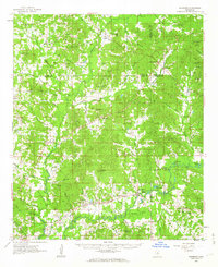
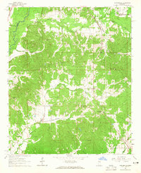
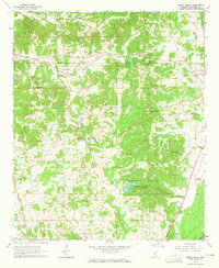
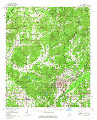
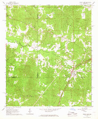
 1964 Kosciusko NE1965 Print · USGSAttala County is shown in the mid-1960s as a landscape of interconnected creek valleys and small community hubs. Researchers can trace family history through numerous landmarks like New Salem Cem, Oak Ridge Ch, and the Sandpit.3 unique versions available
 - 1964 Map of Hesterville, 1965 Print
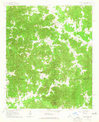
 1964 Hesterville1965 Print · USGSAttala and Carroll counties appear here in the early sixties as a network of creek-bottom farms and rural railroad stops. Genealogists can locate family landmarks like Carmack Sch, Possumneck, and numerous burial sites including Mayo Cem and Guess Cem.
 - 1964 Map of Newport, 1965 Print
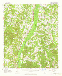
 1964 Newport1965 Print · USGSThe Attala and Madison County line comes alive in the mid-sixties, showing a landscape defined by small churches and early boundaries. Genealogists and historians can trace family locations near Newport, the Sallis Lookout Tower, and the Old Indian Boundary.2 unique versions available
 - 1964 Map of Durant, 1965 Print
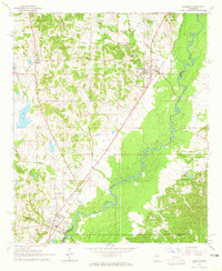
 1964 Durant1965 Print · USGSMid-century Mississippi life unfolds along the Illinois Central Railroad and the winding Big Black River. Genealogists and local historians can trace family roots through numerous sites like Durant Cem, Macedonia Ch, and the community at Sallis.2 unique versions available
 - 1964 Map of Kosciusko, 1965 Print
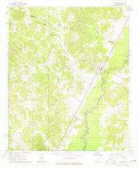
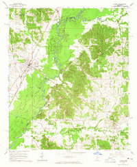
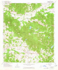
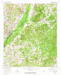
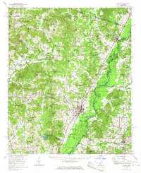
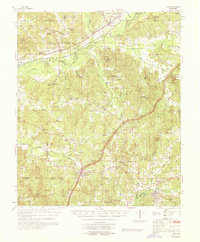
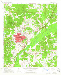 1964 Kosciusko1965 Print · USGSThe town of Kosciusko is captured in the mid-sixties as a growing rail and road hub along the Illinois Central. Researchers can find Gilliland College, the Tipton St Sch, and family sites like Presley Cem and Silas Grove Ch.2 unique versions available
 - 1964 Map of Owens Wells, 1965 Print
 1964 Owens Wells1965 Print · USGSHolmes County in the 1960s reveals a rural landscape shaped by the Illinois Central railroad and historic markers. Genealogists can locate family landmarks like Wesley Chapel Cem, Union Paradise Ch, and the Old Indian Treaty Bdy.3 unique versions available
 - 1964 Map of McAdams, 1965 Print
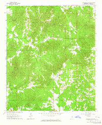
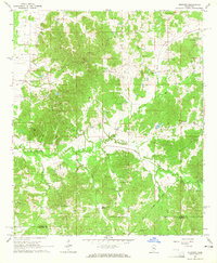
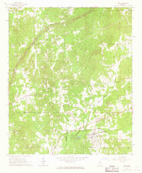
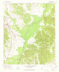
 1964 McAdams1965 Print · USGSAttala County is shown in the mid-1960s as a landscape of rural churches and family cemeteries connected by the Illinois Central railroad. Genealogists can trace local roots at Bethlehem Cem, New Bethel Ch, and the small settlement of McAdams.
 - 1964 Map of Goodman, 1965 Print
 1964 Goodman1965 Print · USGSThe mid-Mississippi corridor at the dawn of the 1960s highlights a landscape shaped by the Big Black River and the storied Illinois Central railroad. Genealogists can trace family footprints through sites like Holmes County Junior College, Bethlehem Ch, and Quiet Ridge Cem.2 unique versions available
 - 1965 Map of Meridian
 1965 Meridian1965 Print · USGSEast Mississippi and West Alabama are mapped here in the mid-sixties as the region's modern highway and reservoir systems began to take shape. Researchers can trace rural lineages through local landmarks like Prince Chapel and Tuscahoma Landing, or follow the historic Gulf Mobile & Ohio rail lines.
 - 1966 Map of Poplar Creek, 1967 Print
 1966 Poplar Creek1967 Print · USGSMontgomery and Attala Counties are captured in the mid-sixties, showing a rural landscape defined by community-centered churches and family cemeteries. Genealogists can trace deep local roots at Poplar Springs Union Ch, Old Pine Bluff Cem, and Joe Walker Cem.2 unique versions available
 - 1966 Map of Kosciusko, 1967 Print
 1966 Kosciusko1967 Print · USGSCentral Mississippi in the mid-sixties centers on Kosciusko and its surrounding rural communities. Genealogists can trace family names through dozens of landmarks like Carmack Sch, Hesterville, and the Bethlehem Cem.
 - 1966 Map of Goodman, 1967 Print
 1966 Goodman1967 Print · USGSMid-century Mississippi hill country and river bottomlands come alive here in the mid-1960s as small farming communities and timberlands span four counties. Genealogists can trace family roots through dozen of rural landmarks like Soule Chapel, Quiet Ridge Cem, and the Holmes County Junior College.
 - 1966 Map of Weir, 1967 Print
 1966 Weir1967 Print · USGSMid-century Choctaw County life is centered on the railroad town of Weir and the winding Natchez Trace. Researchers can trace rural congregation sites like Millsprings Ch or New Zion Ch and follow the path of the Illinois Central near the Yockanookany River.2 unique versions available
 - 1966 Map of Durant, 1967 Print
 1966 Durant1967 Print · USGSMid-century Holmes County is captured here during a time of steady rail commerce and established rural settlements. Family historians can locate dozens of church-and-cemetery sites such as Bethesda Chapel Cem, Owens Wells, and the Old Indian Treaty Boundary.
 - 1966 Map of French Camp, 1967 Print
 1966 French Camp1967 Print · USGSChoctaw and Attala Counties are mapped here in the mid-sixties, showing the rural landscape as the modern Natchez Trace Parkway bypasses older settlements. Researchers can locate family landmarks such as Huntsville Cem, Covenant Ch, and several Sandpits along the timbered creek bottoms.
 - 1966 Map of Vaiden, 1967 Print
 1966 Vaiden1967 Print · USGSThe town of Vaiden and its surrounding Carroll County hill country are captured here in the mid-1960s, centered on the Big Black River. Genealogists and historians can trace the exact locations of Vaiden Hill Ch, Tuckersville Cem, and the old Illinois Central rail line.2 unique versions available
 - 1968 Map of Weir
 1968 Weir1968 Print · USGSChoctaw and Montgomery counties come alive in this late-sixties study of the Mississippi hill country. Genealogists and local historians can trace family locations near French Camp, Weir, and numerous rural landmarks like Serepta Cem and Millsprings Sch.
Showing maps 1-25 of 38
Top cities of Attala County
Frequently asked questions
- What are the different types of historical maps available for Attala County?
- What is the oldest map of Attala County?
- Where can I purchase historical maps of Attala County for my home or office?
- Where can I download high-res historical maps of Attala County?
- Are there historical topographic maps available for Attala County?
- Is there historical aerial imagery available for Attala County?
- Where are historical maps of Attala County sourced from?