1970s Maps of Carroll County, Mississippi
Explore 9 historic maps of Carroll County from the 1970s. These maps offer a rare glimpse into what life looked like during the 1970s — showing old roads, neighborhoods, homes, and landmarks that have changed or disappeared over time.
Whether you're researching your family's past, planning a metal detecting trip, or studying how Carroll County's landscape evolved across the 1970s, these high-resolution maps are a powerful tool for exploring the history of this region.
- Focus on a specific era: All maps on this page are from the 1970s, giving you a focused view of this time period.
- See what’s changed: Compare century-old streets, trails, and buildings to today's modern landscape using overlays and satellite layers.
- Research with precision: Use these maps for genealogy, historical research, land use analysis, or educational projects.
- View, download, or print: Maps are fully viewable online in high resolution, and can be downloaded or printed for your own records.
Start exploring Carroll County's history through authentic maps from the 1970s. This is your window into the past.
Carroll County, MS maps
(9)- 1974 Map of Greenwood NW, 1975 Print
 1974 Greenwood NW1975 Print · USGSThe Mississippi Delta's intricate river systems dominate this mid-seventies aerial perspective of Leflore County. Genealogists and researchers can trace the settlement patterns around MONEY and the winding course of the Tallahatchie and Yalobusha River.
 - 1974 Map of Greenwood SE, 1975 Print
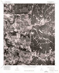 1974 Greenwood SE1975 Print · USGSIn the mid-1970s, the Carroll County landscape was defined by the sharp transition between the Delta bottomlands and the bluffs. Researchers can trace the layout of the settlement at Browning and study the intricate field patterns and woodland boundaries of the era.
 - 1974 Map of Greenwood NE, 1975 Print
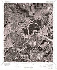
 1974 Greenwood NE1975 Print · USGSThe Mississippi Delta meets the hills in the mid-1970s, showcasing a landscape of river bends and rural clearings. Genealogists and land researchers can trace the settlement at Avalon and the winding course of the Yalobusha River.
 - 1974 Map of Greenwood SW, 1975 Print
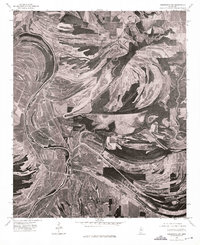
 1974 Greenwood SW1975 Print · USGSGreenwood and the winding Yazoo River basin are captured in great detail in the mid-seventies, showing the city's expansion into the Delta. Researchers can trace the urban footprint of Greenwood and examine the intricate agricultural patterns of the surrounding landscape.
 - 1975 Map of Peachahala Creek, 1978 Print
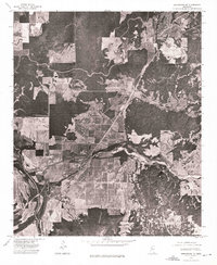
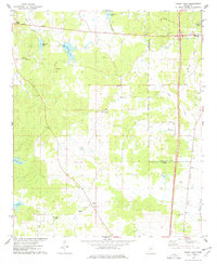
 1975 Peachahala Creek1978 Print · USGSCarroll County's rolling landscape and rural settlements are frozen in time during the mid-seventies. Researchers can trace family history through several local landmarks like Hairston Cem, Lively Stone Ch, and the community at Hocutt.
 - 1975 Map of Murdock Lake, 1978 Print
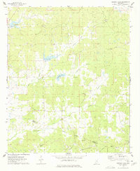 1975 Murdock Lake1978 Print · USGSCarroll and Holmes counties in the mid-seventies remain defined by their rural congregations and historic land divisions. Genealogists can trace family roots through sites like Nebo Ch, Old Salem Cem, and the long-standing Treaty Indian Boundary.2 unique versions available
 - 1975 Map of Bailey Lake, 1978 Print
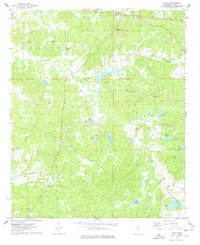
 1975 Bailey Lake1978 Print · USGSThe hills of Carroll and Montgomery counties are documented here in the mid-seventies, showing the rural landscape just west of the county seat. Genealogists can trace family landmarks like Marvin Cem, Ebenezer Ch, and the many small lakes including Booths Lake.2 unique versions available
 - 1975 Map of Coila, 1978 Print
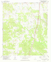
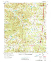
 1975 Coila1978 Print · USGSCarroll County in the mid-seventies is a landscape of winding creeks and scattered hill country settlements. Genealogists and historians can trace the locations of Enon Ch, Stansberry Cem, and the small community of Coila as they appeared during this era.2 unique versions available
 - 1978 Map of Coila
 1978 Coila1978 Print · USGSCentral Mississippi in the late seventies is shown here as a landscape of crossroads communities and historic treaty boundaries. Researchers can trace family roots through numerous rural landmarks like Hopewell Cem, St Johns Chapel, and the small settlement of Coila.
End of results
Showing maps 1-9 of 9
Top cities of Carroll County
Frequently asked questions
- What are the different types of historical maps available for Carroll County?
- What is the oldest map of Carroll County?
- Where can I purchase historical maps of Carroll County for my home or office?
- Where can I download high-res historical maps of Carroll County?
- Are there historical topographic maps available for Carroll County?
- Is there historical aerial imagery available for Carroll County?
- Where are historical maps of Carroll County sourced from?