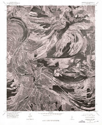
1974 Map of Greenwood NW
USGS Topo · Published 1975About this map
Money sits at a critical junction in the Mississippi Delta landscape, captured here through high-altitude aerial photography. The terrain is defined by the winding paths of the Tallahatchie and the Yalobusha River, which carve deep, rhythmic oxbows and meander scars across the alluvial plain. These watercourses have historically dictated the patterns of agriculture and settlement in the region, with the dark, wooded curves of the riverbanks contrasting sharply against the geometric grid of cleared fields.
Find a feature on this map
3 named features on this map. Tap any name to fly to it.
Don’t see what you’re looking for? This feature index may not catch every label — zoom into the map to look around manually.
Map Details
Editions of this 1974 Greenwood NW Map
This is the sole edition of this map. No revisions or reprints were ever made.
Other maps of this area

1931 · Schlater
USGS Topo · 1:48,000

1931 · Sumner
USGS Topo · 1:48,000

1932 · Philipp
USGS Topo · 1:48,000

1934 · Schlater
USGS Topo · 1:62,500

1935 · Sumner
USGS Topo · 1:62,500

1935 · Philipp
USGS Topo · 1:62,500

1936 · Greenwood
USGS Topo · 1:62,500

1939 · Schlater
USGS Topo · 1:62,500

1939 · Sumner
USGS Topo · 1:62,500

1939 · Philipp
USGS Topo · 1:62,500