Old Maps of Coahoma County, Mississippi for Metal Detecting
Plan your next treasure hunt with 186 historic maps of Coahoma County. Find old homesites, ghost towns, trails, and gathering spots that may be lost to time — perfect for identifying promising metal detecting locations.
- Locate forgotten sites: Uncover places like long-lost settlements, abandoned rail lines, or gathering spots.
- Plan better hunts: Use map overlays combined with LiDAR or satellite views to narrow in on historically rich areas.
- Made for detectorists: Thousands of hobbyists use these maps to discover relics, coins, and hidden history.
Use these historic maps to boost your research and find new opportunities beneath the surface of Coahoma County.
Coahoma County, MS maps
(186)- 1908 Map of Lula, 1957 Print
 1908 Lula1957 Print · USGSThe Mississippi Delta at the start of the twentieth century is defined here by the meeting of rail and river near Lula. Genealogists and historians can trace the early layout of settlements like Rich, Mascot, and Birdie along the various branches of the Yazoo and Mississippi Valley R. R.
 - 1908 Map of Coahoma, 1961 Print
 1908 Coahoma1961 Print · USGSDuring the early years of the twentieth century, the Mississippi Delta was a landscape of rail sidings and massive river estates. Genealogists can trace family holdings at Elkhorn Place and King & Anderson's or locate old rail stops like Rudyard and Armistead.
 - 1908 Map of Moon Lake, 1961 Print
 1908 Moon Lake1961 Print · USGSThe Mississippi Delta's oxbows and bayous are meticulously detailed here in the early 1900s, showing a river-driven landscape. Trace the old rail lines of the Yazoo and Mississippi Valley R R or locate local centers like Delta Gerald P O and Powell.
 - 1908 Map of Jonestown, 1961 Print
 1908 Jonestown1961 Print · USGSThe Mississippi Delta's intricate river systems and early rail settlements are preserved here as they appeared in the first decade of the 1900s. Trace the path of the Yazoo and Mississippi Valley railroad through Jonestown and find historic landmarks like Hopewell Church and Eagles Nest.
 - 1910 Map of Coahoma
 1910 Coahoma1910 Print · USGSCoahoma County at the start of the twentieth century was a landscape of winding bayous and expanding rail lines. Genealogists and historians can trace the foundations of local commerce at Coahoma, King & Anderson's, and along the Sheriff Ridge Road.
 - 1910 Map of Jonestown
 1910 Jonestown1910 Print · USGSCoahoma and Quitman counties appear here in the early twentieth century as a landscape of winding oxbow lakes and essential rail lines. Genealogists and historians can trace local life through rural landmarks like Hopewell Church, the settlement at Eagles Nest, and the Yazoo and Mississippi Valley RR.
 - 1912 Map of Moon Lake
 1912 Moon Lake1912 Print · USGSThe Mississippi Delta's intricate river-and-rail landscape is preserved here during the early twentieth century. Genealogists and local historians can trace the foundations of the area through the Yazoo and Mississippi Valley R R and rural settlements like Powell and Delta Gerald P O.3 unique versions available
 - 1912 Map of Lula
 1912 Lula1912 Print · USGSThe Mississippi Delta at the start of the twentieth century shows a landscape defined by lumber rails and oxbow lakes. Trace the early growth of Lula and Rich along the Yazoo and Mississippi Valley R. R. and the winding Yazoo Pass.
 - 1930 Map of Mellwood
 1930 Mellwood1930 Print · USGSThe Mississippi Delta's shifting banks and rail-tied settlements are frozen in time just before the great mid-century levee expansions. Trace the history of the 1910s floods via the Ferguson Crevasse and locate river-dependent towns like Mellwood and Deeson.
 - 1931 Map of Sumner
 1931 Sumner1931 Print · USGSTallahatchie County in the early thirties is captured here as a landscape of cotton fields and bayous connected by the Yazoo and Mississippi Valley Railroad. Researchers can locate community centers like Glendora and Sumner, or trace family ties to the Brooks-Rosenwald Sch and Indian Mounds.4 unique versions available
 - 1931 Map of Drew
 1931 Drew1931 Print · USGSSunflower County's agricultural and social landscape is meticulously detailed in the early 1930s, centering on the communities of Mound Bayou and Drew. Researchers can trace the layout of the State Penitentiary Reservation and numerous country churches like Beautiful Star Ch and Shady Grove Ch.
 - 1932 Map of Tutwiler
 1932 Tutwiler1932 Print · USGSTallahatchie County was a landscape of winding oxbows and rail-linked settlements in the early 1930s. Genealogists and historians can trace numerous rural congregations like Whitfield Ch and New Bethlehem Ch, alongside industry at Fitches Gin.
 - 1932 Map of Marks
 1932 Marks1932 Print · USGSThe Mississippi Delta in the early 1930s is a landscape of complex bayous and tight-knit rural communities. Genealogists can trace family roots through numerous local landmarks like Swan Lake Normal College, Robinson Chapel, and the Yazoo and Mississippi Valley Railroad.2 unique versions available
 - 1935 Map of Clarksdale
 1935 Clarksdale1935 Print · USGSThe Mississippi Delta's cotton country is captured here in the mid-1930s as the rail-and-river economy flourished. Genealogists can locate numerous rural landmarks like the Rosenwald Sch, Stoverville, and old church sites such as Beautiful Zion Ch.2 unique versions available
 - 1935 Map of Marks
 1935 Marks1935 Print · USGSThe Mississippi Delta landscape of the 1930s is captured here in rich detail, showcasing a network of bayous and rail towns. Genealogists can locate family landmarks like Swan Lake College, Macedonia Chapel, and the Posey Mound near Jonestown.2 unique versions available
 - 1935 Map of Sumner
 1935 Sumner1935 Print · USGSThe Mississippi Delta's intricate river bends and rail towns are captured here in the mid-1930s. Family historians can trace numerous rural sites like Brooks Rosenwald Sch, the State Reservation at Parchman, and the town of Glendora.2 unique versions available
 - 1935 Map of Tutwiler
 1935 Tutwiler1935 Print · USGSThe Mississippi Delta in the 1930s was a landscape defined by the winding Cassidy Bayou and the railroads that sustained its cotton towns. Genealogists can trace the rural communities of Tutwiler and Lambert, or locate local landmarks like Mud Bridge and Holly Grove Ch.2 unique versions available
 - 1935 Map of Mound Bayou
 1935 Mound Bayou1935 Print · USGSThe Mississippi Delta's agricultural and social landscape is captured here in the mid-1930s as local communities thrived along the rail lines. Genealogists can locate family landmarks like Pilgrims Rest Ch or trace the extensive camp system of the State Reservation.2 unique versions available
 - 1939 Map of Farrell, 1941 Print
 1939 Farrell1941 Print · USGSThe Mississippi Delta riverfront at Friar Point is captured here in the years before the Second World War. Researchers can trace family sites like Preston Places and Stovall or locate old rural centers including McLemore Sch and Llewellyn Ch & Sch.2 unique versions available
 - 1939 Map of Modoc, 1941 Print
 1939 Modoc1941 Print · USGSPhillips County sits at a crossroads of river and rail during the late 1930s, as the Delta landscape was shaped by flooding and the Missouri Pacific line. Genealogists can trace family roots at Mt Zion Ch Sch & Cem, Beach Tree Ch & Sch, and the old station at Hugo Sta.
 - 1939 Map of Sumner, 1943 Print
 1939 Sumner1943 Print · USGSTallahatchie County in the late thirties is a landscape of winding river bends and Delta rail towns like Sumner and Glendora. Genealogists and historians can trace numerous rural landmarks, including the Brooks Rosenwald Sch and the ancient Indian Mounds.
 - 1939 Map of Tutwiler, 1943 Print
 1939 Tutwiler1943 Print · USGSNorthwestern Mississippi in the 1930s shows a landscape defined by meandering bayous and the cotton economy of the Delta. Genealogists and historians can trace numerous small communities like Tutwiler and Vance, alongside rural landmarks like St Elmo Chapel and State Farm Camp B.
 - 1939 Map of Marks, 1943 Print
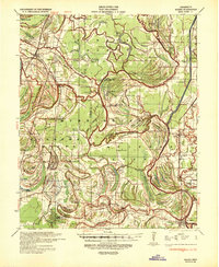 1939 Marks1943 Print · USGSThe Mississippi Delta era is preserved here just before the war, showing a landscape defined by the Coldwater River and the Yazoo and Mississippi Valley RR. Genealogists can trace local roots at Swan Lake College, Belen, and Strangers Rest Ch.
 - 1939 Map of Clarksdale, 1943 Print
 1939 Clarksdale1943 Print · USGSThe Mississippi Delta's agricultural and social landscape is captured here during the late 1930s. Genealogists can trace family roots through numerous local landmarks, including the Rosenwald Sch, Beautiful Zion Ch, and rural stations like Beverly Davenport Sta.
 - 1939 Map of Latour, 1944 Print
 1939 Latour1944 Print · USGSPhillips County and the Mississippi Delta are shown here just before the Second World War as a landscape defined by river navigation and rail transport. Researchers can trace the footprints of communities like Helena and find family-named landmarks such as Tate Ldg, Zion Ch, and Flower Chapel Cemetery.2 unique versions available
Showing maps 1-25 of 186
Top cities of Coahoma County
- Clarksdale historical maps
- Jonestown historical maps
- Friars Point historical maps
- Lyon historical maps
- Coahoma historical maps
- Lula historical maps
Frequently asked questions
- What are the different types of historical maps available for Coahoma County?
- What is the oldest map of Coahoma County?
- Where can I purchase historical maps of Coahoma County for my home or office?
- Where can I download high-res historical maps of Coahoma County?
- Are there historical topographic maps available for Coahoma County?
- Is there historical aerial imagery available for Coahoma County?
- Where are historical maps of Coahoma County sourced from?