1980s Maps of Forrest County, Mississippi
Explore 8 historic maps of Forrest County from the 1980s. These maps offer a rare glimpse into what life looked like during the 1980s — showing old roads, neighborhoods, homes, and landmarks that have changed or disappeared over time.
Whether you're researching your family's past, planning a metal detecting trip, or studying how Forrest County's landscape evolved across the 1980s, these high-resolution maps are a powerful tool for exploring the history of this region.
- Focus on a specific era: All maps on this page are from the 1980s, giving you a focused view of this time period.
- See what’s changed: Compare century-old streets, trails, and buildings to today's modern landscape using overlays and satellite layers.
- Research with precision: Use these maps for genealogy, historical research, land use analysis, or educational projects.
- View, download, or print: Maps are fully viewable online in high resolution, and can be downloaded or printed for your own records.
Start exploring Forrest County's history through authentic maps from the 1980s. This is your window into the past.
Forrest County, MS maps
(8)- 1983 Map of McLaurin
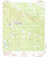 1983 McLaurin1983 Print · USGSMississippi's Pine Belt during the early eighties shows a unique blend of military infrastructure and deep Southern forest. Genealogists and historians can trace family locations near Morning Star Ch and Epps Cem or explore the early layout of Camp Shelby.3 unique versions available
 - 1983 Map of Carnes
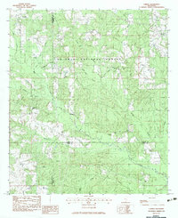 1983 Carnes1983 Print · USGSThe pine forests and creek bottoms of southern Forrest County are captured here in the early eighties. Local researchers can locate family sites including Lee Town Ch, the J E Bounds Mem Cem, and the rural community of Carnes.
 - 1983 Map of Brooklyn
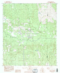 1983 Brooklyn1983 Print · USGSForrest County settlement and industry are captured here in the early 1980s as the rail corridor remained a vital artery through the piney woods. Researchers can locate remote family landmarks like Granny Bounds Cem, the Forrest County Agricultural Sch, and the Maxie Gas Field.2 unique versions available
 - 1983 Map of Bond, 1984 Print
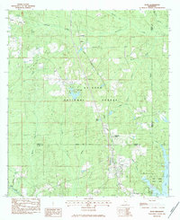 1983 Bond1984 Print · USGSSouthern Mississippi's timber and gas lands are captured in the early eighties as the industrial and recreational landscape matured. Researchers can locate family sites like Batson Cem and Bo Williams Cem or trace the Illinois Central Gulf rail line through Bond and Fruitland Park.
 - 1984 Map of Hattiesburg
 1984 Hattiesburg1984 Print · USGSSouth Mississippi’s Pine Belt is seen here in the mid-eighties, showing the region as a hub of timber production and petroleum extraction. Trace the rail lines of the Illinois Central Gulf RR through old settlements like Richton or the energy developments at the Heidelberg Oil Field.2 unique versions available
 - 1984 Map of Bogalusa
 1984 Bogalusa1984 Print · USGSThe Pearl River basin on the Louisiana-Mississippi border comes into focus in the mid-1980s, showcasing a landscape of river-bottom swamps and timberlands. Local researchers can trace the growth of Bogalusa and Picayune or find rural landmarks like Macedonia Ch and Wheat Swamp.
 - 1984 Map of Mobile
 1984 Mobile1984 Print · USGSThe Gulf Coast at the height of the mid-eighties shows a landscape of rapid industrial growth and military significance. Researchers can trace the sprawling rail lines of the Illinois Central Gulf RR, locate the NASA Test Facility, or study the barrier island chain from Cat Island to Petit Bois Island.3 unique versions available
 - 1984 Map of Hattiesburg
 1984 Hattiesburg1984 Print · USGSSouth Mississippi’s timber and military heartland comes into focus during the mid-eighties, centering on the hub of Hattiesburg and the winding Pearl River. Researchers can trace the rail lines of the Illinois Central Gulf through old towns like Bassfield and Sumrall, or locate rural landmarks like Society Hill Ch.
End of results
Showing maps 1-8 of 8
Top cities of Forrest County
Frequently asked questions
- What are the different types of historical maps available for Forrest County?
- What is the oldest map of Forrest County?
- Where can I purchase historical maps of Forrest County for my home or office?
- Where can I download high-res historical maps of Forrest County?
- Are there historical topographic maps available for Forrest County?
- Is there historical aerial imagery available for Forrest County?
- Where are historical maps of Forrest County sourced from?