Old Maps of Forrest County, Mississippi for Academic Research
Study the evolution of Forrest County with 95 high-resolution historic maps. Whether you're teaching, researching, or modeling changes in land use, these maps provide essential visual documentation of urban, environmental, and geographic change.
- Analyze long-term change: Track patterns in development, transportation, and natural features.
- Ideal for environmental or urban studies: Support academic projects with primary historical map data.
- Use in the classroom or lab: Educators and researchers rely on these maps to bring historical context to life.
These maps are a powerful tool for teaching, research, and visualizing how Forrest County has changed over the decades.
Forrest County, MS maps
(95)- 1947 Map of Wiggins, 1965 Print
 1947 Wiggins1965 Print · USGSSouthern Mississippi's timberlands and railroad towns are captured here in the late 1940s as the regional economy centers on the rails. Genealogists can locate family landmarks like Rosenwall Sch, New York Cem, and the small settlement of Perkinston.2 unique versions available
 - 1947 Map of New Augusta, 1965 Print
 1947 New Augusta1965 Print · USGSThe mid-century landscape of Perry and Forrest Counties is defined here by the growth of Camp Shelby and the vast De Soto National Forest. Genealogists and historians can trace old family sites like Granny Bounds Cem and vanished landmarks like the abandoned CCC Camp.3 unique versions available
 - 1949 Map of Wiggins
 1949 Wiggins1949 Print · USGSStone and Forrest Counties are documented here in the late Forties, showing the rail-dependent timber and farming communities of the Pine Belt. Researchers can locate numerous country landmarks including St Paul Ch, Rosenwall Sch, and the Maxie Fire Tower.2 unique versions available
 - 1949 Map of New Augusta
 1949 New Augusta1949 Print · USGSIn the late 1940s, this area of southern Mississippi was defined by the intersection of military training at Camp Shelby and the lush De Soto National Forest. Researchers can trace rural life through landmarks like Old Augusta, McLaurin Landing Field, and the Barett Fire Tower.2 unique versions available
 - 1953 Map of Hattiesburg, 1965 Print
 1953 Hattiesburg1965 Print · USGSSouth Mississippi and western Alabama are shown here during the mid-twentieth century as the timber and rail industries shaped the region. Genealogists and historians can trace rail lines like the Mississippi Central and locate rural centers such as Magee, Richton, and Mount Vernon.4 unique versions available
 - 1953 Map of Mobile, 1968 Print
 1953 Mobile1968 Print · USGSThe Gulf Coast comes alive in this mid-century survey, from the streets of Mobile to the marshes of New Orleans. Trace family roots in coastal towns like Pass Christian and Bayou La Batre or locate military landmarks including Keesler AFB.3 unique versions available
 - 1957 Map of Mobile
 1957 Mobile1957 Print · USGSThe Gulf Coast in the mid-1950s reveals a bustling corridor of rail-and-river commerce connecting Alabama to Louisiana. Genealogists and historians can trace old settlements and military hubs from Keesler Afb to the coastal reaches of Ship Island and Bogalusa.3 unique versions available
 - 1958 Map of Hattiesburg
 1958 Hattiesburg1958 Print · USGSSoutheastern Mississippi's timber and rail networks are at their peak during the late fifties, centered on the growing hubs of Hattiesburg and Laurel. Researchers can trace old family landmarks like Sims Chapel, the Busbey Game Refuge, and the vanished stops along the Mississippi Central railroad.2 unique versions available
 - 1958 Map of Carnes, 1959 Print
 1958 Carnes1959 Print · USGSPearl River and Lamar counties are shown here during the late fifties as small timber and farming communities were consolidating. You can locate family burial plots like Rouse Field Cem and traces of local education at Bird Line Sch or Magnolia Sch.2 unique versions available
 - 1960 Map of Mobile
 1960 Mobile1960 Print · USGSThe Gulf Coast at the dawn of the sixties shows a landscape of busy ports, military airbases, and barrier islands. Trace the rail lines of the Louisville & Nashville through BILOXI and Pascagoula or find family history in towns like Bayou La Batre and Poplarville.
 - 1963 Map of Mobile
 1963 Mobile1963 Print · USGSThe Gulf Coast at the dawn of the sixties shows a thriving maritime and military corridor from Louisiana to Alabama. Genealogists and historians can trace rail lines like the Louisville & Nashville RR and find landmarks from Brookley AFB to Fort Morgan.
 - 1963 Map of Barrontown, 1964 Print
 1963 Barrontown1964 Print · USGSThe rural piney woods at the junction of Jones, Forrest, and Perry Counties are documented here in the early 1960s. Genealogists and local historians can locate many family landmarks, from Macedonia Ch and Morriston to isolated burial sites like Barlow Cem.4 unique versions available
 - 1963 Map of Rock Hill, 1965 Print
 1963 Rock Hill1965 Print · USGSDeep in the Mississippi piney woods during the early sixties, this area shows a landscape defined by timber and rural faith. Researchers can trace family names and local landmarks like Rock Hill, Anderson Cem, and the Rock Hill Lookout Tower.3 unique versions available
 - 1964 Map of Carterville
 1964 Carterville1964 Print · USGSForrest County and the winding Leaf River basin are captured in the mid-1960s as rural settlements and river-valley industry coexisted. Genealogists can trace family landmarks like Sunrise Sch, Pine Grove Cem, and the tracks of the Bonhomie and Hattiesburg Southern Railroad.5 unique versions available
 - 1964 Map of Hattiesburg, 1965 Print
 1964 Hattiesburg1965 Print · USGSHattiesburg flourished as a vital railway and educational crossroads in the mid-1960s. Genealogists and historians can trace the development of the University of Southern Mississippi and find vanished sites like Dixie Pine and Bonhomie.4 unique versions available
 - 1965 Map of Mobile
 1965 Mobile1965 Print · USGSThe Gulf Coast at mid-century reveals a landscape of expanding ports and vital military installations from Louisiana to Alabama. Genealogists and historians can trace the growth of Biloxi, Pascagoula, and Mobile, alongside the sprawling De Soto National Forest.
 - 1965 Map of Hattiesburg SW, 1966 Print
 1965 Hattiesburg SW1966 Print · USGSLamar County in the mid-sixties shows the transition from rural timberland to growing communities along the MISSISSIPPI CENTRAL railroad. Researchers can trace family sites at Grantham Cem or explore early developments around Hennington Lake and Oak Grove.4 unique versions available
 - 1965 Map of Dixie, 1966 Print
 1965 Dixie1966 Print · USGSForrest and Lamar Counties are captured here in the mid-sixties, a time of transition between traditional rail routes and new interstate interchanges. Local historians can trace family roots through sites like Dixie Cem, Whites Chapel, and the Mineral Springs Church.3 unique versions available
 - 1965 Map of Eastabuchie, 1966 Print
 1965 Eastabuchie1966 Print · USGSThe Leaf River valley in the mid-sixties reveals a landscape of rural settlements and growing broadcast infrastructure along the Forrest and Jones county line. Genealogists can trace family names at Heidelberg Cem or Old Leeville Cem and locate community hubs like New Zion Ch and Eastabuchie.4 unique versions available
 - 1965 Map of Sanford, 1966 Print
 1965 Sanford1966 Print · USGSIn the mid-sixties, the confluence of Bowie Creek and Okatoma Creek anchored a rural landscape of dispersed settlements and rail-side hamlets. Genealogists can trace family landmarks like Byrd Cem and Lott Cem near the Illinois Central line.3 unique versions available
 - 1983 Map of McLaurin
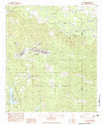 1983 McLaurin1983 Print · USGSMississippi's Pine Belt during the early eighties shows a unique blend of military infrastructure and deep Southern forest. Genealogists and historians can trace family locations near Morning Star Ch and Epps Cem or explore the early layout of Camp Shelby.3 unique versions available
 - 1983 Map of Carnes
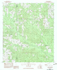 1983 Carnes1983 Print · USGSThe pine forests and creek bottoms of southern Forrest County are captured here in the early eighties. Local researchers can locate family sites including Lee Town Ch, the J E Bounds Mem Cem, and the rural community of Carnes.
 - 1983 Map of Brooklyn
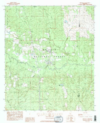 1983 Brooklyn1983 Print · USGSForrest County settlement and industry are captured here in the early 1980s as the rail corridor remained a vital artery through the piney woods. Researchers can locate remote family landmarks like Granny Bounds Cem, the Forrest County Agricultural Sch, and the Maxie Gas Field.2 unique versions available
 - 1983 Map of Bond, 1984 Print
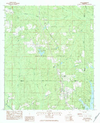 1983 Bond1984 Print · USGSSouthern Mississippi's timber and gas lands are captured in the early eighties as the industrial and recreational landscape matured. Researchers can locate family sites like Batson Cem and Bo Williams Cem or trace the Illinois Central Gulf rail line through Bond and Fruitland Park.
 - 1984 Map of Hattiesburg
 1984 Hattiesburg1984 Print · USGSSouth Mississippi’s Pine Belt is seen here in the mid-eighties, showing the region as a hub of timber production and petroleum extraction. Trace the rail lines of the Illinois Central Gulf RR through old settlements like Richton or the energy developments at the Heidelberg Oil Field.2 unique versions available
Showing maps 1-25 of 95
Top cities of Forrest County
Frequently asked questions
- What are the different types of historical maps available for Forrest County?
- What is the oldest map of Forrest County?
- Where can I purchase historical maps of Forrest County for my home or office?
- Where can I download high-res historical maps of Forrest County?
- Are there historical topographic maps available for Forrest County?
- Is there historical aerial imagery available for Forrest County?
- Where are historical maps of Forrest County sourced from?