1960s Maps of Holmes County, Mississippi
Explore 18 historic maps of Holmes County from the 1960s. These maps offer a rare glimpse into what life looked like during the 1960s — showing old roads, neighborhoods, homes, and landmarks that have changed or disappeared over time.
Whether you're researching your family's past, planning a metal detecting trip, or studying how Holmes County's landscape evolved across the 1960s, these high-resolution maps are a powerful tool for exploring the history of this region.
- Focus on a specific era: All maps on this page are from the 1960s, giving you a focused view of this time period.
- See what’s changed: Compare century-old streets, trails, and buildings to today's modern landscape using overlays and satellite layers.
- Research with precision: Use these maps for genealogy, historical research, land use analysis, or educational projects.
- View, download, or print: Maps are fully viewable online in high resolution, and can be downloaded or printed for your own records.
Start exploring Holmes County's history through authentic maps from the 1960s. This is your window into the past.
Holmes County, MS maps
(18)- 1961 Map of Jackson
 1961 Jackson1961 Print · USGSThe Lower Mississippi Delta and the state capital area are captured here during the post-war era of infrastructure expansion. Researchers can trace the complex river oxbows and rail lines connecting Vicksburg, Yazoo City, and the Illinois Central Railroad network.
 - 1961 Map of Mossy Lake, 1962 Print
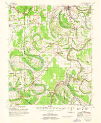 1961 Mossy Lake1962 Print · USGSLeflore County's intricate Delta wetlands and river bends are captured here in the early sixties, showing a landscape of scattered settlements and rural churches. Researchers can trace the Columbus and Greenville rail line through Itta Bena or locate local landmarks like McIntyre Cem and the Indian Mound.3 unique versions available
 - 1961 Map of Valley, 1963 Print
 1961 Valley1963 Print · USGSYazoo City and its rural surroundings are captured in the early sixties as the Delta's agricultural and industrial patterns evolved. Researchers can trace family roots through dozens of local landmarks including Cedar Falls Sch, Bells Chapel, and Coopers Cem.2 unique versions available
 - 1962 Map of Jackson
 1962 Jackson1962 Print · USGSThe Mississippi Delta and the state capital region are mapped here in the early sixties, showing a landscape defined by the great river and the growing city of JACKSON. Genealogists can trace family roots through numerous landmarks like Cedar Hill Cem, rural stops on the Illinois Central RR, and historic sites like Champion Hill.2 unique versions available
 - 1963 Map of West Point
 1963 West Point1963 Print · USGSEastern Mississippi and western Alabama are captured in the early sixties as industrial centers and rail lines connected the Black Prairie to the hills. Genealogists and historians can trace family-named watercourses and the early footprints of Starkville, Columbus, and the Noxubee National Wildlife Refuge.2 unique versions available
 - 1964 Map of West, 1965 Print
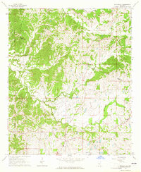
 1964 West1965 Print · USGSCentral Mississippi hill country and river bottomlands come alive in the 1960s. Genealogists can trace family names through landmarks like Whellin Cem, Brister Cem, and rural congregations at Liberty Hill Ch.2 unique versions available
 - 1964 Map of Zeiglerville, 1965 Print
 1964 Zeiglerville1965 Print · USGSThe rural border of Holmes and Yazoo Counties is captured in the mid-1960s, showing a landscape of small farm holdings and creek-side settlements. Researchers can trace family sites at Piney Springs Ch, the King Sch, and Pierce Crossroad.2 unique versions available
 - 1964 Map of Ebenezer, 1965 Print
 1964 Ebenezer1965 Print · USGSMississippi's rural interior comes into focus in this mid-sixties survey of the Ebenezer area. Genealogists can trace family connections through numerous landmarks like Hopewell Cem, Hart Town Cem, and St Peters Rock Ch.
 - 1964 Map of Bowling Green, 1965 Print
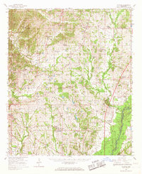
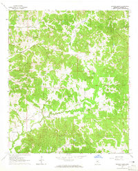 1964 Bowling Green1965 Print · USGSHolmes County in the mid-1960s reveals a landscape of dispersed rural settlements and historic land divisions. Genealogists and researchers can trace the Old Indian Treaty Boundary and locate family landmarks like Bethesda Chapel, Magee Cem, and the community at Bowling Green.2 unique versions available
 - 1964 Map of Hesterville, 1965 Print
 1964 Hesterville1965 Print · USGSAttala and Carroll counties appear here in the early sixties as a network of creek-bottom farms and rural railroad stops. Genealogists can locate family landmarks like Carmack Sch, Possumneck, and numerous burial sites including Mayo Cem and Guess Cem.
 - 1964 Map of Durant, 1965 Print
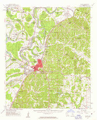
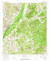
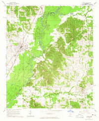 1964 Durant1965 Print · USGSMid-century Mississippi life unfolds along the Illinois Central Railroad and the winding Big Black River. Genealogists and local historians can trace family roots through numerous sites like Durant Cem, Macedonia Ch, and the community at Sallis.2 unique versions available
 - 1964 Map of Owens Wells, 1965 Print
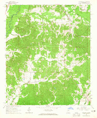
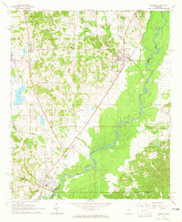
 1964 Owens Wells1965 Print · USGSHolmes County in the 1960s reveals a rural landscape shaped by the Illinois Central railroad and historic markers. Genealogists can locate family landmarks like Wesley Chapel Cem, Union Paradise Ch, and the Old Indian Treaty Bdy.3 unique versions available
 - 1964 Map of Goodman, 1965 Print
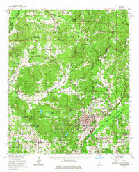
 1964 Goodman1965 Print · USGSThe mid-Mississippi corridor at the dawn of the 1960s highlights a landscape shaped by the Big Black River and the storied Illinois Central railroad. Genealogists can trace family footprints through sites like Holmes County Junior College, Bethlehem Ch, and Quiet Ridge Cem.2 unique versions available
 - 1965 Map of Meridian
 1965 Meridian1965 Print · USGSEast Mississippi and West Alabama are mapped here in the mid-sixties as the region's modern highway and reservoir systems began to take shape. Researchers can trace rural lineages through local landmarks like Prince Chapel and Tuscahoma Landing, or follow the historic Gulf Mobile & Ohio rail lines.
 - 1966 Map of Kosciusko, 1967 Print
 1966 Kosciusko1967 Print · USGSCentral Mississippi in the mid-sixties centers on Kosciusko and its surrounding rural communities. Genealogists can trace family names through dozens of landmarks like Carmack Sch, Hesterville, and the Bethlehem Cem.
 - 1966 Map of Goodman, 1967 Print
 1966 Goodman1967 Print · USGSMid-century Mississippi hill country and river bottomlands come alive here in the mid-1960s as small farming communities and timberlands span four counties. Genealogists can trace family roots through dozen of rural landmarks like Soule Chapel, Quiet Ridge Cem, and the Holmes County Junior College.
 - 1966 Map of Vaughan, 1967 Print
 1966 Vaughan1967 Print · USGSCentral Mississippi's rural landscape comes alive in the mid-1960s, showing the intersection of rail and river life. Researchers can trace family roots at Piney Springs Cem, Holy City, and schools like Linwood Sch.2 unique versions available
 - 1966 Map of Durant, 1967 Print
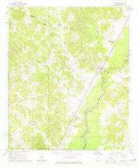
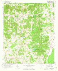
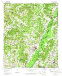 1966 Durant1967 Print · USGSMid-century Holmes County is captured here during a time of steady rail commerce and established rural settlements. Family historians can locate dozens of church-and-cemetery sites such as Bethesda Chapel Cem, Owens Wells, and the Old Indian Treaty Boundary.
End of results
Showing maps 1-18 of 18
Top cities of Holmes County
- Durant historical maps
- Tchula historical maps
- Lexington historical maps
- Pickens historical maps
- Goodman historical maps
- Cruger historical maps
See more
Frequently asked questions
- What are the different types of historical maps available for Holmes County?
- What is the oldest map of Holmes County?
- Where can I purchase historical maps of Holmes County for my home or office?
- Where can I download high-res historical maps of Holmes County?
- Are there historical topographic maps available for Holmes County?
- Is there historical aerial imagery available for Holmes County?
- Where are historical maps of Holmes County sourced from?