1970s Maps of Kemper County, Mississippi
Explore 7 historic maps of Kemper County from the 1970s. These maps offer a rare glimpse into what life looked like during the 1970s — showing old roads, neighborhoods, homes, and landmarks that have changed or disappeared over time.
Whether you're researching your family's past, planning a metal detecting trip, or studying how Kemper County's landscape evolved across the 1970s, these high-resolution maps are a powerful tool for exploring the history of this region.
- Focus on a specific era: All maps on this page are from the 1970s, giving you a focused view of this time period.
- See what’s changed: Compare century-old streets, trails, and buildings to today's modern landscape using overlays and satellite layers.
- Research with precision: Use these maps for genealogy, historical research, land use analysis, or educational projects.
- View, download, or print: Maps are fully viewable online in high resolution, and can be downloaded or printed for your own records.
Start exploring Kemper County's history through authentic maps from the 1970s. This is your window into the past.
Kemper County, MS maps
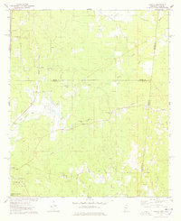
(7)- 1973 Map of Panola, 1975 Print
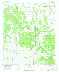 1973 Panola1975 Print · USGSThe borderlands of Alabama and Mississippi come into focus in the early seventies, centered on the Noxubee River bottoms. Researchers can trace family sites at Mt Tabor Ch Cem and St Marys Ch or follow the St Louis-San Francisco rail line.2 unique versions available
 - 1973 Map of Scooba, 1975 Print
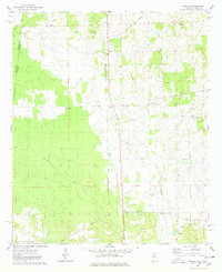
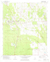 1973 Scooba1975 Print · USGSEastern Kemper County centers on the rail and educational hub of Scooba in the early seventies. Genealogists can locate family landmarks like Electric Mills, East Mississippi Jr College, and the Old Scooba Cem.
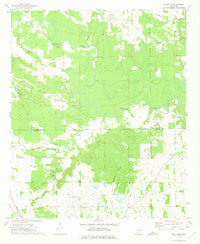
 - 1973 Map of Geiger, 1975 Print
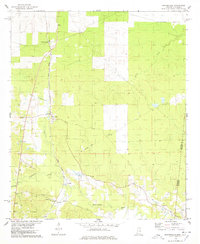
 1973 Geiger1975 Print · USGSThe Alabama-Mississippi borderlands come into focus in the early 1970s, showing a landscape defined by the St Louis-San Francisco railroad and rural creek bottoms. Genealogists can trace family landmarks like Souls Chapel Cem and Jerusalem Ch along the meandering Bodka Creek.2 unique versions available
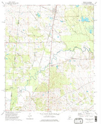
 - 1973 Map of Paulette, 1975 Print
 1973 Paulette1975 Print · USGSThe Noxubee and Kemper county line area in the early 1970s was a landscape of winding river bottoms and small family-named settlements. Researchers can trace the layout of rural communities like Paulette and Binnsville, or locate family burial grounds at Woodlawn Cem and Old Wahalak Cem.
 - 1974 Map of Tamola, 1978 Print
 1974 Tamola1978 Print · USGSIn the 1970s, this Mississippi-Alabama borderland centered on the ILLINOIS CENTRAL GULF railroad and the rural hub of Tamola. Researchers can trace family history at Lauderdale Springs Cem, Mt Hebron Ch, and the Tamola Lookout Tower.2 unique versions available
 - 1974 Map of Emelle, 1978 Print
 1974 Emelle1978 Print · USGSThe Alabama-Mississippi state line comes alive in the 1970s, focused on the rail-side community of Emelle and its surrounding rural townships. Genealogists can trace family roots through several landmarks including Shiloh Zion Ch, Bell Cem, and the quiet crossing at Sledge.2 unique versions available
 - 1974 Map of Porterville, 1978 Print
 1974 Porterville1978 Print · USGSPorterville and the eastern edge of Kemper County are captured in the mid-1970s as the rail and river systems shaped local life. Researchers can trace family sites like Enondale Ch Cem and the Old Railroad Grade near Payne.2 unique versions available
End of results
Showing maps 1-7 of 7
Top cities of Kemper County
Frequently asked questions
- What are the different types of historical maps available for Kemper County?
- What is the oldest map of Kemper County?
- Where can I purchase historical maps of Kemper County for my home or office?
- Where can I download high-res historical maps of Kemper County?
- Are there historical topographic maps available for Kemper County?
- Is there historical aerial imagery available for Kemper County?
- Where are historical maps of Kemper County sourced from?