1900s (20th Century) Maps of Kemper County, Mississippi
Explore 27 historic maps of Kemper County from the 1900s (20th Century). These maps offer a rare glimpse into what life looked like during the 1900s — showing old roads, neighborhoods, homes, and landmarks that have changed or disappeared over time.
Whether you're researching your family's past, planning a metal detecting trip, or studying how Kemper County's landscape evolved across the 1900s, these high-resolution maps are a powerful tool for exploring the history of this region.
- Focus on a specific era: All maps on this page are from the 1900s, giving you a focused view of this time period.
- See what’s changed: Compare century-old streets, trails, and buildings to today's modern landscape using overlays and satellite layers.
- Research with precision: Use these maps for genealogy, historical research, land use analysis, or educational projects.
- View, download, or print: Maps are fully viewable online in high resolution, and can be downloaded or printed for your own records.
Start exploring Kemper County's history through authentic maps from the 1900s. This is your window into the past.
Kemper County, MS maps
(27)- 1953 Map of Meridian, 1966 Print
 1953 Meridian1966 Print · USGSEast Central Mississippi and the Alabama borderlands are captured here during a period of steady growth and infrastructure expansion. Genealogists and historians can trace rail-town development along the Gulf Mobile & Ohio Railroad and find early settlements like Scooba, Pelahatchie, and De Kalb.2 unique versions available
 - 1957 Map of Meridian
 1957 Meridian1957 Print · USGSEast Central Mississippi and parts of Western Alabama come alive in the mid-1950s, centered on the transit hub of Meridian. Researchers can trace old rail lines like the Illinois Central and find historic sites such as the Choctaw Indian Reservation and Roosevelt State Park.
 - 1962 Map of House, 1963 Print
 1962 House1963 Print · USGSThe rural communities along the Neshoba and Kemper county line are captured here in the early sixties, showing a landscape of small farms and crossroads parishes. Genealogists can locate family landmarks like Wilson Cem, McDonald Cem, and the East Neshoba Sch.3 unique versions available
 - 1962 Map of Lynville, 1963 Print
 1962 Lynville1963 Print · USGSMississippi hill country life meets Cold War military aviation in the early sixties, as the runway of Bravo Field carves through rural Kemper County. Researchers can trace ancestral locations near Kellis Store, Clarks Chapel, and Shepard Ch.3 unique versions available
 - 1962 Map of Vernon, 1963 Print
 1962 Vernon1963 Print · USGSWinston and Neshoba Counties are captured in the early sixties, centered on rural communities and the significant Nanih Waiya Indian Mound. Researchers can trace local lineage through sites like Fulton Cem, Enon Ch, and Claytown.3 unique versions available
 - 1962 Map of Daleville, 1963 Print
 1962 Daleville1963 Print · USGSLauderdale and Kemper counties are captured here in the early sixties, a landscape of small farming communities and historic rural parishes. Researchers can locate family landmarks like Samuel Dale Cem, Andrews Chapel, and the settlement of Lizelia.4 unique versions available
 - 1962 Map of Lauderdale, 1963 Print
 1962 Lauderdale1963 Print · USGSEastern Mississippi's rural landscape is captured here in the early 1960s, showing the intersection of military aviation and traditional railroad life. Local historians can trace family roots through Soules Chapel and Gordon Cem, or explore the sprawling Mc Cain Field Naval Auxiliary Air Station.5 unique versions available
 - 1962 Map of Owl Creek, 1963 Print
 1962 Owl Creek1963 Print · USGSNeshoba and Kemper counties appear in the early 1960s as a landscape of rural schoolhouses and family cemeteries. Genealogists can locate Bogue Chitto Indian Sch, Sandtown Lookout Tower, and Cooks Chapel.2 unique versions available
 - 1962 Map of Lauderdale NW, 1963 Print
 1962 Lauderdale NW1963 Print · USGSKemper County in the early sixties remained a deeply rural landscape of small congregations and family-named waterways. Local historians can trace the locations of New Hope Ch, explore the banks of Pawticfaw Creek, and locate family burial sites like Hampton Cem.4 unique versions available
 - 1962 Map of Center Hill, 1963 Print
 1962 Center Hill1963 Print · USGSLauderdale and Kemper Counties are shown here in the early sixties, a landscape of creek-bottom farms and scattered rural communities. Genealogists can locate family landmarks like Chisholm Cem, Little Zion Ch, and the settlements of Klondike or Shuektown.3 unique versions available
 - 1962 Map of Preston, 1963 Print
 1962 Preston1963 Print · USGSThe tri-county borderlands of Winston, Noxubee, and Kemper counties are captured here in the early 1960s. Genealogists can locate family landmarks like Good Hope Ch, Hailey Cem, and the old schoolhouse at Preston.2 unique versions available
 - 1962 Map of Oak Grove, 1964 Print
 1962 Oak Grove1964 Print · USGSKemper County in the early sixties is a landscape of rural communities and wooded creek bottoms. Genealogists and historians can trace the foundations of local life through country churches like Center Ridge Ch and the high vantage of the Porterville Lookout Tower.2 unique versions available
 - 1962 Map of Post, 1964 Print
 1962 Post1964 Print · USGSFour Mississippi counties meet in this early 1960s survey, showing a rural landscape tied together by local churches and the railroad. Genealogists and researchers can trace family landmarks like Trussel Cem, Antioch Ch, and the rail stop at Perdue.2 unique versions available
 - 1962 Map of Moscow, 1964 Print
 1962 Moscow1964 Print · USGSKemper County in the early 1960s shows a landscape of small hamlets and timber management before modern expansion. Genealogists can trace family names and community centers through sites like McDonald Cem, Little Rock Sch, and West Kemper Ch.4 unique versions available
 - 1962 Map of Shuqualak, 1964 Print
 1962 Shuqualak1964 Print · USGSEastern Mississippi's rural timber and rail corridors come into focus in the early sixties. Researchers can trace family history through numerous landmarks like Shuqualak Cem, the settlement of Wahalak, and the old Gulf Mobile and Ohio line.2 unique versions available
 - 1963 Map of De Kalb, 1964 Print
 1963 De Kalb1964 Print · USGSKemper County life in the early sixties is centered here on the county seat and its surrounding timberlands. Genealogists and local historians can locate many family-named landmarks, including the McRae Cem, Sciple Mill, and the Old Railroad Grade.3 unique versions available
 - 1963 Map of Townsend, 1964 Print
 1963 Townsend1964 Print · USGSKemper County's rural landscape is captured here in the early sixties, showing a world of creekside settlements and country churches. Researchers can trace the Old Railroad Grade and find family landmarks like Felton Cem or Antioch Ch.2 unique versions available
 - 1963 Map of Gholson, 1964 Print
 1963 Gholson1964 Print · USGSNoxubee and Kemper counties are shown in the early sixties as a landscape of timbered ridges and family-run farms. Genealogists can trace rural roots through landmarks like Poorhouse Cem, Union Hill Ch, and the small settlement of Gholson.3 unique versions available
 - 1965 Map of Meridian
 1965 Meridian1965 Print · USGSEast Mississippi and West Alabama are mapped here in the mid-sixties as the region's modern highway and reservoir systems began to take shape. Researchers can trace rural lineages through local landmarks like Prince Chapel and Tuscahoma Landing, or follow the historic Gulf Mobile & Ohio rail lines.
 - 1973 Map of Panola, 1975 Print
 1973 Panola1975 Print · USGSThe borderlands of Alabama and Mississippi come into focus in the early seventies, centered on the Noxubee River bottoms. Researchers can trace family sites at Mt Tabor Ch Cem and St Marys Ch or follow the St Louis-San Francisco rail line.2 unique versions available
 - 1973 Map of Scooba, 1975 Print
 1973 Scooba1975 Print · USGSEastern Kemper County centers on the rail and educational hub of Scooba in the early seventies. Genealogists can locate family landmarks like Electric Mills, East Mississippi Jr College, and the Old Scooba Cem.
 - 1973 Map of Geiger, 1975 Print
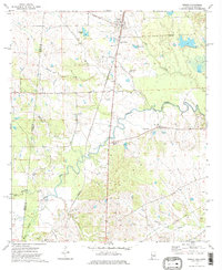 1973 Geiger1975 Print · USGSThe Alabama-Mississippi borderlands come into focus in the early 1970s, showing a landscape defined by the St Louis-San Francisco railroad and rural creek bottoms. Genealogists can trace family landmarks like Souls Chapel Cem and Jerusalem Ch along the meandering Bodka Creek.2 unique versions available
 - 1973 Map of Paulette, 1975 Print
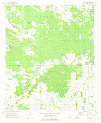 1973 Paulette1975 Print · USGSThe Noxubee and Kemper county line area in the early 1970s was a landscape of winding river bottoms and small family-named settlements. Researchers can trace the layout of rural communities like Paulette and Binnsville, or locate family burial grounds at Woodlawn Cem and Old Wahalak Cem.
 - 1974 Map of Tamola, 1978 Print
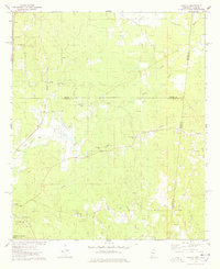 1974 Tamola1978 Print · USGSIn the 1970s, this Mississippi-Alabama borderland centered on the ILLINOIS CENTRAL GULF railroad and the rural hub of Tamola. Researchers can trace family history at Lauderdale Springs Cem, Mt Hebron Ch, and the Tamola Lookout Tower.2 unique versions available
 - 1974 Map of Emelle, 1978 Print
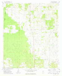 1974 Emelle1978 Print · USGSThe Alabama-Mississippi state line comes alive in the 1970s, focused on the rail-side community of Emelle and its surrounding rural townships. Genealogists can trace family roots through several landmarks including Shiloh Zion Ch, Bell Cem, and the quiet crossing at Sledge.2 unique versions available
Showing maps 1-25 of 27
Top cities of Kemper County
Frequently asked questions
- What are the different types of historical maps available for Kemper County?
- What is the oldest map of Kemper County?
- Where can I purchase historical maps of Kemper County for my home or office?
- Where can I download high-res historical maps of Kemper County?
- Are there historical topographic maps available for Kemper County?
- Is there historical aerial imagery available for Kemper County?
- Where are historical maps of Kemper County sourced from?