Old Maps of Lafayette County, Mississippi for Hiking & Exploration
Hike through history with 147 historic maps of Lafayette County. Explore old trails, ghost towns, and forgotten backroads — perfect for outdoor adventurers and local explorers.
- Rediscover forgotten places: Map out old mining camps, roads, and footpaths that no longer exist on modern maps.
- Layer with modern tools: Combine with LiDAR or satellite views to plan hikes through historical terrain.
- Made for exploration: Popular among hikers, overlanders, and local history lovers.
Use these maps to find adventure and explore the hidden past of Lafayette County.
Lafayette County, MS maps
(147)- 1940 Map of Oxford, 1956 Print
 1940 Oxford1956 Print · USGSLafayette County was undergoing a major landscape shift in the 1940s as the Sardis Reservoir took shape northwest of Oxford. Researchers can trace the early layout of the University of Mississippi and dozens of rural landmarks like Pearly Gate Ch and College Hill Sta.2 unique versions available
 - 1942 Map of Denmark, 1973 Print
 1942 Denmark1973 Print · USGSLafayette County was a landscape of small timber stands and creek-bottom farms during the early 1940s. Genealogists can trace family roots through numerous local landmarks like Lafayette Springs Sch, Bethel Ch, and Jefferson Cem.
 - 1943 Map of Denmark
 1943 Denmark1943 Print · USGSLafayette County was a landscape of small schools and forest lookouts in the years during the Second World War. Genealogists can trace family roots through numerous rural landmarks like Lafayette Springs, Denmark Sch, and Shiloh Cem.3 unique versions available
 - 1943 Map of Oxford
 1943 Oxford1943 Print · USGSLafayette County during the early years of the Second World War shows the transformation of the Tallahatchie valley as the Sardis Reservoir begins to dominate the north. Researchers can trace the rural infrastructure of the era through sites like Spring Hill Sch & Ch, the Illinois Central tracks, and the University of Mississippi.2 unique versions available
 - 1944 Map of Tyro, 1964 Print
 1944 Tyro1964 Print · USGSMississippi's hill country met a changing river landscape in the mid-1940s as the Sardis Reservoir took shape. Genealogists can trace hundreds of family landmarks, from Harmontown to local institutions like St Josephs Ch & Sch and Lammey Fam Cem.
 - 1944 Map of Potts Camp, 1973 Print
 1944 Potts Camp1973 Print · USGSMarshall County's rural landscape is captured here during the mid-1940s, highlighting the area's transition between the national forest and the Tallahatchie valley. Researchers can trace family sites at St Pauls Ch & Cem, the community at Potts Camp, and early engineering like the Tallahatchie Canal.
 - 1945 Map of Potts Camp, 1964 Print
 1945 Potts Camp1964 Print · USGSNorth Mississippi's rural timber and farm country comes into focus in the mid-1940s, just as the local landscape was being reshaped by large-scale flood control projects. Genealogists can locate family landmarks such as Bethany Ch & Cem, the Winborn Lookout Tower, and small settlements like Cornersville and Malone.
 - 1949 Map of New Albany, 1964 Print
 1949 New Albany1964 Print · USGSNorth Mississippi's rural landscape comes to life in the late 1940s as rail lines and river bottoms connect scattered farming communities. Researchers can trace the heritage of local crossroads and schools like Ingomar, Possum Trot, and Beulah Grove Sch.
 - 1951 Map of New Albany
 1951 New Albany1951 Print · USGSMississippi's hill country comes into focus in the early fifties, showing a landscape defined by the GULF MOBILE AND OHIO railroad and the Tallahatchie River. Researchers can trace rural lineages through numerous local sites like Possum Trot, Turnpike Ch, and Ingomar.2 unique versions available
 - 1954 Map of Water Valley, 1966 Print
 1954 Water Valley1966 Print · USGSYalobusha County was undergoing significant hydrological change in the mid-fifties as the Enid Reservoir reshaped the valley. Researchers can trace dozens of rural church and school sites, from Sylva Rena Ch & Cem to the Pine Valley Sch.2 unique versions available
 - 1954 Map of Water Valley West, 1980 Print
 1954 Water Valley West1980 Print · USGSYalobusha and Lafayette counties are shown here as the Enid Lake reservoir reshaped the Yocona River valley in the early 1980s. Genealogists and local historians can locate numerous rural landmarks like Pine Spring Cem, Kind Providence Ch, and the town of Water Valley.
 - 1955 Map of Water Valley
 1955 Water Valley1955 Print · USGSYalobusha County enters the mid-fifties with the newly formed Enid Reservoir reshaping the valley's geography. Genealogists and historians can trace family locations through numerous rural sites like Sylva Rena Ch & Cem and the Oak Grove Sch.
 - 1955 Map of Blue Mountain, 1956 Print
 1955 Blue Mountain1956 Print · USGSTippah and Union counties are shown in the mid-fifties during a period of steady growth along the regional rail lines. Researchers can trace family sites among dozens of landmarks like St Matthew Ch, Pumpkin Center, and the Myrtle Lookout Tower.3 unique versions available
 - 1956 Map of Tupelo, 1967 Print
 1956 Tupelo1967 Print · USGSNortheast Mississippi and parts of Tennessee and Alabama are shown here during the mid-fifties, a time of major reservoir construction and forestry management. Researchers can trace the St Louis-San Francisco RR through Tupelo or locate historic sites like Tishomingo State Park and the University.2 unique versions available
 - 1958 Map of Tupelo
 1958 Tupelo1958 Print · USGSNortheast Mississippi and neighboring Alabama and Tennessee appear here during the late fifties as a region defined by new reservoirs and historic rail lines. Genealogists can trace family locations near Sardis Lake, Woodall Mountain, and the St Louis-San Francisco Ry.
 - 1971 Map of Laws Hill, 1973 Print
 1971 Laws Hill1973 Print · USGSUpper Lafayette County and the Sardis Lake shoreline are captured here in the early seventies, as the river valley's transition to a major reservoir was well-established. Genealogists can trace family sites at Abbeville Cem, Mt Moriah Ch, and the historic Wyatt Cem near the water.2 unique versions available
 - 1971 Map of Tyro, 1973 Print
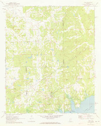 1971 Tyro1973 Print · USGSThe rural borderlands of Lafayette, Tate, and Marshall counties are captured here in the early 1970s before modern development altered these small communities. Researchers can trace family sites at Mt Patient Cem, Langstons Cem, and rural hubs like Harmontown and Tyro.2 unique versions available
 - 1972 Map of Paris, 1974 Print
 1972 Paris1974 Print · USGSLafayette County rural life is well-documented in the early seventies, centered on the crossroads at Paris. Researchers can trace old family roots through sites like Rock Hill Ch, Delay, and several smaller cemeteries near Otoucalofa Creek.
 - 1972 Map of Randolph, 1974 Print
 1972 Randolph1974 Print · USGSRandolph and the surrounding Pontotoc County countryside are shown here in the early 1970s as a network of small family farms and rural churches. Genealogists can trace family names through numerous local burial grounds including Salmon Cem and Harrison-Tutor Cem, or locate landmarks like Camp Yocona.
 - 1972 Map of Tula, 1975 Print
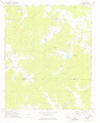 1972 Tula1975 Print · USGSLafayette and Calhoun Counties are captured here in the early seventies, showing a landscape defined by the Yocona River and rural crossroads. Local historians can trace the foundations of Tula and Sarepta alongside sites like Stutson Chapel and Old Dallas Cemetery.
 - 1980 Map of Coles Point, 1981 Print
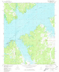 1980 Coles Point1981 Print · USGSLafayette and Panola counties are shown during the 1980s as the regional landscape adjusted to the presence of the Sardis reservoir. You can trace family roots and old land patterns through features like Emery Cem, Spring Hill Ch, and the high ground of Carter Mountain.
 - 1980 Map of Thaxton, 1981 Print
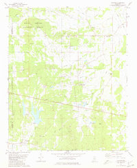 1980 Thaxton1981 Print · USGSNortheast Mississippi during the late seventies reveals a landscape of small agricultural hubs and national forest land. Researchers can pinpoint rural congregations and family cemeteries like Sand Spring Ch, Bellvue Ch, and Laodicea Cem.
 - 1980 Map of Splinter, 1981 Print
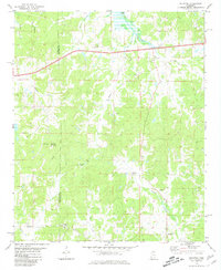 1980 Splinter1981 Print · USGSLafayette and Panola counties appear here in the early eighties as a landscape of rural crossroads and wooded hills. Genealogists can trace ancestral sites like Browning Cem, Acree Hill Ch, and the community of Orwood.
 - 1980 Map of Oxford South, 1981 Print
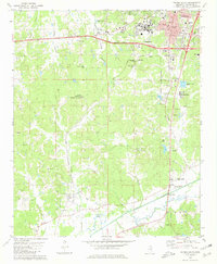 1980 Oxford South1981 Print · USGSOxford and the University of Mississippi expanded southward during the late seventies as the surrounding landscape remained a mix of rural valley and rail corridor. Researchers can locate family landmarks like Craig Cem, New Hope Ch, and the high point at Thacker Mountain.2 unique versions available
 - 1980 Map of Puskus Lake, 1981 Print
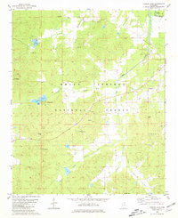 1980 Puskus Lake1981 Print · USGSLafayette and Marshall counties were largely wooded and rural at the start of the eighties, defined by the Holly Springs National Forest. Researchers can find numerous family-centric sites like Shiloh Cem, Jefferson Cem, and the settlement of Cambridge.
Showing maps 1-25 of 147
Top cities of Lafayette County
Frequently asked questions
- What are the different types of historical maps available for Lafayette County?
- What is the oldest map of Lafayette County?
- Where can I purchase historical maps of Lafayette County for my home or office?
- Where can I download high-res historical maps of Lafayette County?
- Are there historical topographic maps available for Lafayette County?
- Is there historical aerial imagery available for Lafayette County?
- Where are historical maps of Lafayette County sourced from?