1980s Maps of Monroe County, Mississippi
Explore 8 historic maps of Monroe County from the 1980s. These maps offer a rare glimpse into what life looked like during the 1980s — showing old roads, neighborhoods, homes, and landmarks that have changed or disappeared over time.
Whether you're researching your family's past, planning a metal detecting trip, or studying how Monroe County's landscape evolved across the 1980s, these high-resolution maps are a powerful tool for exploring the history of this region.
- Focus on a specific era: All maps on this page are from the 1980s, giving you a focused view of this time period.
- See what’s changed: Compare century-old streets, trails, and buildings to today's modern landscape using overlays and satellite layers.
- Research with precision: Use these maps for genealogy, historical research, land use analysis, or educational projects.
- View, download, or print: Maps are fully viewable online in high resolution, and can be downloaded or printed for your own records.
Start exploring Monroe County's history through authentic maps from the 1980s. This is your window into the past.
Monroe County, MS maps
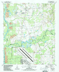
(8)- 1982 Map of West Point, 1983 Print
 1982 West Point1983 Print · USGSEastern Mississippi and western Alabama are captured in the early eighties as the river-and-rail economy evolved. Trace family roots and old township lines near West Point, Columbus Air Force Base, and the historic Natchez Trace Parkway.
 - 1984 Map of West Point
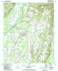
 1984 West Point1984 Print · USGSNorth-Central Mississippi in the mid-eighties shows a landscape defined by massive water management projects and dense timberlands. Researchers can trace the legacy of rural settlements like Geeslin Corner or the rail corridors of the Illinois Central Gulf RR near Grenada Lake.3 unique versions available
 - 1984 Map of Tupelo
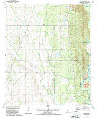
 1984 Tupelo1984 Print · USGSNorth Mississippi in the 1980s is defined by its massive river basin reservoirs and the growing regional hubs of Tupelo and Oxford. Researchers can trace the legacy of the Pontotoc Ridge, find the University of Mississippi, and map early Interstate corridors near Sardis Lake.3 unique versions available
 - 1984 Map of Tupelo, 1985 Print
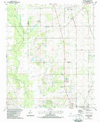
 1984 Tupelo1985 Print · USGSNortheast Mississippi and the Alabama borderlands are shown in the mid-1980s as timber and river networks shaped the region. Trace local history through the Illinois Central Gulf rail line and sites like the Old Natchez Trace Parkway.
 - 1987 Map of Hamilton
 1987 Hamilton1987 Print · USGSThe Monroe and Lowndes County line in the late eighties shows a landscape of military aviation and river engineering. Trace the boundaries of Columbus Air Force Base or locate rural landmarks like Sardis Cem and Sulphur Springs Sch.
 - 1987 Map of Caledonia
 1987 Caledonia1987 Print · USGSCaledonia sits at the heart of this border region in the 1980s, where the Mississippi and Alabama lines meet. Researchers can trace rural life and ancestry through landmarks like Bethlehem Ch, Unity Cem, and the historic Wolf Road.
 - 1987 Map of Strong
 1987 Strong1987 Print · USGSThe Tombigbee River valley in the late eighties shows a landscape of traditional settlements and modern engineering projects. Genealogists can trace family sites like Strong Cem and Mt Zion Ch alongside the newly formed Columbus Lake.
 - 1987 Map of Muldon
 1987 Muldon1987 Print · USGSClay and Monroe Counties in the late eighties show a landscape of energy production and rural community. Genealogists can trace family roots at Le Noir Cem and Siloam Cems or locate old pulpits like New Hope Ch.
End of results
Showing maps 1-8 of 8
Top cities of Monroe County
- Amory historical maps
- Aberdeen historical maps
- Smithville historical maps
- New Hamilton historical maps
- Hatley historical maps
- Gattman historical maps
Frequently asked questions
- What are the different types of historical maps available for Monroe County?
- What is the oldest map of Monroe County?
- Where can I purchase historical maps of Monroe County for my home or office?
- Where can I download high-res historical maps of Monroe County?
- Are there historical topographic maps available for Monroe County?
- Is there historical aerial imagery available for Monroe County?
- Where are historical maps of Monroe County sourced from?