1950s Maps of Noxubee County, Mississippi
Explore 5 historic maps of Noxubee County from the 1950s. These maps offer a rare glimpse into what life looked like during the 1950s — showing old roads, neighborhoods, homes, and landmarks that have changed or disappeared over time.
Whether you're researching your family's past, planning a metal detecting trip, or studying how Noxubee County's landscape evolved across the 1950s, these high-resolution maps are a powerful tool for exploring the history of this region.
- Focus on a specific era: All maps on this page are from the 1950s, giving you a focused view of this time period.
- See what’s changed: Compare century-old streets, trails, and buildings to today's modern landscape using overlays and satellite layers.
- Research with precision: Use these maps for genealogy, historical research, land use analysis, or educational projects.
- View, download, or print: Maps are fully viewable online in high resolution, and can be downloaded or printed for your own records.
Start exploring Noxubee County's history through authentic maps from the 1950s. This is your window into the past.
Noxubee County, MS maps
(5)- 1953 Map of Meridian, 1966 Print
 1953 Meridian1966 Print · USGSEast Central Mississippi and the Alabama borderlands are captured here during a period of steady growth and infrastructure expansion. Genealogists and historians can trace rail-town development along the Gulf Mobile & Ohio Railroad and find early settlements like Scooba, Pelahatchie, and De Kalb.2 unique versions available
 - 1953 Map of West Point, 1973 Print
 1953 West Point1973 Print · USGSNorth-Central Mississippi and the Alabama borderlands are captured here during the mid-twentieth century as new reservoirs and national forests transformed the landscape. Researchers can trace the path of the Mississippi & Skuna Valley railroad or locate old landings along the Tombigbee River and Schooner Creek.3 unique versions available
 - 1957 Map of Meridian
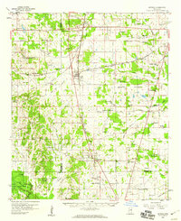
 1957 Meridian1957 Print · USGSEast Central Mississippi and parts of Western Alabama come alive in the mid-1950s, centered on the transit hub of Meridian. Researchers can trace old rail lines like the Illinois Central and find historic sites such as the Choctaw Indian Reservation and Roosevelt State Park.
 - 1958 Map of West Point
 1958 West Point1958 Print · USGSNortheastern Mississippi and western Alabama are shown in the late 1950s, highlighting a region defined by its river-and-rail economy. Researchers can trace family roots through numerous settlements like Artesia and Vardaman or explore the corridor of the Tombigbee River.
 - 1959 Map of Artesia, 1960 Print
 1959 Artesia1960 Print · USGSThe Gulf Mobile and Ohio railroad corridor anchors this mid-century look at the prairie country of eastern Mississippi. Genealogists can trace family names at Ledbetter Cem or locate rural centers like Truevine Sch and the community of Artesia.3 unique versions available
End of results
Showing maps 1-5 of 5
Top cities of Noxubee County
Frequently asked questions
- What are the different types of historical maps available for Noxubee County?
- What is the oldest map of Noxubee County?
- Where can I purchase historical maps of Noxubee County for my home or office?
- Where can I download high-res historical maps of Noxubee County?
- Are there historical topographic maps available for Noxubee County?
- Is there historical aerial imagery available for Noxubee County?
- Where are historical maps of Noxubee County sourced from?