Old Maps of Sharkey County, Mississippi for Genealogy
Trace your family roots with 97 historic maps of Sharkey County. These high-res maps reveal old neighborhoods, homesites, landmarks, and streets — helping you uncover where your ancestors lived and how the area evolved over time.
- Explore historic neighborhoods: Identify where your relatives may have lived in the 1800s or 1900s.
- Compare maps over time: Trace the changes in streets, buildings, and landmarks for multi-generational research.
- Perfect for genealogy & ancestry research: Used by family historians and researchers to map out lineage and migration.
These maps are an incredible resource for exploring your personal connection to Sharkey County's past.
Sharkey County, MS maps
(97)- 1939 Map of Onward
 1939 Onward1939 Print · USGSThe Mississippi Delta in the late 1930s shows a landscape of river-bend settlements and bayou-side commerce before modern infrastructure took hold. You can trace the Illinois Central railroad through Smedes and Kelso or locate family landmarks like Haynes Bluff and the Lumber Yard at Valley Park.3 unique versions available
 - 1939 Map of Lorenzen, 1941 Print
 1939 Lorenzen1941 Print · USGSSharkey County at the end of the Depression era is a intricate landscape of rail junctions and Delta waterways. Genealogists and researchers can trace local landmarks like Mont Helena, the Indian Mound at Grace, and rural stations such as Riverside Jct and Lorenzen.2 unique versions available
 - 1939 Map of Swan Lake, 1966 Print
 1939 Swan Lake1966 Print · USGSThe Mississippi Delta's intricate water and rail networks are captured here during the late 1930s. Researchers can locate numerous plantation-era settlements and landmarks including Indian Mounds, the community of Nitta Yuma, and the grounds of Leroy Percy State Park.
 - 1940 Map of Auter, 1941 Print
 1940 Auter1941 Print · USGSThe Mississippi Delta in the early 1940s is captured here as a world of river landings and plantation agriculture along the Big Sunflower River. Genealogists and researchers can trace family landmarks at Hard Cash, Midnight, and Daybreak Plantation.
 - 1940 Map of Mechanicsburg, 1947 Print
 1940 Mechanicsburg1947 Print · USGSThe Yazoo River Delta in the early 1940s reveals a landscape defined by steamboat landings and the edge of the Loess Bluffs. Researchers can trace historic river access points like Enola Ldg and Miller Ldg or locate the early footprints of Satartia and Mechanicsburg.2 unique versions available
 - 1953 Map of Greenwood, 1966 Print
 1953 Greenwood1966 Print · USGSThe Mississippi Delta in the mid-fifties is captured here as a thriving network of river towns, railroads, and oxbow lakes. Researchers can trace the legacy of the Illinois Central Railroad and locate landmarks like the State Penal Farm and Greenville Air Force Base.5 unique versions available
 - 1955 Map of Jackson
 1955 Jackson1955 Print · USGSThe Lower Mississippi Valley at the middle of the century reveals a landscape of deep river meanders and growing rail hubs. Genealogists and historians can trace the mid-century footprints of Vicksburg National Military Park, old river landings at Port Gibson, and the rail corridors of the Illinois Central Railroad.3 unique versions available
 - 1956 Map of Greenwood
 1956 Greenwood1956 Print · USGSThe Mississippi Delta in the mid-fifties is captured here during a period of significant military and agricultural activity. Researchers can trace the rail lines of the Illinois Central RR, find the Greenville Air Force Base, or locate the State Penal Farm.
 - 1961 Map of Jackson
 1961 Jackson1961 Print · USGSThe Lower Mississippi Delta and the state capital area are captured here during the post-war era of infrastructure expansion. Researchers can trace the complex river oxbows and rail lines connecting Vicksburg, Yazoo City, and the Illinois Central Railroad network.
 - 1961 Map of Bayland
 1961 Bayland1961 Print · USGSThe Mississippi Delta's intricate water network and rural communities are captured here in the early sixties. Genealogists and historians can trace family locations through Huddleston Cem, Indian Mounds, and the Humphreys Co Training School.3 unique versions available
 - 1962 Map of Jackson
 1962 Jackson1962 Print · USGSThe Mississippi Delta and the state capital region are mapped here in the early sixties, showing a landscape defined by the great river and the growing city of JACKSON. Genealogists can trace family roots through numerous landmarks like Cedar Hill Cem, rural stops on the Illinois Central RR, and historic sites like Champion Hill.2 unique versions available
 - 1963 Map of Mechanicsburg, 1965 Print
 1963 Mechanicsburg1965 Print · USGSThe Yazoo Delta and its surrounding bluffs are shown in the early sixties as a landscape of river landings and rural parishes. Researchers can trace family history through Satartia, Mechanicsburg, and numerous rural churches like Germania El Bethel Ch or Lynch Chapel.
 - 1963 Map of Onward, 1965 Print
 1963 Onward1965 Print · USGSThe Mississippi Delta lowlands appear in detail in the early sixties, showing the rail-and-river network before modern land-use changes. Genealogists can trace family names through rural landmarks like Rock of Mt Zion Ch, Valley Park, and the Cement Plant at Haynes Bluff.3 unique versions available
 - 1964 Map of Lorenzen, 1966 Print
 1964 Lorenzen1966 Print · USGSThe Mississippi Delta's intricate bayou network is meticulously detailed here during the mid-1960s. Genealogists and local historians can trace family roots through numerous landmarks like St Michaels Ch, Elmwood Cem, and the old rail stop at Riverside Junction.2 unique versions available
 - 1965 Map of Richey, 1966 Print
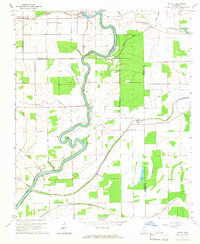 1965 Richey1966 Print · USGSSharkey County and the surrounding Delta lands are captured here in the mid-1960s as the river economy remained central to local life. Genealogists can locate family landmarks like Short Jerusalem Ch and the river crossings at Murphy Ferry or Bommers Ferry.
 - 1967 Map of Auter
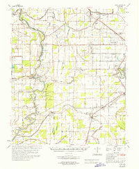 1967 Auter1967 Print · USGSHumphreys County and the surrounding Delta flatlands are captured here in the late sixties as the agricultural economy relied on both rail and river. Trace family roots at Midnight or Silver City, and find old landmarks like River Oak Sch and Pilgrim Rest Cem.
 - 1967 Map of Percy, 1970 Print
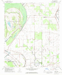 1967 Percy1970 Print · USGSThis Mississippi Delta landscape in the late sixties reveals a mix of protected wetlands and deep-rooted agricultural life across three counties. Genealogists and researchers can locate old communities like Percy and Grace, or trace family landmarks including Canaan Hill Cem and Goodwill Ch.2 unique versions available
 - 1968 Map of Delta City, 1970 Print
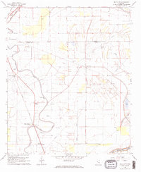 1968 Delta City1970 Print · USGSThe Mississippi Delta's agricultural landscape is captured here in the late sixties as rail and river networks defined local life. Trace family roots and vanished landmarks near Delta City, Nitta Yuma, and several Indian Mounds along the Illinois Central.2 unique versions available
 - 1969 Map of Swan Lake
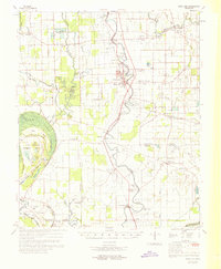 1969 Swan Lake1969 Print · USGSThe Mississippi Delta in the late sixties reveals a landscape of productive cotton fields and vital wetlands along Deer Creek. Genealogists can trace family names at Bellamy Cem, visit Simmons Sch, or locate the historic siding at Panther Burn.
 - 1984 Map of Yazoo City
 1984 Yazoo City1984 Print · USGSThe Mississippi Delta and loess bluffs meet in the mid-eighties as the Yazoo River snakes through a dense network of wildlife areas and rail lines. Researchers can trace rural life and drainage history through small communities like Holly Bluff, Mechanicsburg, and Satartia.2 unique versions available
 - 1984 Map of Indianola, 1985 Print
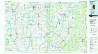 1984 Indianola1985 Print · USGSThe Mississippi Delta of the mid-1980s reveals a landscape of fertile bottomlands shaped by the Sunflower River and Yazoo River. Researchers can trace the rail-and-river economy through landmarks like Saints College, the Leflore Cemetery, and the Columbus and Greenville Railway.
 - 1988 Map of Rolling Fork West
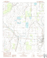 1988 Rolling Fork West1988 Print · USGSThe Yazoo Delta in the late eighties reveals a landscape shaped by water management and a growing aquaculture industry. Genealogists and local historians can trace family-named sites and rural hubs like Rolling Fork, Grace, and the Lookout Tower near Steele Bayou.
 - 1988 Map of Rolling Fork East
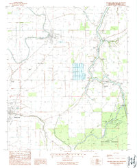 1988 Rolling Fork East1988 Print · USGSThe Sharkey County floodplain in the late eighties shows a landscape of river landings and agricultural settlements. Researchers can trace family sites near Anguilla, explore the Delta National Forest boundary, or locate the historic community of Africa.
 - 1988 Map of Lucre
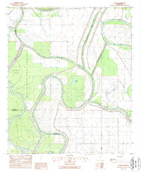 1988 Lucre1988 Print · USGSThe convergence of the Yazoo and Sunflower rivers in the late 1980s reveals a landscape of deep-delta timber and intensive water management. Researchers can trace the boundaries of the Delta National Forest and locate small rural outposts like Lucre and Cypress.
 - 1988 Map of Red Rock
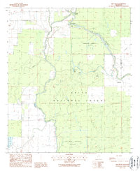 1988 Red Rock1988 Print · USGSSharkey County's bottomland hardwood forests and river systems are documented here during the late eighties. Researchers can trace the water management of the Sunflower Greentree Reservoir and find old river sites like Choctaw Landing and Red Rock.
Showing maps 1-25 of 97
Top cities of Sharkey County
Frequently asked questions
- What are the different types of historical maps available for Sharkey County?
- What is the oldest map of Sharkey County?
- Where can I purchase historical maps of Sharkey County for my home or office?
- Where can I download high-res historical maps of Sharkey County?
- Are there historical topographic maps available for Sharkey County?
- Is there historical aerial imagery available for Sharkey County?
- Where are historical maps of Sharkey County sourced from?