Old Maps of Tishomingo County, Mississippi for Academic Research
Study the evolution of Tishomingo County with 105 high-resolution historic maps. Whether you're teaching, researching, or modeling changes in land use, these maps provide essential visual documentation of urban, environmental, and geographic change.
- Analyze long-term change: Track patterns in development, transportation, and natural features.
- Ideal for environmental or urban studies: Support academic projects with primary historical map data.
- Use in the classroom or lab: Educators and researchers rely on these maps to bring historical context to life.
These maps are a powerful tool for teaching, research, and visualizing how Tishomingo County has changed over the decades.
Tishomingo County, MS maps
(105)- 1911 Map of Iuka
 1911 Iuka1911 Print · USGSThe tri-state border region of Mississippi, Alabama, and Tennessee is captured here at the peak of the river-landing era. Genealogists can trace family connections through numerous river access points like Shellbank Landing and rural landmarks such as Salem Church and Jackson Ridge School.2 unique versions available
 - 1914 Map of Iuka
 1914 Iuka1914 Print · USGSThe Tennessee River valley at the Mississippi and Alabama border was a busy network of landings and rail junctions in the early twentieth century. Researchers can trace riverfront life at Eastport Landing or locate rural family landmarks like Salem Church and Guthrie School.4 unique versions available
 - 1935 Map of Holcut
 1935 Holcut1935 Print · USGSNortheast Mississippi was undergoing significant federal study in the mid-1930s as the railroad and river systems defined local life. Researchers can locate the community centers of the day, from the town of Holcut to rural landmarks like Lebanon Ch and Liberty Sch.
 - 1935 Map of Doskie
 1935 Doskie1935 Print · USGSTishomingo County and the Tennessee borderlands are captured here in the mid-1930s just as the Tennessee Valley Authority began reshaping the local geography. Researchers can trace the rural communities of Doskie and Cross Roads or find family history at Pleasant Hill Ch and Mulberry Sch.
 - 1935 Map of Iuka
 1935 Iuka1935 Print · USGSTishomingo County is captured in the mid-1930s as the Tennessee Valley Authority begins modernizing the region. Genealogists and local historians can locate many rural landmarks, from Woodall Mtn to the Oak Grove Cem, Hopewell Sch, and Snowdown Ch.
 - 1935 Map of Leedy
 1935 Leedy1935 Print · USGSIn the mid-1930s, the Tishomingo County countryside was a landscape of small rail spurs and country churches centered around Burnsville. Researchers can locate vanished rural landmarks such as Rolands Mill Sch, Opossum Trot Cem, and the Illinois Central rail line.
 - 1936 Map of Margerum
 1936 Margerum1936 Print · USGSThe Alabama-Mississippi borderland is captured during a time of immense change as the Tennessee Valley Authority prepares for the Pickwick Landing Reservoir. Local historians can trace family roots through sites like Carytown Ch, Crenshaw Cem, and the settlement of Margerum.
 - 1936 Map of Belmont
 1936 Belmont1936 Print · USGSNortheast Mississippi at the height of the New Deal era features the growth of Belmont and the establishment of Tishomingo State Park. You can trace rural schoolhouses and family cemeteries like Burnt Mill Sch and Russell Cem along the Illinois Central Railroad.
 - 1936 Map of Waterloo
 1936 Waterloo1936 Print · USGSThe Tennessee River border between Alabama and Mississippi is captured here during the mid-1930s transition to a dammed waterway. Genealogists and historians can locate community landmarks like Fords Mill Ch, the Riverton Ferry, and Watkins Cem.
 - 1936 Map of Red Bay
 1936 Red Bay1936 Print · USGSRed Bay and the Franklin County borderlands appear here in the mid-thirties as the Tennessee Valley Authority began its regional transformations. Genealogists and local historians can trace family sites at Patterson Chapel, Burgess Cem, and the old rail stops along the Illinois Central line.
 - 1936 Map of Shaws
 1936 Shaws1936 Print · USGSThe Tennessee Valley was undergoing a massive transformation in the mid-1930s as the Pickwick Landing project reshaped the tri-state border. Genealogists and local historians can trace rural family-named sites like Hubbard Cem, Panther Creek Sch, and Beckman Landing.
 - 1936 Map of Bishop
 1936 Bishop1936 Print · USGSThe Alabama-Mississippi borderlands appear here during the mid-1930s as the Tennessee Valley Authority planned its massive reservoir system. Researchers can trace ancestral sites like Allsboro, Liberty Sch, and Burns Cem alongside the proposed shoreline of the Pickwick Landing Reservoir.
 - 1936 Map of Tishomingo
 1936 Tishomingo1936 Print · USGSThe Tennessee-Mississippi borderlands come alive in the mid-1930s as the Natchez Trace and Illinois Central railroad define the region's movement. Researchers can trace rural lineages through local landmarks like Nunley Cem, Bogg Chapel, and the Rutledge Salem Sch.
 - 1950 Map of Paden, 1954 Print
 1950 Paden1954 Print · USGSIn the Tishomingo hills during the early 1950s, the rural life of northeast Mississippi centered on rail sidings and remote creek crossings. Researchers can locate family landmarks like Stricklen Cem, follow the Illinois Central through Paden, and trace the historic Natchez Trace.3 unique versions available
 - 1950 Map of Burnsville, 1954 Print
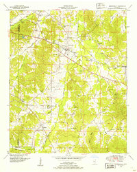 1950 Burnsville1954 Print · USGSTishomingo County at mid-century reveals a landscape of rural schools, family cemeteries, and critical rail junctions during the post-war era. Researchers can trace ancestral roots at Opossum Trot Cem or locate the old Gravel Hill School and Hazard Switch.3 unique versions available
 - 1950 Map of Doskie, 1954 Print
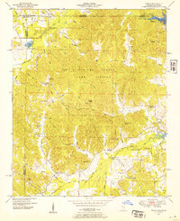 1950 Doskie1954 Print · USGSNortheast Mississippi and southern Tennessee appear here just after the war, showing the area near Doskie and the Tishomingo County Game Refuge. Researchers can trace rural life at Lambs Chapel School, Shady Grove Ch, and the Beaver Pond gaging station.3 unique versions available
 - 1950 Map of Belmont, 1971 Print
 1950 Belmont1971 Print · USGSTishomingo County at mid-century shows a landscape of ridge-top settlements and growing infrastructure like the Natchez Trace Parkway. Researchers can trace the path of the Illinois Central Railroad through Belmont or locate rural landmarks like Liberty Ch and Russell Cem.2 unique versions available
 - 1950 Map of Bishop, 1974 Print
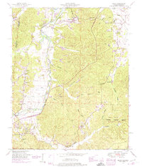 1950 Bishop1974 Print · USGSWestern Colbert County at mid-century shows a landscape of border-town settlements and river-valley farms just as the modern parkway was arriving. Trace the old community footprints at Allsboro, Maud, and Bishop, or locate family sites like Twitty Cem and Asphalt Rock Church.2 unique versions available
 - 1950 Map of Tishomingo, 1974 Print
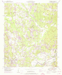 1950 Tishomingo1974 Print · USGSTishomingo and the surrounding hill country of northeast Mississippi are captured here in the mid-twentieth century. Researchers can trace the development of the Natchez Trace Parkway and locate rural landmarks like Boggs Chapel, Petertown, and the Illinois Central rail line.3 unique versions available
 - 1951 Map of Red Bay
 1951 Red Bay1951 Print · USGSRed Bay and the surrounding borderlands of Alabama and Mississippi are captured here in the early fifties. Local historians can trace the rail-side growth of Red Bay and locate rural landmarks like Banner Sch, Sims Memorial Church, and the Burgess Cem.3 unique versions available
 - 1951 Map of Bishop
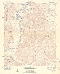 1951 Bishop1951 Print · USGSThe Alabama-Mississippi state line and the historic Natchez Trace corridor are captured here during the mid-century. Researchers can locate family roots at Allsboro and Maud, or trace historic burial sites like Alsobrook Cem and Liberty Cem.2 unique versions available
 - 1951 Map of Belmont
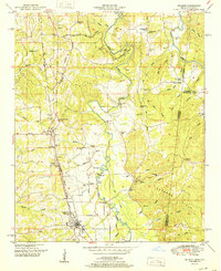 1951 Belmont1951 Print · USGSTishomingo County, Mississippi, and the Alabama borderlands come alive in the early fifties as the Illinois Central railroad links the rural south. Genealogists can trace family roots through numerous landmarks like Russell Cem, Forest Grove School, and the settlement of Belmont.
 - 1951 Map of Tishomingo
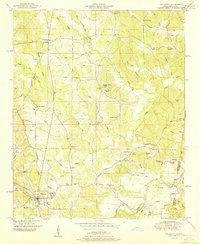 1951 Tishomingo1951 Print · USGSThe Tennessee and Mississippi borderland comes into focus in the early 1950s as the Natchez Trace winds through the hills of Tishomingo. Researchers can trace the Illinois Central rail line, find the Indian mound near the state line, or locate family sites like Hodges Cem and Boggs Chapel.
 - 1953 Map of Margerum, 1958 Print
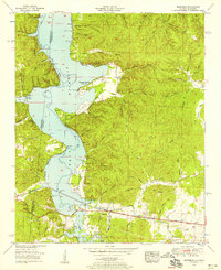 1953 Margerum1958 Print · USGSThe Colbert County shoreline and the community of Margerum appear here in the early fifties as Pickwick Lake reshapes the valley. Trace industrial sites like the Alabama Asphaltic Limestone Company and rural landmarks such as Douthit Ch and a covered bridge.4 unique versions available
 - 1953 Map of Iuka, 1958 Print
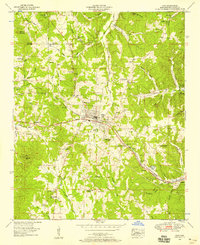 1953 Iuka1958 Print · USGSIuka and the rolling hills of Tishomingo County are captured here in the early 1950s, showing a landscape defined by the railroad and local mineral springs. Researchers can find many rural landmarks, from the John M Stone Memorial Marker to the Toenail Cem and Snowdown Sch.3 unique versions available
Showing maps 1-25 of 105
Top cities of Tishomingo County
- Iuka historical maps
- Belmont historical maps
- Burnsville historical maps
- Tishomingo historical maps
- Golden historical maps
- Paden historical maps
Frequently asked questions
- What are the different types of historical maps available for Tishomingo County?
- What is the oldest map of Tishomingo County?
- Where can I purchase historical maps of Tishomingo County for my home or office?
- Where can I download high-res historical maps of Tishomingo County?
- Are there historical topographic maps available for Tishomingo County?
- Is there historical aerial imagery available for Tishomingo County?
- Where are historical maps of Tishomingo County sourced from?