1900s (20th Century) Maps of Wilkinson County, Mississippi
Explore 59 historic maps of Wilkinson County from the 1900s (20th Century). These maps offer a rare glimpse into what life looked like during the 1900s — showing old roads, neighborhoods, homes, and landmarks that have changed or disappeared over time.
Whether you're researching your family's past, planning a metal detecting trip, or studying how Wilkinson County's landscape evolved across the 1900s, these high-resolution maps are a powerful tool for exploring the history of this region.
- Focus on a specific era: All maps on this page are from the 1900s, giving you a focused view of this time period.
- See what’s changed: Compare century-old streets, trails, and buildings to today's modern landscape using overlays and satellite layers.
- Research with precision: Use these maps for genealogy, historical research, land use analysis, or educational projects.
- View, download, or print: Maps are fully viewable online in high resolution, and can be downloaded or printed for your own records.
Start exploring Wilkinson County's history through authentic maps from the 1900s. This is your window into the past.
Wilkinson County, MS maps
(59)- 1906 Map of Bayou Sara
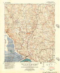
 1906 Bayou Sara1906 Print · USGSThe Feliciana parishes and the Mississippi River bottomlands come to life in this early twentieth-century survey. Genealogists can trace family footprints through river-town settlements like St Francisville or find early rail stops such as Gayden Sta (Gurley P.O.) and Slaughter.3 unique versions available
 - 1936 Map of Woodville, 1944 Print
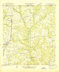
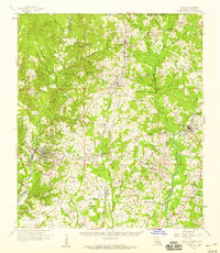
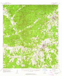
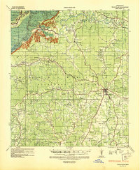 1936 Woodville1944 Print · USGSWilkinson County was a land of sprawling estates and quiet country crossroads in the mid-1930s. Genealogists can trace hundreds of family landmarks and community centers, from La Grange Plantation and Bells Store to Peach Grove Ch & Cem.
 - 1939 Map of St. Francisville
 1939 St. Francisville1939 Print · USGSWest Feliciana Parish and the Mississippi River borderlands are captured here in the late 1930s. Genealogists and historians can trace the foundations of the plantation economy through landmarks like Magnolia Plantation and schools like Afton Villa Ch & Sch.3 unique versions available
 - 1939 Map of Kingston, 1944 Print
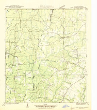
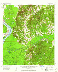
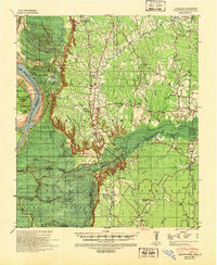 1939 Kingston1944 Print · USGSThe bluffs and bayous of Adams and Wilkinson Counties are captured here in the late 1930s just as the national forest was expanding. Genealogists and researchers can trace family landmarks like Beverly Plantation, Rose Hill Ch & Cem, and the community of Kingston.2 unique versions available
 - 1939 Map of Artonish, 1945 Print
 1939 Artonish1945 Print · USGSThe river-and-rail economy of the Louisiana-Mississippi border is frozen in time just before the mid-century, showing the dense settlement of the bottomlands. Genealogists can trace family roots through numerous local landmarks like Fort Adams, Singleton Chapel & Cem, and the Black Hawk Plantation.
 - 1941 Map of Norwood
 1941 Norwood1941 Print · USGSEast Feliciana Parish near the Mississippi border reveals its 1940s landscape of rural settlements and transport corridors. Genealogists can trace family roots through landmarks like Antioch Ch, Morning Glory Ch, and burial sites such as Beech Grove Cem.
 - 1941 Map of Lost Creek
 1941 Lost Creek1941 Print · USGSThe borderlands of East and West Feliciana Parish come alive in this early 1940s survey of rural Louisiana. Genealogists can trace family landmarks like Rogillioville, Hickory Grove Sch, and the Mc Queen Cem alongside the Illinois Central rail line.
 - 1941 Map of Batchelor, 1944 Print
 1941 Batchelor1944 Print · USGSThe Mississippi River's powerful shifts define this corner of Louisiana in the early 1940s, from the oxbows of the Raccourci Old River to the banks of Angola. Local researchers can locate family landmarks such as Mains Plantation, St Stevens Ch, and the Lower Latanache Sch.
 - 1945 Map of Norwood
 1945 Norwood1945 Print · USGSEast Feliciana Parish near the Mississippi border is shown here during the mid-1940s, centered on the Illinois Central rail line. Researchers can trace rural genealogy through landmarks like Pemble Cem, Morning Glory Ch, and the Industrial Training Sch.
 - 1945 Map of Lost Creek
 1945 Lost Creek1945 Print · USGSThe rural border of East and West Feliciana Parishes comes into focus in the mid-1940s, revealing a dense network of country schools and family cemeteries. Genealogists can trace the exact locations of Rogillio-ville, the Mc Queen Cem, and Hickory Grove Sch.
 - 1953 Map of Natchez, 1966 Print
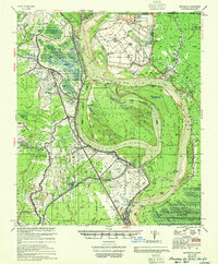
 1953 Natchez1966 Print · USGSSouthwest Mississippi and the Louisiana border country come alive in this mid-century survey of the river valley and forest lands. Researchers can trace the rail lines of the Illinois Central RR and locate rural hubs like Gloster and Ferriday.3 unique versions available
 - 1954 Map of Artonish, 1966 Print
 1954 Artonish1966 Print · USGSThe riverfronts of Concordia Parish and Wilkinson County are captured here in the mid-fifties, during a period of significant hydraulic engineering and transition. Genealogists and historians can trace family-named sites like Shaw Plantation, Singleton Cem, and the old military outpost at Fort Adams.
 - 1954 Map of Baton Rouge, 1974 Print
 1954 Baton Rouge1974 Print · USGSSoutheast Louisiana in the mid-fifties is captured here during a period of transition for its river and rail economies. Researchers can trace the path of the Mississippi River and find landmarks like the Bonnet Carre Spillway and Bayou Plaquemine.2 unique versions available
 - 1955 Map of Artonish
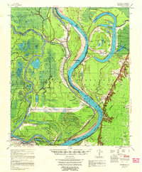
 1955 Artonish1955 Print · USGSWilkinson County and Concordia Parish in the mid-fifties are defined here by the massive plantations and river landings along the winding Mississippi River. Genealogists can trace local roots through numerous sites like Royal Oak Ch & Cem, Fort Adams, and the Torras Community Sch.
 - 1955 Map of Batchelor
 1955 Batchelor1955 Print · USGSLouisiana's river country is captured here in the mid-fifties, showing the massive impact of cutoffs and flood control projects on local parishes. Researchers can trace the sprawling Penitentiary Farm at Angola or locate family roots at St Marys Ch & Cem and Lacour Plantation.
 - 1956 Map of Natchez
 1956 Natchez1956 Print · USGSThe Mississippi River borderlands and the Pine Hills come alive in this mid-fifties study of the Natchez region. Genealogists and historians can trace rail-era towns along the Illinois Central RR and explore the oxbows of Lake Bruin and Lake Concordia.
 - 1956 Map of Baton Rouge
 1956 Baton Rouge1956 Print · USGSSouth Louisiana at the height of the mid-century oil boom shows a landscape of river oxbows and rising industry. Researchers can trace family roots through river towns like Scotlandville or locate early industrial sites and Oil wells near Lake Maurepas.
 - 1958 Map of Artonish
 1958 Artonish1958 Print · USGSThe river bluffs of Mississippi and the bottomlands of Louisiana meet here in the late fifties as massive engineering projects began to reshape the landscape. Local historians can trace family-named sites like Stamps Plantation or locate rural landmarks such as Royal Oak Ch & Cem and the Texas and Pacific RR.
 - 1958 Map of Clinton, 1959 Print
 1958 Clinton1959 Print · USGSEast Feliciana Parish in the late fifties remains a landscape defined by its small towns, rail lines, and scattered family homesteads. Genealogists can trace roots at Richland Cem & Ch, find the Parish Industrial Training Sch, or follow the path of the old Plank Road.3 unique versions available
 - 1958 Map of Woodville, 1960 Print
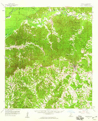 1958 Woodville1960 Print · USGSWoodville and the surrounding Wilkinson County countryside are captured here in the late fifties. Genealogists can trace family roots through numerous rural landmarks like St James Ch, Pickneyville, and the Bowling Green Cem.4 unique versions available
 - 1958 Map of Kingston, 1960 Print
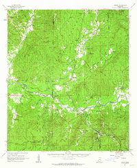
 1958 Kingston1960 Print · USGSThe Mississippi riverfront south of Natchez was still a wilderness of bayous and cutoffs in the late fifties. Genealogists can trace rural communities around Kingston, find family names near Mars Hill Cem, or locate landmarks like Esperance Landing.2 unique versions available
 - 1959 Map of Natchez
 1959 Natchez1959 Print · USGSSouthwestern Mississippi and eastern Louisiana are captured in the late fifties, showing a landscape defined by the winding Mississippi River and the timbered Homochitto National Forest. Researchers can trace the sprawling Illinois Central RR and find rural landmarks like Union Church and Camp Van Dorn (Abandoned).
 - 1961 Map of Crosby, 1962 Print
 1961 Crosby1962 Print · USGSThe Homochitto River valley and its neighboring oil fields are captured here in the early sixties as they span four Mississippi counties. Researchers can trace rural lineages through numerous family sites like Dorsey Cem, Perrytown Ch, and the Illinois Central Railroad corridor.3 unique versions available
 - 1961 Map of Gloster, 1963 Print
 1961 Gloster1963 Print · USGSSouthwest Mississippi is mapped here in the early sixties, showing the rural communities along the Illinois Central line. Genealogists can trace family roots at Wilkinson Cem, Mt Carmel Ch, and the small settlement of Caledonia.2 unique versions available
 - 1961 Map of Baton Rouge, 1966 Print
 1961 Baton Rouge1966 Print · USGSSoutheastern Louisiana in the early sixties remains a landscape of deep river bends and sprawling coastal lakes. Genealogists and historians can trace the rail-and-river economy through landmarks like Free-Nigger Point, Donaldsonville, and the Illinois Central Railroad.
Showing maps 1-25 of 59
Top cities of Wilkinson County
Frequently asked questions
- What are the different types of historical maps available for Wilkinson County?
- What is the oldest map of Wilkinson County?
- Where can I purchase historical maps of Wilkinson County for my home or office?
- Where can I download high-res historical maps of Wilkinson County?
- Are there historical topographic maps available for Wilkinson County?
- Is there historical aerial imagery available for Wilkinson County?
- Where are historical maps of Wilkinson County sourced from?