1980s Maps of Wilkinson County, Mississippi
Explore 16 historic maps of Wilkinson County from the 1980s. These maps offer a rare glimpse into what life looked like during the 1980s — showing old roads, neighborhoods, homes, and landmarks that have changed or disappeared over time.
Whether you're researching your family's past, planning a metal detecting trip, or studying how Wilkinson County's landscape evolved across the 1980s, these high-resolution maps are a powerful tool for exploring the history of this region.
- Focus on a specific era: All maps on this page are from the 1980s, giving you a focused view of this time period.
- See what’s changed: Compare century-old streets, trails, and buildings to today's modern landscape using overlays and satellite layers.
- Research with precision: Use these maps for genealogy, historical research, land use analysis, or educational projects.
- View, download, or print: Maps are fully viewable online in high resolution, and can be downloaded or printed for your own records.
Start exploring Wilkinson County's history through authentic maps from the 1980s. This is your window into the past.
Wilkinson County, MS maps
(16)- 1983 Map of New Roads
 1983 New Roads1983 Print · USGSThe river parishes of central Louisiana are documented in the early 1980s, showcasing the winding courses of the Atchafalaya and Mississippi. Genealogists and historians can trace rail-served river towns like Melville and Simmesport, or locate the Port Hudson National Cem and the State Penitentiary.2 unique versions available
 - 1984 Map of Woodville
 1984 Woodville1984 Print · USGSThe Mississippi-Louisiana borderlands in the mid-eighties show a landscape defined by the shifting MISSISSIPPI RIVER and sprawling timberlands. Researchers can trace the ILLINOIS CENTRAL GULF railroad through Gloster or locate historic river points like Fort Adams and Point Breeze.
 - 1984 Map of Rogillioville, 1985 Print
 1984 Rogillioville1985 Print · USGSThe Louisiana-Mississippi borderlands come alive in this mid-1980s survey, showing the deep creek bottoms and rail-linked towns of the Felicianas. Genealogists can trace family landmarks and burial sites like Rogillioville, Wilson, and local Cem locations.
 - 1985 Map of Wilson
 1985 Wilson1985 Print · USGSEast Feliciana Parish in the mid-1980s shows a landscape of rural settlements and winding bayous along the Mississippi border. Genealogists and historians can trace the Illinois Central Gulf rail line as it passes through Norwood and Wilson.
 - 1988 Map of Laneheart
 1988 Laneheart1988 Print · USGSWilkinson County in the late eighties is defined here by the winding Buffalo River and its quiet rural interior. Researchers can trace old watercourses near Horseshoe Lake or locate the settlement of Laneheart among a network of drainages like Fords Creek.
 - 1988 Map of Doloroso
 1988 Doloroso1988 Print · USGSWilkinson and Adams counties appear here in the late eighties as a landscape defined by the winding Homochitto River. Genealogists and historians can locate rural landmarks like Doloroso, Possum Corner, and several Cem sites within the Homochitto National Forest.
 - 1988 Map of Crosby
 1988 Crosby1988 Print · USGSSouthwestern Mississippi in the 1980s reveals a landscape where the timber industry and oil exploration meet the winding Homochitto River. Researchers can trace old family sites and rural landmarks like Berryhill Cem, Wesley Chapel, and the community of Crosby.2 unique versions available
 - 1988 Map of Buck Island
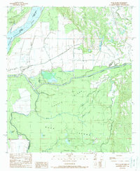 1988 Buck Island1988 Print · USGSThe alluvial plains of Adams County and Concordia Parish were undergoing significant hydraulic change in the late eighties. Researchers can trace the massive Glasscock Cutoff and the redirected flow of the Homochitto River Canal across Buck Island.
 - 1988 Map of Pinckneyville
 1988 Pinckneyville1988 Print · USGSWilkinson County in the late eighties remains a landscape of remote settlements and intricate bayous. Researchers can trace the rural layout of Pinckneyville and Donegal or follow the winding paths of Pinckneyville Bayou and Stockfarm Creek.
 - 1988 Map of Woodville
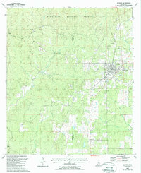
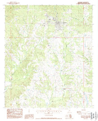 1988 Woodville1988 Print · USGSWoodville and the surrounding Wilkinson County uplands are captured in the late eighties as a landscape of timber and creek-side settlements. Researchers can trace the Old RR Grade and locate rural communities such as Ashwood and Turnbull.
 - 1988 Map of Gloster
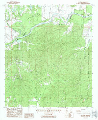
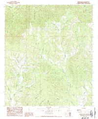
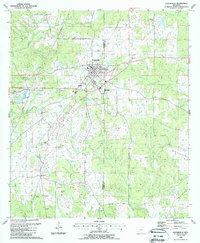
 1988 Gloster1988 Print · USGSAmite and Wilkinson counties are shown here in the late 1980s, centered on the rail-aligned town of Gloster. Local historians can trace family roots at Mt Carmel Church, the Galilee Cemetery, and rural sites along the Buffalo River.
 - 1988 Map of Centreville
 1988 Centreville1988 Print · USGSCentreville and its surrounding farmstead landscape are captured in the late eighties at the intersection of Wilkinson and Amite counties. Genealogists can locate numerous family-named landmarks including Stafford Cem, Nathaniel Ch, and Whitaker.
 - 1988 Map of Garden City
 1988 Garden City1988 Print · USGSWilkinson County was still defined by its dense timber and winding waterways in the late eighties. Researchers can trace rural lineages through markers like Perrytown Ch, Homer Hill Cem, and the settlement of Garden City.2 unique versions available
 - 1988 Map of Newtonia
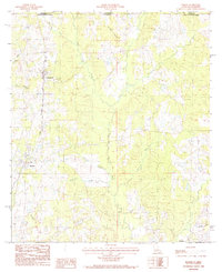
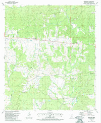 1988 Newtonia1988 Print · USGSWilkinson County’s interior reveals a landscape of family-named cemeteries and rural churches in the late eighties. Researchers can trace local lineages through Netterville Cem, Bleak House Ch, and the settlement of Newtonia.
 - 1988 Map of Wilkinson
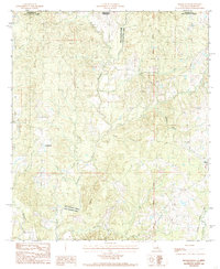
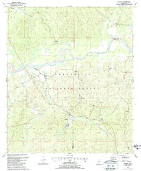
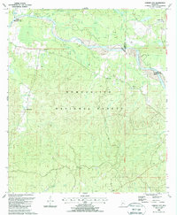
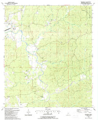 1988 Wilkinson1988 Print · USGSWilkinson County in the late 1980s reveals a landscape of timbered hills and winding river bottoms within the Homochitto National Forest. Genealogists and local historians can trace family ties through numerous rural burial sites like McCrain Cem, Shropshire Cem, and Macedonia Cem.
 - 1988 Map of Lessley, 1989 Print
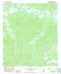
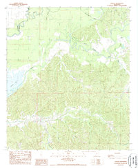 1988 Lessley1989 Print · USGSWilkinson County in the late eighties is a landscape of complex waterways and dense ridge systems. Genealogists and researchers can trace local hydrology through Foster Lake and family-named landmarks like Peggy Row Branch and Dixons Bayou.
End of results
Showing maps 1-16 of 16
Top cities of Wilkinson County
Frequently asked questions
- What are the different types of historical maps available for Wilkinson County?
- What is the oldest map of Wilkinson County?
- Where can I purchase historical maps of Wilkinson County for my home or office?
- Where can I download high-res historical maps of Wilkinson County?
- Are there historical topographic maps available for Wilkinson County?
- Is there historical aerial imagery available for Wilkinson County?
- Where are historical maps of Wilkinson County sourced from?