1980s Maps of Yazoo County, Mississippi
Explore 24 historic maps of Yazoo County from the 1980s. These maps offer a rare glimpse into what life looked like during the 1980s — showing old roads, neighborhoods, homes, and landmarks that have changed or disappeared over time.
Whether you're researching your family's past, planning a metal detecting trip, or studying how Yazoo County's landscape evolved across the 1980s, these high-resolution maps are a powerful tool for exploring the history of this region.
- Focus on a specific era: All maps on this page are from the 1980s, giving you a focused view of this time period.
- See what’s changed: Compare century-old streets, trails, and buildings to today's modern landscape using overlays and satellite layers.
- Research with precision: Use these maps for genealogy, historical research, land use analysis, or educational projects.
- View, download, or print: Maps are fully viewable online in high resolution, and can be downloaded or printed for your own records.
Start exploring Yazoo County's history through authentic maps from the 1980s. This is your window into the past.
Yazoo County, MS maps
(24)- 1982 Map of Silver City
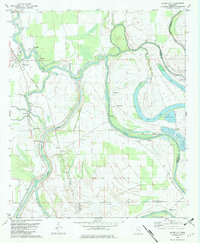 1982 Silver City1982 Print · USGSThe Delta lowlands of Humphreys County appear in the early eighties as a landscape shaped by the winding Yazoo River. Researchers can trace rural lineages through numerous country churches like Burns Chapel and find old footprints along the Old Railroad Grade near Silver City.
 - 1982 Map of Thornton, 1984 Print
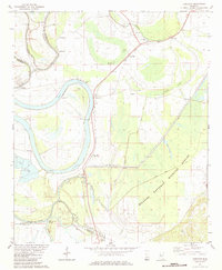 1982 Thornton1984 Print · USGSThe Mississippi Delta river-and-rail corridor is documented here in the early 1980s. Genealogists can trace rural communities through local landmarks like Mileston Sch, Quofaloma, and the Sweet Kingdom Ch near Bee Lake.
 - 1984 Map of Yazoo City
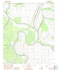
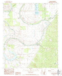
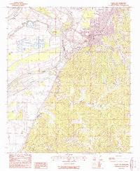
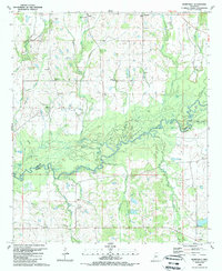
 1984 Yazoo City1984 Print · USGSThe Mississippi Delta and loess bluffs meet in the mid-eighties as the Yazoo River snakes through a dense network of wildlife areas and rail lines. Researchers can trace rural life and drainage history through small communities like Holly Bluff, Mechanicsburg, and Satartia.2 unique versions available
 - 1984 Map of Carthage
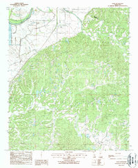
 1984 Carthage1984 Print · USGSLeake and Neshoba counties in the mid-1980s showcase a transition from the Government Hills to the dense Bienville National Forest. Genealogists and researchers can trace the historic Natchez Trace Parkway and local settlements like Plattsburg and Williamsville.
 - 1984 Map of Indianola, 1985 Print
 1984 Indianola1985 Print · USGSThe Mississippi Delta of the mid-1980s reveals a landscape of fertile bottomlands shaped by the Sunflower River and Yazoo River. Researchers can trace the rail-and-river economy through landmarks like Saints College, the Leflore Cemetery, and the Columbus and Greenville Railway.
 - 1988 Map of Lucre
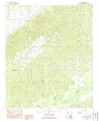
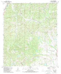
 1988 Lucre1988 Print · USGSThe convergence of the Yazoo and Sunflower rivers in the late 1980s reveals a landscape of deep-delta timber and intensive water management. Researchers can trace the boundaries of the Delta National Forest and locate small rural outposts like Lucre and Cypress.
 - 1988 Map of Eden
 1988 Eden1988 Print · USGSThe Yazoo River floodplain and the bluffs of the Mississippi interior are documented here in the late eighties. Genealogists and local historians can locate small settlements like Zelleria, Free Run, and Ingersoll, or trace the intricate hydrology of Dead Man Bayou.
 - 1988 Map of Benton
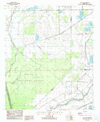
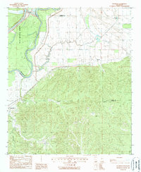
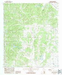 1988 Benton1988 Print · USGSYazoo County rural life is captured in the late 1980s as agriculture and industry intersect near the settlement of Benton. Researchers can trace old family burial sites marked Cem, explore the drainage of Walesheba Creek, or locate local landmarks like Woodlawn and Mills Crossing.
 - 1988 Map of Red Rock
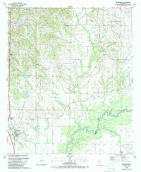
 1988 Red Rock1988 Print · USGSSharkey County's bottomland hardwood forests and river systems are documented here during the late eighties. Researchers can trace the water management of the Sunflower Greentree Reservoir and find old river sites like Choctaw Landing and Red Rock.
 - 1988 Map of Satartia
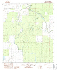
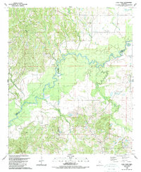
 1988 Satartia1988 Print · USGSThe Yazoo River floodplain meets the eastern bluffs in the late eighties, showing a landscape shaped by river bends and conservation. Trace local family roots in Satartia and Mechanicsburg, or locate features like the Fish Farm and Lake George.
 - 1988 Map of Holly Bluff
 1988 Holly Bluff1988 Print · USGSThe Yazoo-Mississippi Delta is captured in the late eighties as a landscape of winding rivers and sprawling conservation lands. Researchers can trace the Old Railroad Grade near Holly Bluff or locate family history at Spanish Fort Cem and Patmos.
 - 1988 Map of Louise
 1988 Louise1988 Print · USGSThe Mississippi Delta's agricultural landscape is in full view here during the late 1980s. Genealogists and local historians can trace family locations near Louise or explore the rural environs of Anchorage, Craig, and Potosi along the banks of Silver Creek.
 - 1988 Map of Bayland
 1988 Bayland1988 Print · USGSThe Mississippi Delta bottomlands come alive in the late eighties, showing a landscape of dense woods and complex water management. You can trace the boundaries of the Delta National Forest and locate the settlement at Bayland near Silver Creek.
 - 1988 Map of Carter
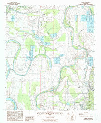 1988 Carter1988 Print · USGSThe Yazoo River Delta in the late 1980s reveals a landscape of alluvial agriculture, levee systems, and river-bend settlements. Trace the rail-and-river history through Yazoo City up to Carter and identify vanished trackside sites like Renshaw.
 - 1988 Map of Yazoo City
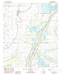
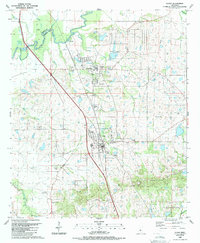
 1988 Yazoo City1988 Print · USGSYazoo City and its surrounding riverbanks are shown in the late eighties as the region balanced its river-port economy with delta agriculture. Trace local developments including the Yazoo City Cut-Off 1940, Muni Airport, and the community at Jonestown.
 - 1988 Map of Phoenix
 1988 Phoenix1988 Print · USGSThe hill country of Yazoo County in the late eighties is documented here as it reaches down toward the Big Black River. Researchers can locate several rural Cem sites and trace the ridges connecting the settlements of Phoenix and Germania.
 - 1988 Map of Eldorado
 1988 Eldorado1988 Print · USGSWarren and Yazoo Counties in the late 1980s show a landscape of river-bend wetlands and wooded uplands. Genealogists and historians can trace the positions of Eldorado and Russellville, or follow the path of the Old RR Grade and Corn House Creek.
 - 1988 Map of Bayland Se
 1988 Bayland Se1988 Print · USGSThe Yazoo River basin in the late eighties is defined here by the vast Panther Swamp National Wildlife Refuge. Researchers can trace local settlements at Limerick and Wade or follow the Will M Whittington Auxiliary Channel.
 - 1988 Map of Coxs Ferry, 1989 Print
 1988 Coxs Ferry1989 Print · USGSThe Big Black River basin in the late eighties reveals a landscape where Yazoo, Madison, and Hinds Counties meet. Genealogists can trace family-named sites like Cox Cem and Clayton Cem or explore rural centers such as Nevada and Hall Chapel.
 - 1988 Map of Tinsley, 1989 Print
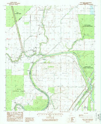
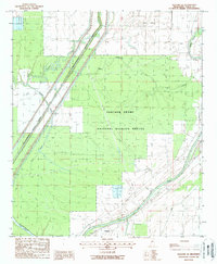
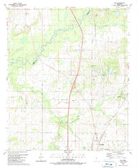
 1988 Tinsley1989 Print · USGSYazoo County at the end of the eighties shows a landscape of petroleum production and rail-side settlements. Genealogists and local historians can trace rural roots through landmarks like Oil City, Gibbs Sch, and New Pleasant Grove Ch.
 - 1988 Map of Flora, 1989 Print
 1988 Flora1989 Print · USGSMadison County and the town of Flora are captured here in the late 1980s as the area balanced industrial growth with its rural heritage. Researchers can trace family roots through several landmarks including Vernon Cem, Smith Chapel, and the well-known Petrified Forest.
 - 1988 Map of Bentonia, 1989 Print
 1988 Bentonia1989 Print · USGSIn the late eighties, the Yazoo County countryside remained a patchwork of small communities and active oil fields. Genealogists can locate rural landmarks like Pleasant Grove Ch, Central Holmes Cem, and Andrew Chapel near the Big Black River.
 - 1989 Map of Way
 1989 Way1989 Print · USGSMississippi's river borderlands appear in detail in the late 1980s, centered on the Big Black River. Genealogists can trace family burial sites like Knott Cem and rural centers including Cobbville, Way, and Thornton Chapel.
 - 1989 Map of Berryville
 1989 Berryville1989 Print · USGSThe Yazoo and Madison county line follows the winding Big Black River in the 1980s, revealing a landscape of oxbow lakes and rural hamlets. Family historians can locate ancestral sites like Beatties Bluff, Shiloh Chapel, and the Mt Elam Cem.
End of results
Showing maps 1-24 of 24
Top cities of Yazoo County
Frequently asked questions
- What are the different types of historical maps available for Yazoo County?
- What is the oldest map of Yazoo County?
- Where can I purchase historical maps of Yazoo County for my home or office?
- Where can I download high-res historical maps of Yazoo County?
- Are there historical topographic maps available for Yazoo County?
- Is there historical aerial imagery available for Yazoo County?
- Where are historical maps of Yazoo County sourced from?