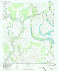
1982 Map of Silver City
USGS Topo · Published 1982About this map
Yazoo River currents carve a complex path through the Delta landscape of Humphreys, Holmes, and Yazoo Counties in this early 1980s topographical record. The settlement of Silver City sits at a strategic bend, protected by a prominent Levee system and the Auxiliary Channel, which managed the heavy seasonal flows of this fertile floodplain. The map reveals a deeply rooted rural community defined by its spiritual landmarks, including Beautiful Zion Ch No 2, Christian Valley Ch, and Rose Hill Ch.
Find a feature on this map
34 named features on this map. Tap any name to fly to it.
Don’t see what you’re looking for? This feature index may not catch every label — zoom into the map to look around manually.
Map Details
Editions of this 1982 Silver City Map
This is the sole edition of this map. No revisions or reprints were ever made.
Other maps of this area

1940 · Auter
USGS Topo · 1:62,500

1940 · Mileston
USGS Topo · 1:62,500

1953 · Greenwood
USGS Topo · 1:250,000

1954 · Mileston
USGS Topo · 1:62,500

1955 · Jackson
USGS Topo · 1:250,000

1956 · Greenwood
USGS Topo · 1:250,000

1961 · Jackson
USGS Topo · 1:250,000

1961 · Bayland
USGS Topo · 1:62,500

1961 · Valley
USGS Topo · 1:62,500

1962 · Jackson
USGS Topo · 1:250,000