Old Maps of Yazoo County, Mississippi for Genealogy
Trace your family roots with 190 historic maps of Yazoo County. These high-res maps reveal old neighborhoods, homesites, landmarks, and streets — helping you uncover where your ancestors lived and how the area evolved over time.
- Explore historic neighborhoods: Identify where your relatives may have lived in the 1800s or 1900s.
- Compare maps over time: Trace the changes in streets, buildings, and landmarks for multi-generational research.
- Perfect for genealogy & ancestry research: Used by family historians and researchers to map out lineage and migration.
These maps are an incredible resource for exploring your personal connection to Yazoo County's past.
Yazoo County, MS maps
(190)- 1939 Map of Lorenzen, 1941 Print
 1939 Lorenzen1941 Print · USGSSharkey County at the end of the Depression era is a intricate landscape of rail junctions and Delta waterways. Genealogists and researchers can trace local landmarks like Mont Helena, the Indian Mound at Grace, and rural stations such as Riverside Jct and Lorenzen.2 unique versions available
 - 1940 Map of Mechanicsburg, 1947 Print
 1940 Mechanicsburg1947 Print · USGSThe Yazoo River Delta in the early 1940s reveals a landscape defined by steamboat landings and the edge of the Loess Bluffs. Researchers can trace historic river access points like Enola Ldg and Miller Ldg or locate the early footprints of Satartia and Mechanicsburg.2 unique versions available
 - 1940 Map of Mileston, 1953 Print
 1940 Mileston1953 Print · USGSThe Mississippi Delta's winding waterways and rail-linked settlements are captured here just before the mid-century. Genealogists can trace family roots through communities like Mileston and Silver City, or locate specific landmarks like the Good Hope Ch and ancient Indian Mounds.
 - 1953 Map of Meridian, 1966 Print
 1953 Meridian1966 Print · USGSEast Central Mississippi and the Alabama borderlands are captured here during a period of steady growth and infrastructure expansion. Genealogists and historians can trace rail-town development along the Gulf Mobile & Ohio Railroad and find early settlements like Scooba, Pelahatchie, and De Kalb.2 unique versions available
 - 1953 Map of Greenwood, 1966 Print
 1953 Greenwood1966 Print · USGSThe Mississippi Delta in the mid-fifties is captured here as a thriving network of river towns, railroads, and oxbow lakes. Researchers can trace the legacy of the Illinois Central Railroad and locate landmarks like the State Penal Farm and Greenville Air Force Base.5 unique versions available
 - 1954 Map of Mileston
 1954 Mileston1954 Print · USGSThe Yazoo River Delta in the mid-1950s reveals a landscape shaped by massive flood control projects and deep-rooted river communities. Genealogists can trace family footprints through numerous rural landmarks like Holly Grove Ch & Cem, Jaketown, and the remote settlement of Pluto.
 - 1955 Map of Jackson
 1955 Jackson1955 Print · USGSThe Lower Mississippi Valley at the middle of the century reveals a landscape of deep river meanders and growing rail hubs. Genealogists and historians can trace the mid-century footprints of Vicksburg National Military Park, old river landings at Port Gibson, and the rail corridors of the Illinois Central Railroad.3 unique versions available
 - 1956 Map of Greenwood
 1956 Greenwood1956 Print · USGSThe Mississippi Delta in the mid-fifties is captured here during a period of significant military and agricultural activity. Researchers can trace the rail lines of the Illinois Central RR, find the Greenville Air Force Base, or locate the State Penal Farm.
 - 1957 Map of Meridian
 1957 Meridian1957 Print · USGSEast Central Mississippi and parts of Western Alabama come alive in the mid-1950s, centered on the transit hub of Meridian. Researchers can trace old rail lines like the Illinois Central and find historic sites such as the Choctaw Indian Reservation and Roosevelt State Park.
 - 1961 Map of Jackson
 1961 Jackson1961 Print · USGSThe Lower Mississippi Delta and the state capital area are captured here during the post-war era of infrastructure expansion. Researchers can trace the complex river oxbows and rail lines connecting Vicksburg, Yazoo City, and the Illinois Central Railroad network.
 - 1961 Map of Bayland
 1961 Bayland1961 Print · USGSThe Mississippi Delta's intricate water network and rural communities are captured here in the early sixties. Genealogists and historians can trace family locations through Huddleston Cem, Indian Mounds, and the Humphreys Co Training School.3 unique versions available
 - 1961 Map of Canton, 1963 Print
 1961 Canton1963 Print · USGSMadison County at the start of the 1960s reveals a transition from the historic rail hub of Canton to the bottomlands of the Big Black River. Genealogists and local historians can trace rural family roots at Mt Pisgah Cem, Livingston, and Campbell Chapel.3 unique versions available
 - 1961 Map of Valley, 1963 Print
 1961 Valley1963 Print · USGSYazoo City and its rural surroundings are captured in the early sixties as the Delta's agricultural and industrial patterns evolved. Researchers can trace family roots through dozens of local landmarks including Cedar Falls Sch, Bells Chapel, and Coopers Cem.2 unique versions available
 - 1962 Map of Jackson
 1962 Jackson1962 Print · USGSThe Mississippi Delta and the state capital region are mapped here in the early sixties, showing a landscape defined by the great river and the growing city of JACKSON. Genealogists can trace family roots through numerous landmarks like Cedar Hill Cem, rural stops on the Illinois Central RR, and historic sites like Champion Hill.2 unique versions available
 - 1962 Map of Flora, 1964 Print
 1962 Flora1964 Print · USGSMadison and Yazoo counties in the early sixties reveal a landscape of river-bottom farms and emerging industry along the rail lines. Local historians can trace old community ties through sites like Coxs Ferry, Kearney Park, and Old Liberty Ch Cem.2 unique versions available
 - 1963 Map of Mechanicsburg, 1965 Print
 1963 Mechanicsburg1965 Print · USGSThe Yazoo Delta and its surrounding bluffs are shown in the early sixties as a landscape of river landings and rural parishes. Researchers can trace family history through Satartia, Mechanicsburg, and numerous rural churches like Germania El Bethel Ch or Lynch Chapel.
 - 1964 Map of Zeiglerville, 1965 Print
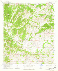 1964 Zeiglerville1965 Print · USGSThe rural border of Holmes and Yazoo Counties is captured in the mid-1960s, showing a landscape of small farm holdings and creek-side settlements. Researchers can trace family sites at Piney Springs Ch, the King Sch, and Pierce Crossroad.2 unique versions available
 - 1964 Map of Ebenezer, 1965 Print
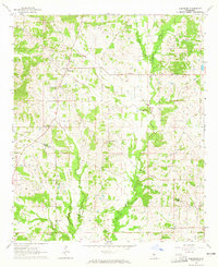 1964 Ebenezer1965 Print · USGSMississippi's rural interior comes into focus in this mid-sixties survey of the Ebenezer area. Genealogists can trace family connections through numerous landmarks like Hopewell Cem, Hart Town Cem, and St Peters Rock Ch.
 - 1964 Map of Linwood, 1965 Print
 1964 Linwood1965 Print · USGSYazoo County in the mid-1960s reveals a rural landscape of dispersed family settlements and country churches. Genealogists can trace local roots through numerous family-named sites such as Pickett Cem, Hicks Cem, and the community around Linwood Sch.2 unique versions available
 - 1964 Map of Vaughan, 1965 Print
 1964 Vaughan1965 Print · USGSYazoo and Madison Counties are captured here in the mid-1960s, showing a rural landscape organized around the Illinois Central line. Genealogists can locate family landmarks like Strangers Home Cem, Day Cem, and churches such as Bell Chapel.3 unique versions available
 - 1964 Map of Goodman, 1965 Print
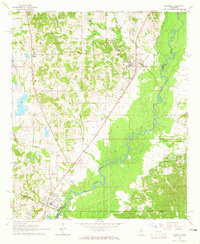 1964 Goodman1965 Print · USGSThe mid-Mississippi corridor at the dawn of the 1960s highlights a landscape shaped by the Big Black River and the storied Illinois Central railroad. Genealogists can trace family footprints through sites like Holmes County Junior College, Bethlehem Ch, and Quiet Ridge Cem.2 unique versions available
 - 1964 Map of Lorenzen, 1966 Print
 1964 Lorenzen1966 Print · USGSThe Mississippi Delta's intricate bayou network is meticulously detailed here during the mid-1960s. Genealogists and local historians can trace family roots through numerous landmarks like St Michaels Ch, Elmwood Cem, and the old rail stop at Riverside Junction.2 unique versions available
 - 1965 Map of Meridian
 1965 Meridian1965 Print · USGSEast Mississippi and West Alabama are mapped here in the mid-sixties as the region's modern highway and reservoir systems began to take shape. Researchers can trace rural lineages through local landmarks like Prince Chapel and Tuscahoma Landing, or follow the historic Gulf Mobile & Ohio rail lines.
 - 1966 Map of Goodman, 1967 Print
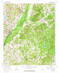 1966 Goodman1967 Print · USGSMid-century Mississippi hill country and river bottomlands come alive here in the mid-1960s as small farming communities and timberlands span four counties. Genealogists can trace family roots through dozen of rural landmarks like Soule Chapel, Quiet Ridge Cem, and the Holmes County Junior College.
 - 1966 Map of Vaughan, 1967 Print
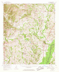 1966 Vaughan1967 Print · USGSCentral Mississippi's rural landscape comes alive in the mid-1960s, showing the intersection of rail and river life. Researchers can trace family roots at Piney Springs Cem, Holy City, and schools like Linwood Sch.2 unique versions available
Showing maps 1-25 of 190
Top cities of Yazoo County
Frequently asked questions
- What are the different types of historical maps available for Yazoo County?
- What is the oldest map of Yazoo County?
- Where can I purchase historical maps of Yazoo County for my home or office?
- Where can I download high-res historical maps of Yazoo County?
- Are there historical topographic maps available for Yazoo County?
- Is there historical aerial imagery available for Yazoo County?
- Where are historical maps of Yazoo County sourced from?