Old Maps of Audrain County, Missouri for Genealogy
Trace your family roots with 121 historic maps of Audrain County. These high-res maps reveal old neighborhoods, homesites, landmarks, and streets — helping you uncover where your ancestors lived and how the area evolved over time.
- Explore historic neighborhoods: Identify where your relatives may have lived in the 1800s or 1900s.
- Compare maps over time: Trace the changes in streets, buildings, and landmarks for multi-generational research.
- Perfect for genealogy & ancestry research: Used by family historians and researchers to map out lineage and migration.
These maps are an incredible resource for exploring your personal connection to Audrain County's past.
Audrain County, MO maps
(121)- 1890 Map of Louisiana
 1890 Louisiana1890 Print · USGSUpper Missouri and Illinois river country in the 1890s is captured here at the height of the steam-rail era. Genealogists can trace family roots through old rural outposts like New Harmony, Prairieville, and the transit hub at Bowling Green.5 unique versions available
 - 1890 Map of Mexico
 1890 Mexico1890 Print · USGSMid-Missouri was a bustling junction of rail and river in the late 1880s, where iron rails began to reshape the old prairie. Genealogists can trace family roots in early settlements like Mexico, Laddonia, and the rural community at Shamrock P.O..5 unique versions available
 - 1890 Map of Moberly
 1890 Moberly1890 Print · USGSMid-Missouri at the close of the frontier era was a landscape defined by the iron rails of the Wabash and Chicago & Alton lines. Genealogists can trace early homesteads and rail stops from Moberly to Centralia, and find rural communities like Middle Grove or Dripping Spring.6 unique versions available
 - 1917 Map of Sturgeon
 1917 Sturgeon1917 Print · USGSMid-Missouri rural life is captured here in the years before the First World War, centered on the Sturgeon rail connection. Researchers can trace ancestral farmsteads through dozens of local landmarks like Indian Mound, Stephens, and the many country schoolhouses like Wade School.3 unique versions available
 - 1932 Map of Mexico
 1932 Mexico1932 Print · USGSThe rail hub of Mexico and the surrounding Audrain County farm country are captured here between the wars, just as modern highways began to parallel the older tracks. Genealogists can locate dozens of country schools and churches, from Hedgesdale Sch to Sunrise Ch, and the grounds of the Mo Military Academy.3 unique versions available
 - 1942 Map of Wellsville
 1942 Wellsville1942 Print · USGSMid-Missouri's rail-and-river landscape is meticulously detailed here just before the war, showcasing the busy corridors of the Alton and Wabash lines. Researchers can trace rural life through dozens of local landmarks like Chapel Grove Sch, the Laclede Christy Mine, and Shamrock.2 unique versions available
 - 1942 Map of Bellflower, 1966 Print
 1942 Bellflower1966 Print · USGSEastern Missouri farm country is captured here during the early years of the war, revealing a landscape defined by the Cuivre River and the Chicago Burlington and Quincy rail line. Genealogists can locate family-named landmarks and rural hubs like Middletown, Smyrna Ch, and the Prairie Flower Sch.
 - 1943 Map of Vandalia, 1972 Print
 1943 Vandalia1972 Print · USGSMissouri's rural heartland is captured here in the 1940s at the junction of Audrain, Pike, and Ralls Counties. Genealogists can trace dozens of rural schoolhouses and churches, including Round Grove Sch, Elm Grove Ch, and the settlement of Madisonville.
 - 1945 Map of Florida
 1945 Florida1945 Print · USGSThe Salt River forks in Monroe and Audrain counties defined local life in the 1940s before modern reservoirs changed the landscape. Genealogists can trace family footprints through dozens of rural landmarks like Walnut Grove Cem, Cedar Grove Ch, and Dye Sch.3 unique versions available
 - 1945 Map of Bellflower
 1945 Bellflower1945 Print · USGSThe rural borderlands of Montgomery, Audrain, and Pike counties are captured here in the mid-1940s as a network of tightly-knit farming communities. Genealogists can trace family footprints through dozens of local landmarks, including Payne Cem, Smyrna Ch, and the many namesake schoolhouses like Mudd Sch.2 unique versions available
 - 1945 Map of Perry
 1945 Perry1945 Print · USGSNortheast Missouri’s agricultural heartland is documented here in the mid-1940s as the rail era began to fade. Researchers can trace dozens of vanished country schoolhouses like Oakdale Sch and early rural churches including Corinth Ch and Prairie View Ch.3 unique versions available
 - 1945 Map of Vandalia
 1945 Vandalia1945 Print · USGSMid-century Audrain and Pike Counties are shown here at a peak of rural settlement, centered on the rail hub of Vandalia. Genealogists can locate dozens of country schools and churches, from New Michigan Sch to Mt Air Ch and Spencerburg.3 unique versions available
 - 1945 Map of Centralia
 1945 Centralia1945 Print · USGSNorth Central Missouri is shown just after the war, featuring a landscape defined by its rail junctions and numerous rural school districts. Genealogists can trace family heritage through dozens of named sites like Skull Lick Cem, Hallsville, and Angell Sch.2 unique versions available
 - 1948 Map of Quincy
 1948 Quincy1948 Print · USGSThe Mississippi and Illinois River valleys are captured at a post-war crossroads as rail and river travel met the expanding highway system. Genealogists can trace family settlements from Quincy to Hannibal and smaller towns like Vandalia and Jerseyville.2 unique versions available
 - 1953 Map of Moberly
 1953 Moberly1953 Print · USGSMid-century north-central Missouri is documented here as a bustling intersection of river commerce and heavy rail. Researchers can trace historic family-named landmarks and transport hubs from the Missouri River corridor to the rail yards of Moberly, Chillicothe, and Macon.
 - 1953 Map of Clark, 1955 Print
 1953 Clark1955 Print · USGSNear the intersection of Randolph, Monroe, and Audrain counties in the 1950s, this area centers on the rail hub of Clark. Genealogists can trace rural family sites near Chapel Grove Cem, Macedonia Ch, and the Mt Pisgah Sch.3 unique versions available
 - 1954 Map of Moberly, 1969 Print
 1954 Moberly1969 Print · USGSMid-century Missouri is captured here during a period of transition for its river towns and rail hubs. Genealogists and historians can trace the paths of the Wabash railroad through Moberly or explore the riverside layout of Lexington and Brunswick.3 unique versions available
 - 1956 Map of Quincy, 1967 Print
 1956 Quincy1967 Print · USGSThe river and rail corridors of the Illinois-Missouri border are documented here during the mid-1950s. Researchers can trace historic river landings and regional transit hubs from Quincy and Hannibal to smaller settlements like Meredosia and Roodhouse.3 unique versions available
 - 1957 Map of Moberly
 1957 Moberly1957 Print · USGSNorth-central Missouri in the late nineteen-forties and fifties remains a landscape defined by its great rivers and a dense network of steam and diesel rail lines. Genealogists and historians can trace the paths of the Wabash RR and Santa Fe RR through historic junctions like Moberly, Brookfield, and Macon.
 - 1958 Map of Tulip, 1960 Print
 1958 Tulip1960 Print · USGSAudrain and Monroe counties appear in the late fifties as a rural landscape of branching creeks and country schoolhouses. Genealogists and local historians can trace the locations of Appleman Ch, Friendship Sch, and the rail corridor of the G M & O.2 unique versions available
 - 1960 Map of Moberly
 1960 Moberly1960 Print · USGSCentral Missouri comes alive in the mid-twentieth century as a bustling network of river towns and significant rail corridors. Genealogists and historians can trace the paths of the Wabash RR through Moberly or explore the riverfronts of Lexington and Brunswick.
 - 1960 Map of Rowena, 1961 Print
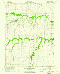 1960 Rowena1961 Print · USGSThe rural borders of Monroe and Audrain counties are captured here at the start of the 1960s, showing a landscape defined by traditional farming communities. Genealogists can locate several named country schoolhouses and churches, including Goodwater Sch, Strother Sch, and Bethlehem Ch.2 unique versions available
 - 1969 Map of Hatton, 1971 Print
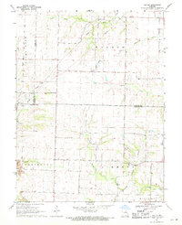 1969 Hatton1971 Print · USGSMid-Missouri's rural character is captured here in the late sixties at the triple border of Callaway, Boone, and Audrain counties. Researchers can locate family landmarks like Youngers Cem, local congregations at Westminster Ch, and industrial Strip Mines.
 - 1969 Map of Centralia, 1971 Print
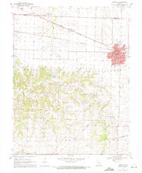 1969 Centralia1971 Print · USGSThe mid-Missouri rail hub of Centralia is captured here at the close of the 1960s as it straddles the Audrain and Boone county line. Researchers can trace the town's growth along the Norfolk and Western tracks or locate landmarks like Sunnydale Academy and Fax West Cem.3 unique versions available
 - 1969 Map of Centralia NE, 1971 Print
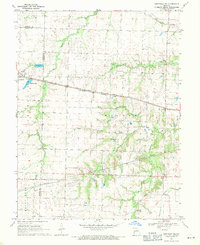 1969 Centralia NE1971 Print · USGSAudrain and Boone counties are captured in the late sixties as rail lines and small-town growth reshaped the rural Missouri landscape. Genealogists can trace family roots through landmarks like Skull Lick Cem, German Cem, and the community at Liberty.
Showing maps 1-25 of 121
Top cities of Audrain County
- Mexico historical maps
- Vandalia historical maps
- Laddonia historical maps
- Farber historical maps
- Martinsburg historical maps
- Rush Hill historical maps
See more
Frequently asked questions
- What are the different types of historical maps available for Audrain County?
- What is the oldest map of Audrain County?
- Where can I purchase historical maps of Audrain County for my home or office?
- Where can I download high-res historical maps of Audrain County?
- Are there historical topographic maps available for Audrain County?
- Is there historical aerial imagery available for Audrain County?
- Where are historical maps of Audrain County sourced from?