1900s (20th Century) Maps of Benton County, Missouri
Explore 61 historic maps of Benton County from the 1900s (20th Century). These maps offer a rare glimpse into what life looked like during the 1900s — showing old roads, neighborhoods, homes, and landmarks that have changed or disappeared over time.
Whether you're researching your family's past, planning a metal detecting trip, or studying how Benton County's landscape evolved across the 1900s, these high-resolution maps are a powerful tool for exploring the history of this region.
- Focus on a specific era: All maps on this page are from the 1900s, giving you a focused view of this time period.
- See what’s changed: Compare century-old streets, trails, and buildings to today's modern landscape using overlays and satellite layers.
- Research with precision: Use these maps for genealogy, historical research, land use analysis, or educational projects.
- View, download, or print: Maps are fully viewable online in high resolution, and can be downloaded or printed for your own records.
Start exploring Benton County's history through authentic maps from the 1900s. This is your window into the past.
Benton County, MO maps
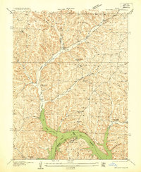
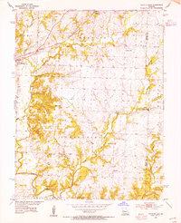
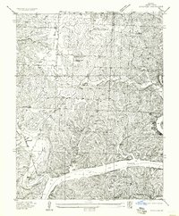
(61)- 1935 Map of Edwards
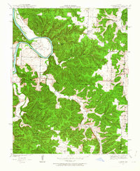
 1935 Edwards1935 Print · USGSBenton County was adjusting to a transformed landscape in the mid-1930s following the creation of the Lake of the Ozarks. Local historians and genealogists can trace the early shoreline at Duckworths Camp or locate rural landmarks like Rock Spring School and Hastain Ch.
 - 1935 Map of Dell
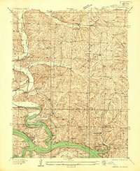
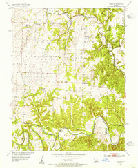
 1935 Dell1935 Print · USGSBenton County was a landscape of river camps and small school districts during the mid-1930s. Genealogists can locate family landmarks like Old Fredonia, White Cem, and rural schoolhouses including Evening Shade School and Lookout School.
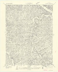
 - 1935 Map of Boylers Mill
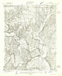
 1935 Boylers Mill1935 Print · USGSThe Morgan and Benton county lines meet here in the 1930s, showing the early impact of the newly formed Lake of the Ozarks. Genealogists can trace family landmarks like the Shiloh Church, Boylers Mill, and several rural one-room schoolhouses.
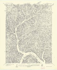
 - 1935 Map of Knobby Creek
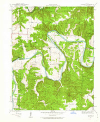
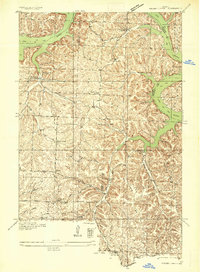 1935 Knobby Creek1935 Print · USGSThe northern Lake of the Ozarks shoreline and its surrounding uplands appear here in the mid-1930s as the reservoir era began. Genealogists can trace rural school districts like Olive Branch School and Nickel Hill School or locate family sites near Dority Cem and Sagrada.2 unique versions available
 - 1936 Map of Shawnee Bend
 1936 Shawnee Bend1936 Print · USGSBenton County was undergoing a massive transformation in the mid-1930s as the newly formed Lake of the Ozarks reshaped the river valleys. Genealogists and local historians can trace family locations near Baugh Cem, the settlement of Racket, and numerous rural schoolhouses like Shawnee Bend Sch.
 - 1936 Map of Lakeview Heights
 1936 Lakeview Heights1936 Print · USGSBenton County landscape during the mid-thirties captures the early shoreline of the Lake of the Ozarks. Researchers can locate several rural landmarks including the Mount Hulda Ch, Mossy Cem, and the vanished Walnut Valley School.2 unique versions available
 - 1936 Map of Schuyler
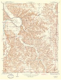
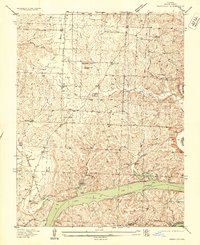 1936 Schuyler1936 Print · USGSBenton County saw a major transformation in the 1930s as the rising waters of the Lake Of The Ozarks reshaped the southern valleys. Genealogists and local historians can trace family locations through numerous rural landmarks like Black Oak Church, Feaster School, and the Bird Cem.
 - 1940 Map of Iconium, 1963 Print
 1940 Iconium1963 Print · USGSNear the bend of the Osage River just before the war, this rural landscape reveals a network of Missouri hollows and prairie lands. Genealogists can trace early homesteads and community hubs like Iconium, Liberty Sch, and the Boy Scout Camp.2 unique versions available
 - 1941 Map of Valhalla, 1963 Print
 1941 Valhalla1963 Print · USGSThe Osage River valley in the early 1940s was a landscape of sharp bends and small riverside outposts. Researchers can trace rural life through family-named landmarks like McGuiness Bend, local gathering spots like the Valhalla Store, and the Peaceful Home Cem.2 unique versions available
 - 1944 Map of Iconium
 1944 Iconium1944 Print · USGSThe Osage River bends through the St. Clair County hills in the early 1940s, revealing a landscape of steep hollows and upland farms. Trace local family roots at Iconium, Corbin Ch, and several rural schoolhouses like Square Prairie Sch.2 unique versions available
 - 1945 Map of Fristoe
 1945 Fristoe1945 Print · USGSBenton and Hickory Counties appear here in the mid-1940s, showing a landscape of Ozark ridges and river bottomlands before major mid-century changes. Researchers can trace ancestral locations through numerous rural schools and river crossings like Evening Shade Sch and Little Mill Creek Ford.3 unique versions available
 - 1945 Map of Valhalla
 1945 Valhalla1945 Print · USGSThe Osage River valley in the mid-1940s is captured here just as rural life began to shift away from old river fords and camp settlements. Genealogists can locate Peaceful Home Cem, Valhalla P O, and family-named schools like Wright Creek Sch.
 - 1947 Map of Jefferson City, 1949 Print
 1947 Jefferson City1949 Print · USGSCentral Missouri and the northern Ozarks come into focus in this late 1940s survey of the river-and-rail landscape. Genealogists and historians can trace the growth of Jefferson City and Sedalia or locate family roots near Bagnell Dam and the Lake of the Ozarks.
 - 1948 Map of Green Ridge
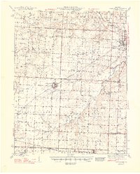 1948 Green Ridge1948 Print · USGSMid-Missouri farming and rail life are preserved here in the late 1940s, centered on the junction of three major railroads. Genealogists can locate dozens of rural landmarks, from the Quisenberry Cem to the one-room Prairie Flower Sch and McKee Chapel.2 unique versions available
 - 1953 Map of Calhoun East, 1955 Print
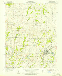
 1953 Calhoun East1955 Print · USGSHenry County and the border of Benton County are captured in the early 1950s, showing a landscape of rural schoolhouses and prairie creek forks. Trace the old Missouri Kansas Texas rail line and find sites like Edgewood Sch, Oak Grove Ch, and Roseland.2 unique versions available
 - 1953 Map of Leesville, 1955 Print
 1953 Leesville1955 Print · USGSHenry and Benton counties come together along the Missouri river bottoms in the early fifties. Genealogists can trace family roots through numerous country schools and chapels, from Hortense Sch and Tebo Ch to the memorably named Tightwad.3 unique versions available
 - 1954 Map of Jefferson City
 1954 Jefferson City1954 Print · USGSCentral Missouri in the early postwar years showcases a landscape defined by the winding Lake of the Ozarks and the state capital at Jefferson City. Researchers can trace the mid-century rail networks of the Missouri Pacific RR and locate rural communities like Tuscumbia, St Elizabeth, and St Anthony.2 unique versions available
 - 1955 Map of Shawnee Bend
 1955 Shawnee Bend1955 Print · USGSBenton County was a land of winding river valleys and ridge-top farmsteads during the mid-thirties and fifties. Genealogists and historians can trace the exact locations of local landmarks like Shawnee Bend Sch, Baugh Cem, and Shady Grove Ch.
 - 1955 Map of Windsor, 1956 Print
 1955 Windsor1956 Print · USGSThe rail junctions and coal mines of Henry County are captured here in the mid-1950s as industry shaped the West Central Missouri landscape. Genealogists and local historians can trace the foundations of Windsor through landmarks like Laurel Oak Cem, the Windsor Fairgrounds, and the rural Sunny Side Sch.2 unique versions available
 - 1955 Map of Jefferson City, 1967 Print
 1955 Jefferson City1967 Print · USGSCentral Missouri in the mid-fifties is defined by the winding Missouri River and the expanding reach of Lake of the Ozarks. Researchers can trace the rail corridors of the Missouri Pacific or locate the early footprint of Whiteman AFB and Jefferson City.4 unique versions available
 - 1957 Map of Schuyler
 1957 Schuyler1957 Print · USGSBenton County was a landscape of small school districts and lakeside communities in the years following the creation of the Lake of the Ozarks. Genealogists can trace family footprints at Pleasant Hill Church, Black Oak Cem, and rural schoolhouses like Fredonia School.
 - 1957 Map of Edwards
 1957 Edwards1957 Print · USGSBenton County in the mid-1930s reveals a landscape of deep hollows and the newly established Lake of the Ozarks shoreline. Researchers can trace the locations of rural schoolhouses like Pleasant Green School and Rock Spring School or follow the path of the original Warsaw Road.
 - 1957 Map of Boylers Mill
 1957 Boylers Mill1957 Print · USGSIn the mid-thirties, this part of the Missouri Ozarks centered on the waters of the newly formed lake and the valleys of Boylers Mill. Genealogists can locate family landmarks like Big Buffalo School, Shiloh Church, and the site of Zachada Ferry.
 - 1958 Map of Jefferson City
 1958 Jefferson City1958 Print · USGSCentral Missouri in the late fifties shows a region transforming through the growth of Whiteman Air Force Base and the Lake of the Ozarks. Researchers can trace rail lines like the Missouri Pacific or find family roots at Enloe Cemetery and Mount Pleasant Cem.
 - 1959 Map of Jefferson City
 1959 Jefferson City1959 Print · USGSCentral Missouri is captured during the mid-fifties as the river economy and rail networks like the Missouri Pacific met the rise of the automobile. Local researchers can trace family landmarks and rural infrastructure from the Lake of the Ozarks up to Providence Cemetery and Knob Noster State Park.
Showing maps 1-25 of 61
Top cities of Benton County
Frequently asked questions
- What are the different types of historical maps available for Benton County?
- What is the oldest map of Benton County?
- Where can I purchase historical maps of Benton County for my home or office?
- Where can I download high-res historical maps of Benton County?
- Are there historical topographic maps available for Benton County?
- Is there historical aerial imagery available for Benton County?
- Where are historical maps of Benton County sourced from?