1900s (20th Century) Maps of Saint Joseph, Missouri
Explore 22 historic maps of Saint Joseph from the 1900s (20th Century). These maps offer a rare glimpse into what life looked like during the 1900s — showing old roads, neighborhoods, homes, and landmarks that have changed or disappeared over time.
Whether you're researching your family's past, planning a metal detecting trip, or studying how Saint Joseph's landscape evolved across the 1900s, these high-resolution maps are a powerful tool for exploring the history of this region.
- Focus on a specific era: All maps on this page are from the 1900s, giving you a focused view of this time period.
- See what’s changed: Compare century-old streets, trails, and buildings to today's modern landscape using overlays and satellite layers.
- Research with precision: Use these maps for genealogy, historical research, land use analysis, or educational projects.
- View, download, or print: Maps are fully viewable online in high resolution, and can be downloaded or printed for your own records.
Start exploring Saint Joseph's history through authentic maps from the 1900s. This is your window into the past.
Saint Joseph, MO maps
(22)- 1923 Map of Clarksdale, 1963 Print
 1923 Clarksdale1963 Print · USGSNorthwest Missouri's agricultural heartland is captured here in the 1920s, when small rail towns and country schools defined the rural landscape. Trace the old rail lines of the CHICAGO ROCK ISLAND AND PACIFIC RR or locate family landmarks like Bedford Chapel and Frogge School.3 unique versions available
 - 1924 Map of St. Joseph, 1960 Print
 1924 St. Joseph1960 Print · USGSNorthwest Missouri is captured in the mid-twenties as the Missouri River defines the landscape near St. Joseph. Genealogists and local historians can trace scores of rural institutions, from the State Hospital and County Farm to family-named landmarks like Old Union Cem and Gee School.2 unique versions available
 - 1925 Map of Gower
 1925 Gower1925 Print · USGSClinton and Buchanan Counties at the mid-twenties are mapped here as a network of rail-side towns and small farm districts. Genealogists can locate dozens of rural landmarks like Matheys Mill, Blinkley Cem, and the many namesake schoolhouses such as Mc Gruhey School.3 unique versions available
 - 1925 Map of Clarksdale
 1925 Clarksdale1925 Print · USGSNorthwest Missouri's river valleys and rail lines are captured here in the mid-1920s at the height of its rural schoolhouse era. Genealogists and historians can trace dozens of family-named landmarks like Bowen Cemetery, Fountain Blue School, and the unique Wire Bridge.2 unique versions available
 - 1926 Map of Saint Joseph
 1926 Saint Joseph1926 Print · USGSNorthwest Missouri thrived as a rail and river hub during the mid-twenties, centered on the growing industrial footprint of St. Joseph and Savannah. Researchers can trace early school districts like Liggett School, locate the historic Old Union Cem, and study the river-bottom landscape of French Bottom.3 unique versions available
 - 1927 Map of Dearborn
 1927 Dearborn1927 Print · USGSNorthwest Missouri thrived as a rail and river hub during the mid-twenties, where the industrial Stockyards of Saint Joseph gave way to a landscape of oxbow lakes. Genealogists can trace family roots through a dense network of rural landmarks, including New Market, De Kalb, and nearly two dozen local schools like Sleepy Hollow School.3 unique versions available
 - 1950 Map of Kansas City
 1950 Kansas City1950 Print · USGSMid-century Kansas and Missouri are captured here during a period of industrial growth and shifting transportation. Genealogists and historians can trace rail lines like the Wabash RR or locate ancestral homes near the Potawatomi Indian Reservation and Horton.
 - 1954 Map of Kansas City
 1954 Kansas City1954 Print · USGSThe Missouri-Kansas borderlands flourished in the post-war era as river commerce and rail networks converged at the Missouri River. Genealogists and historians can trace the foundations of Kansas City and smaller rural hubs like Hiawatha or Sabetha.
 - 1956 Map of Kansas City, 1967 Print
 1956 Kansas City1967 Print · USGSThe Kansas-Missouri border region thrived during the mid-fifties, centered on the growing metropolitan cores and the busy river valleys. Researchers can trace the layout of significant government sites like Fort Leavenworth and the Lake City Army Ammunition Plant.4 unique versions available
 - 1960 Map of Kansas City
 1960 Kansas City1960 Print · USGSMid-century Kansas and Missouri meet at the river forks, showing a sprawling rail-and-river economy during the 1950s growth era. Genealogists and researchers can trace tribal lands like the Kickapoo Indian Reservation or follow the early interstate corridors through Saint Joseph and Independence.3 unique versions available
 - 1961 Map of Halls, 1962 Print
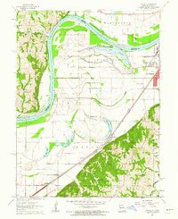 1961 Halls1962 Print · USGSIn the early 1960s, the Missouri River floodplain south of St. Joseph was a network of oxbow lakes and essential rail lines. Genealogists and historians can trace local landmarks like Halls School, Kerrin Cemetery, and the riverfront settlement of Palermo.2 unique versions available
 - 1961 Map of Wathena, 1962 Print
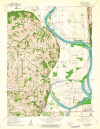 1961 Wathena1962 Print · USGSDoniphan County and the Missouri River bluffs are captured here in the early sixties as the rail-and-river economy transitioned toward modern infrastructure. Genealogists can trace family names at Columbus Cem and Zion Ch or locate schools like Lehman Sch and Gladden Sch.4 unique versions available
 - 1971 Map of St. Joseph South, 1973 Print
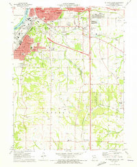 1971 St. Joseph South1973 Print · USGSSouthern Buchanan County comes into focus in the early 1970s as the rail-and-river economy of St. Joseph meets the rural Missouri countryside. Genealogists and local historians can trace family roots at Old Sparta Cem and Mt Pleasant Cem, or locate landmarks like the Shackelford Landing Strip.3 unique versions available
 - 1971 Map of St. Joseph North, 1973 Print
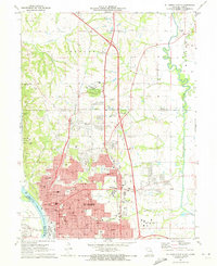 1971 St. Joseph North1973 Print · USGSSt. Joseph and the surrounding Missouri River bluffs are shown in great detail during a period of significant suburban expansion in the early 1970s. Researchers can trace historic cemeteries like Mt Mora Cem and locate local landmarks such as Missouri Western College and Country Club Village.4 unique versions available
 - 1971 Map of Agency, 1973 Print
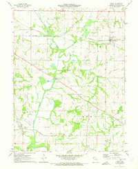 1971 Agency1973 Print · USGSBuchanan County's agricultural and rail heartland is captured here in the early seventies as three major railroads crossed the fertile Platte River valley. Researchers can pinpoint historic family plots like Blakely Cem and trace the paths of the Burlington Northern through Easton.
 - 1980 Map of St. Joseph South, 1981 Print
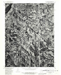 1980 St. Joseph South1981 Print · USGSThe southern fringes of St Joseph and the surrounding Buchanan County farmlands are seen here in the early eighties. Genealogists and local historians can trace the rural landscape around Saxton and Willow Brook or follow the path of Contrary Creek.
 - 1980 Map of Halls, 1981 Print
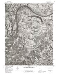 1980 Halls1981 Print · USGSThe Missouri-Kansas borderlands are captured here in the early 1980s, documenting the river's influence on the landscape south of St Joseph. Genealogists and researchers can trace local landmarks like the settlement of Halls and the prominent Lake Contrary.2 unique versions available
 - 1980 Map of Wathena, 1981 Print
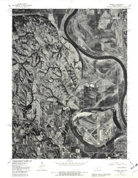 1980 Wathena1981 Print · USGSThe Missouri River floodplain comes into sharp focus during the early 1980s, revealing the complex relationship between the water and the land. Local historians can trace the development of Wathena and Elwwod alongside natural features like Browning Lake.
 - 1980 Map of St. Joseph North, 1981 Print
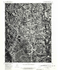 1980 St. Joseph North1981 Print · USGSSt. Joseph's northern reaches and rural Buchanan County are captured in the early eighties as suburban development meets traditional farmland. Trace the winding One Hundred and Two River or locate homes in Country Club Village.
 - 1983 Map of Cosby, 1984 Print
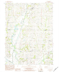 1983 Cosby1984 Print · USGSIn the early 1980s, the rural border between Andrew and Buchanan counties was defined by the winding Platte River and small crossroads communities. Genealogists can locate family burial sites like Oak Ridge Cem and Brown Cem, or trace the path of the Old Railroad Grade.
 - 1986 Map of Saint Joseph
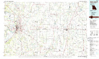 1986 Saint Joseph1986 Print · USGSNorthwest Missouri thrived as a regional transportation and educational hub during the mid-eighties, centered on the historic river city of Saint Joseph. Researchers can locate specific local landmarks like Burlington Cemetery, Pigeon Hill Church, and the winding Pony Express Trail.2 unique versions available
 - 1997 Map of St. Joseph North, 2001 Print
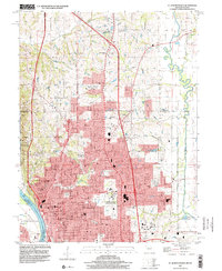 1997 St. Joseph North2001 Print · USGSSt. Joseph's urban core and northern suburbs are captured in the late nineties as the city pushed toward the Andrew County line. Genealogists and historians can trace family plots at Mt Mora Cem or locate institutional landmarks like Missouri Western College and Camp Geiger.
End of results
Showing maps 1-22 of 22
Top cities near Saint Joseph
- Savannah historical maps
- Gower historical maps
- Wathena historical maps
- Elwood historical maps
- Agency historical maps
- Dearborn historical maps
See more
Top neighborhoods of Saint Joseph
- Saxton historical maps
- Kirschner historical maps
- The Hills historical maps
- Mission Woods historical maps
- The Commons historical maps
- Wilshire Place historical maps
See more
Frequently asked questions
- What are the different types of historical maps available for Saint Joseph?
- What is the oldest map of Saint Joseph?
- Where can I purchase historical maps of Saint Joseph for my home or office?
- Where can I download high-res historical maps of Saint Joseph?
- Are there historical topographic maps available for Saint Joseph?
- Is there historical aerial imagery available for Saint Joseph?
- Where are historical maps of Saint Joseph sourced from?