1900s (20th Century) Maps of Carrollton, Missouri
Explore 10 historic maps of Carrollton from the 1900s (20th Century). These maps offer a rare glimpse into what life looked like during the 1900s — showing old roads, neighborhoods, homes, and landmarks that have changed or disappeared over time.
Whether you're researching your family's past, planning a metal detecting trip, or studying how Carrollton's landscape evolved across the 1900s, these high-resolution maps are a powerful tool for exploring the history of this region.
- Focus on a specific era: All maps on this page are from the 1900s, giving you a focused view of this time period.
- See what’s changed: Compare century-old streets, trails, and buildings to today's modern landscape using overlays and satellite layers.
- Research with precision: Use these maps for genealogy, historical research, land use analysis, or educational projects.
- View, download, or print: Maps are fully viewable online in high resolution, and can be downloaded or printed for your own records.
Start exploring Carrollton's history through authentic maps from the 1900s. This is your window into the past.
Carrollton, MO maps
(10)- 1901 Map of Marshall
 1901 Marshall1901 Print · USGSCentral Missouri thrives along the river and rail lines at the turn of the century. Trace the early footprints of Marshall and Slater, or locate long-standing river landings and rural stations like Miami Station, Malta Bend, and Laynesville.5 unique versions available
 - 1951 Map of Carrollton East, 1952 Print
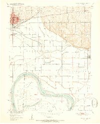 1951 Carrollton East1952 Print · USGSCarroll County at mid-century reveals a landscape defined by the winding Missouri River and a dense network of country schools. Researchers can trace the dual rail lines of the Wabash and Atchison Topeka and Santa Fe near Wakenda and Dietrich Sch.4 unique versions available
 - 1951 Map of Standish, 1952 Print
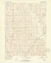 1951 Standish1952 Print · USGSCarroll County was undergoing significant rural changes during the early fifties as old schoolhouses closed and the railroad remained a vital corridor. Genealogists can locate family landmarks like Van Horn Ch, St Marys Cem, and several former school sites such as North Baker Sch.3 unique versions available
 - 1953 Map of Moberly
 1953 Moberly1953 Print · USGSMid-century north-central Missouri is documented here as a bustling intersection of river commerce and heavy rail. Researchers can trace historic family-named landmarks and transport hubs from the Missouri River corridor to the rail yards of Moberly, Chillicothe, and Macon.
 - 1954 Map of Moberly, 1969 Print
 1954 Moberly1969 Print · USGSMid-century Missouri is captured here during a period of transition for its river towns and rail hubs. Genealogists and historians can trace the paths of the Wabash railroad through Moberly or explore the riverside layout of Lexington and Brunswick.3 unique versions available
 - 1956 Map of Carrollton West, 1957 Print
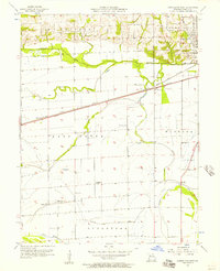 1956 Carrollton West1957 Print · USGSCarroll County in the mid-fifties is seen here as a bustling corridor of rail and agriculture just west of the county seat. Genealogists can locate rural landmarks like Fletcher Sch, Austin Cem, and the small settlement of Sugartree along the sloughs.2 unique versions available
 - 1957 Map of Moberly
 1957 Moberly1957 Print · USGSNorth-central Missouri in the late nineteen-forties and fifties remains a landscape defined by its great rivers and a dense network of steam and diesel rail lines. Genealogists and historians can trace the paths of the Wabash RR and Santa Fe RR through historic junctions like Moberly, Brookfield, and Macon.
 - 1957 Map of Bogard, 1958 Print
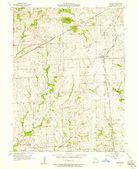 1957 Bogard1958 Print · USGSCarroll County farm country is centered here in the late fifties as the local rail economy begins to shift. Researchers can locate family landmarks like Ebenezer Cem, the village of Mandoville, and the railroad stop at Aalberg Siding.2 unique versions available
 - 1960 Map of Moberly
 1960 Moberly1960 Print · USGSCentral Missouri comes alive in the mid-twentieth century as a bustling network of river towns and significant rail corridors. Genealogists and historians can trace the paths of the Wabash RR through Moberly or explore the riverfronts of Lexington and Brunswick.
 - 1982 Map of Marshall
 1982 Marshall1982 Print · USGSMid-Missouri river life and rail history meet in this early 1980s landscape, centered on the Missouri's winding course. Researchers can trace the historic Santa Fe Trail and explore sites like the Confederate Memorial State Park and Carrollton Mem Cemetery.
End of results
Showing maps 1-10 of 10
Top cities near Carrollton
- Waverly historical maps
- Norborne historical maps
- Wakenda historical maps
- Bosworth historical maps
- Malta Bend historical maps
- Bogard historical maps
See more
Top neighborhoods of Carrollton
Frequently asked questions
- What are the different types of historical maps available for Carrollton?
- What is the oldest map of Carrollton?
- Where can I purchase historical maps of Carrollton for my home or office?
- Where can I download high-res historical maps of Carrollton?
- Are there historical topographic maps available for Carrollton?
- Is there historical aerial imagery available for Carrollton?
- Where are historical maps of Carrollton sourced from?