2020s Maps of Cedar County, Missouri
Explore 17 historic maps of Cedar County from the 2020s. These maps offer a rare glimpse into what life looked like during the 2020s — showing old roads, neighborhoods, homes, and landmarks that have changed or disappeared over time.
Whether you're researching your family's past, planning a metal detecting trip, or studying how Cedar County's landscape evolved across the 2020s, these high-resolution maps are a powerful tool for exploring the history of this region.
- Focus on a specific era: All maps on this page are from the 2020s, giving you a focused view of this time period.
- See what’s changed: Compare century-old streets, trails, and buildings to today's modern landscape using overlays and satellite layers.
- Research with precision: Use these maps for genealogy, historical research, land use analysis, or educational projects.
- View, download, or print: Maps are fully viewable online in high resolution, and can be downloaded or printed for your own records.
Start exploring Cedar County's history through authentic maps from the 2020s. This is your window into the past.
Cedar County, MO maps
(17)- 2021 Map of El Dorado Springs South, 2021 Print
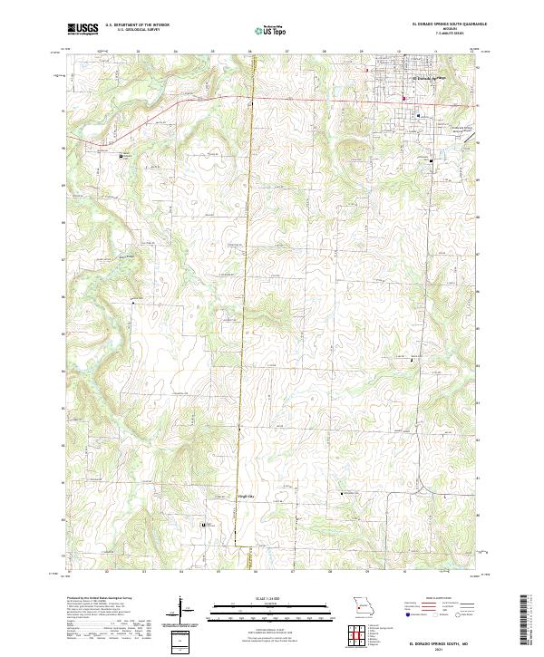 2021 El Dorado Springs South2021 Print · USGSThe Cedar and Vernon County line comes alive in this 2020s study of the southwest Missouri plains. Researchers can trace family history through numerous burial grounds like Virgil City Cem and Whitehall Cem or follow the path of Clear Creek.
 - 2021 Map of Montevallo, 2021 Print
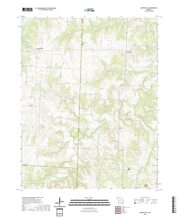 2021 Montevallo2021 Print · USGSThe rural borderlands of Cedar and Vernon Counties come alive in this recent survey of Missouri's prairie-timber transition. Genealogists can locate family landmarks like Walnut Grove Cem and Brasher Cem or trace old routes through Montevallo and Olympia.
 - 2021 Map of Jerico Springs, 2021 Print
 2021 Jerico Springs2021 Print · USGSJerico Springs and its surrounding tri-county borderlands are detailed here in this contemporary look at Cedar, Barton, and Dade counties. Researchers can trace local lineage through numerous sites like Round Prairie Cem, Newport, and Bethlehem Cem.
 - 2021 Map of Stockton, 2021 Print
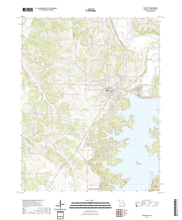 2021 Stockton2021 Print · USGSStockton and the surrounding Cedar County landscape are shown here as the local geography is defined by the winding reaches of Stockton Lake. Researchers can locate historic burial sites like Pankey Cem and Cedar Cem or trace the civic center at the Cedar County Courthouse.
 - 2021 Map of Filley, 2021 Print
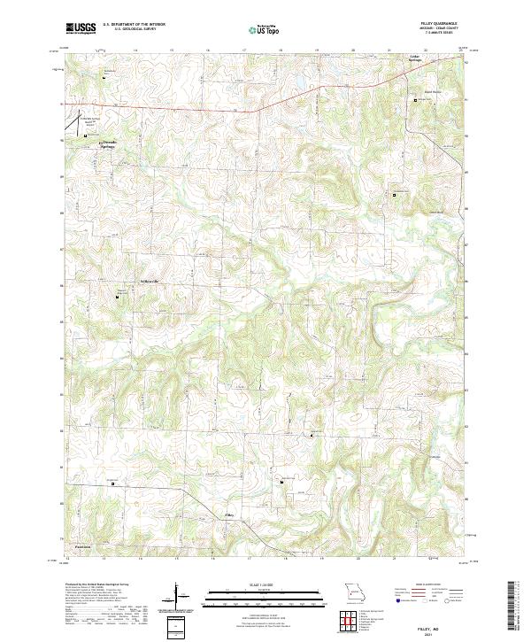 2021 Filley2021 Print · USGSCedar County in the early twenty-first century maintains its rural character through a grid of country roads and small communities. Genealogists can trace family roots through numerous sites like Tennessee Cem, Wright Cem, and the crossing at Ivy Bridge.
 - 2021 Map of Aldrich, 2021 Print
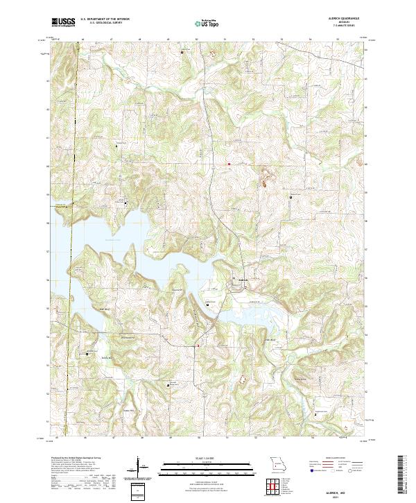 2021 Aldrich2021 Print · USGSThe community of Aldrich and the sprawling waters of Stockton Lake define this part of the Missouri Ozarks in the early 2020s. Genealogists can trace family heritage through numerous rural burial sites like Pleasant Ridge Cem, Trimble Cem, and Henderson Cem.
 - 2021 Map of Wagoner, 2021 Print
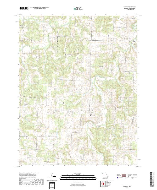 2021 Wagoner2021 Print · USGSCedar County's rural landscape is mapped here in the early twenty-first century, showing a region shaped by winding creeks and family homesteads. Genealogists can trace local history through several burial grounds like Hamby Cem and Wagoner Cem, or locate crossings at Vasser Ford Bridge.
 - 2021 Map of Roscoe, 2021 Print
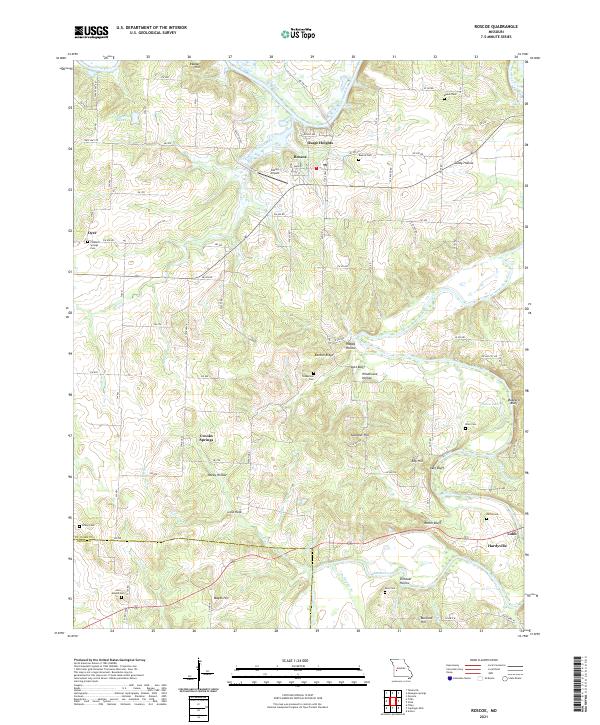 2021 Roscoe2021 Print · USGSThe confluence of the Osage and Sac Rivers in St. Clair and Cedar counties is documented here in the early twenty-first century. Genealogists and local researchers can locate numerous burial sites such as Love Mound Cem and Roscoe Cem, alongside landmarks like Pasley Airport.
 - 2021 Map of Bearcreek, 2021 Print
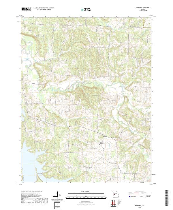 2021 Bearcreek2021 Print · USGSCedar County's rural landscape comes alive in this contemporary survey of the area around the Bearcreek settlement. Researchers can trace family history at the Lindley Prairie Cem or follow the waters of Stockton Lake and the Sac River.
 - 2021 Map of Cedarville, 2021 Print
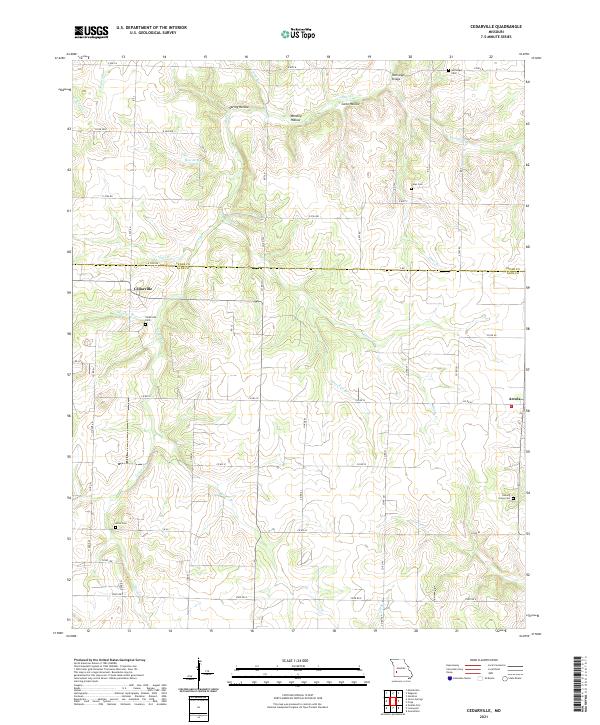 2021 Cedarville2021 Print · USGSThe rural border of Dade and Cedar counties is documented here as it appeared in the early 2020s, centered on the settlements of Cedarville and Arcola. Local historians can trace family roots through numerous sites including Noffsinger Cem, Amos Cem, and the crossing at Noffsinger Bridge.
 - 2021 Map of Arnica, 2021 Print
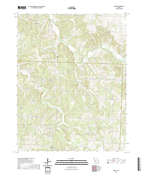 2021 Arnica2021 Print · USGSArnica and the tri-county borderlands of Missouri are captured here in the early twenty-first century, showing a landscape of quiet rural settlements. Genealogists and local historians can locate Sheeks Cem and Simrell Cem or trace the drainage of Turkey Cr and Silver Cr.
 - 2021 Map of Tiffin, 2021 Print
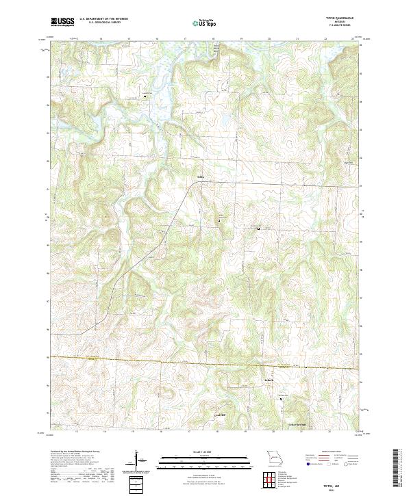 2021 Tiffin2021 Print · USGSThis southwestern Missouri landscape near the border of St. Clair and Cedar Counties was documented during the early 2020s. Researchers can locate long-standing rural community centers like Tiffin and Lebeck, alongside family burial grounds such as Landers Cem and Preston Cem.
 - 2021 Map of Fair Play, 2021 Print
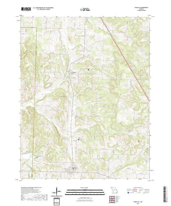 2021 Fair Play2021 Print · USGSThe rural border of Cedar and Polk counties comes into focus in this early 2020s survey. Genealogists and local historians can trace family burial sites at Hopkins Cem and Pickel Cem or follow the waters of Jump Off Cr and Campbell Br.
 - 2021 Map of Caplinger Mills, 2021 Print
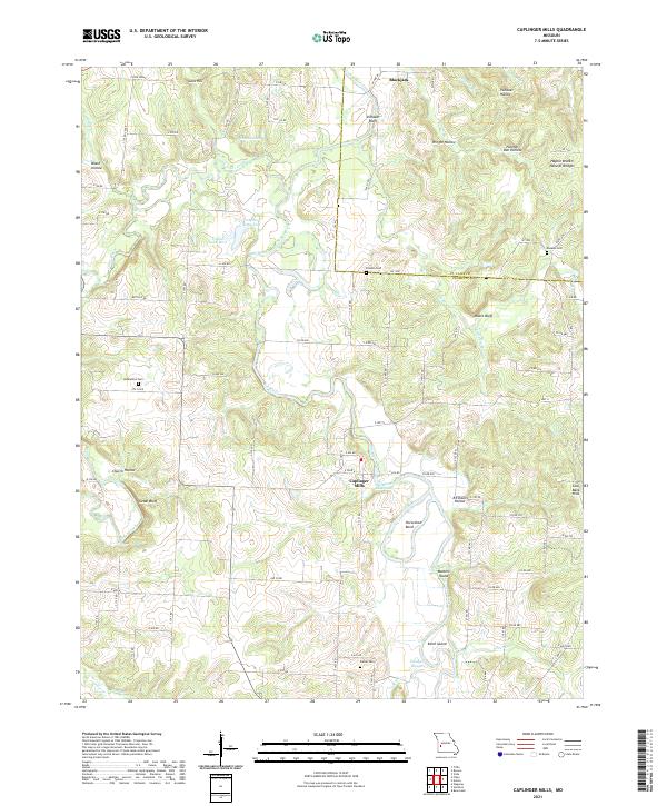 2021 Caplinger Mills2021 Print · USGSThe Cedar and St. Clair County borderlands are captured here in the early 2020s, centered on the riverfront community of Caplinger Mills. Researchers can trace the local landscape through landmarks like Hackleman Cem, Masters Island, and the Haynie Branch Natural Bridges.
 - 2021 Map of Crisp, 2021 Print
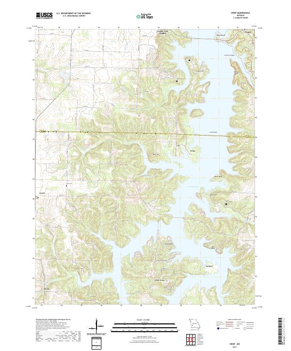 2021 Crisp2021 Print · USGSMissouri's lake country in the Ozark foothills is shown here as it appeared in recent years, where modern water management meets old settlements. Genealogists can locate several family burial grounds, including Acord Cem and Bald Mound Cem, alongside the communities of Arcola and Seybert.
 - 2021 Map of Bona, 2021 Print
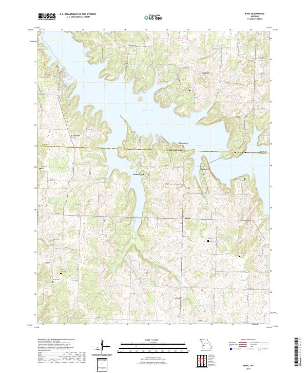 2021 Bona2021 Print · USGSThe northern Ozarks landscape around the Stockton Lake reservoir appears here in the early twenty-first century. Genealogists can trace family footprints across several rural cemeteries including Asbell Cem, Mount Zion Cem, and Devine Cem.
 - 2021 Map of El Dorado Springs North, 2021 Print
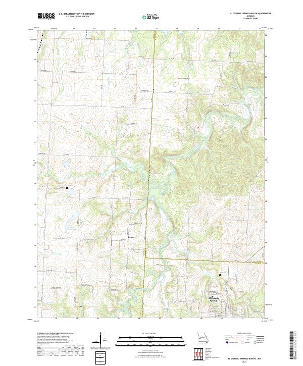 2021 El Dorado Springs North2021 Print · USGSEl Dorado Springs and the surrounding prairie lands of St. Clair and Cedar Counties appear in this modern survey of the Missouri countryside. Genealogists can locate family landmarks such as the Martin Cem, Lefler Cem, and the small settlement of Portia along the creek banks.
End of results
Showing maps 1-17 of 17
Top cities of Cedar County
- El Dorado Springs historical maps
- Stockton historical maps
- Jerico Springs historical maps
- Umber View Heights historical maps
Frequently asked questions
- What are the different types of historical maps available for Cedar County?
- What is the oldest map of Cedar County?
- Where can I purchase historical maps of Cedar County for my home or office?
- Where can I download high-res historical maps of Cedar County?
- Are there historical topographic maps available for Cedar County?
- Is there historical aerial imagery available for Cedar County?
- Where are historical maps of Cedar County sourced from?