1900s (20th Century) Maps of Fremont Hills, Missouri
Explore 11 historic maps of Fremont Hills from the 1900s (20th Century). These maps offer a rare glimpse into what life looked like during the 1900s — showing old roads, neighborhoods, homes, and landmarks that have changed or disappeared over time.
Whether you're researching your family's past, planning a metal detecting trip, or studying how Fremont Hills's landscape evolved across the 1900s, these high-resolution maps are a powerful tool for exploring the history of this region.
- Focus on a specific era: All maps on this page are from the 1900s, giving you a focused view of this time period.
- See what’s changed: Compare century-old streets, trails, and buildings to today's modern landscape using overlays and satellite layers.
- Research with precision: Use these maps for genealogy, historical research, land use analysis, or educational projects.
- View, download, or print: Maps are fully viewable online in high resolution, and can be downloaded or printed for your own records.
Start exploring Fremont Hills's history through authentic maps from the 1900s. This is your window into the past.
Fremont Hills, MO maps
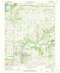
(11)- 1937 Map of Ozark
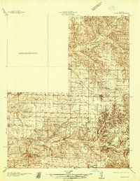 1937 Ozark1937 Print · USGSChristian and Greene Counties are captured here in the mid-1930s, showing a landscape of river-valley farms and small railroad towns. Genealogists can trace family names through dozens of rural landmarks like Roller Cemetery, Riverside Inn, and the Whiteoak Church.
 - 1943 Map of Ozark, 1968 Print
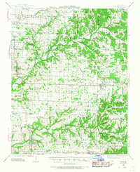 1943 Ozark1968 Print · USGSThe James River valley south of Springfield comes alive in the 1940s, showing a landscape defined by small settlements and the St Louis - San Francisco line. Genealogists can trace family roots at Holland Cem or locate old school sites like Blue Star Sch and Plummer Sch.
 - 1945 Map of Ozark
 1945 Ozark1945 Print · USGSSouth of Springfield in the mid-1940s, this area shows a landscape transitioning from rural farmsteads to modern aviation hubs. Genealogists can trace family names at Holland Cem, Riverside Inn, and numerous school sites like Pedelo Sch.2 unique versions available
 - 1954 Map of Springfield
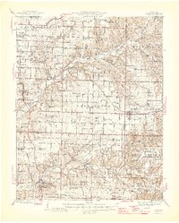
 1954 Springfield1954 Print · USGSThe Missouri Ozarks are captured here during the post-war era, showing the expansion of Springfield and the surrounding river valleys. Genealogists and historians can trace local landmarks like Mount Comfort Cemetery and the Fort Leonard Wood military grounds.6 unique versions available
 - 1958 Map of Springfield
 1958 Springfield1958 Print · USGSThe Missouri Ozarks are captured during the mid-century era of growth, centered on the bustling hub of Springfield. Genealogists and historians can trace family roots through numerous landmarks like Ebenezer Church, Stockton Cem, and the various county courthouses.
 - 1959 Map of Springfield
 1959 Springfield1959 Print · USGSThe Missouri Ozarks are captured here during a decade of postwar growth and increasing highway connectivity. Researchers can trace the legacy of the St Louis-San Francisco RR and locate early sites in Springfield, Lebanon, and Mountain Grove.
 - 1960 Map of Nixa, 1961 Print
 1960 Nixa1961 Print · USGSThe Ozark foothills south of Springfield appear here in the early 1960s as a landscape of rural family cemeteries and creek-side settlements. Genealogists can trace local history through landmarks like Union Chapel, McConnell Cem, and the historic Frazier Bridge.5 unique versions available
 - 1970 Map of Ozark, 1971 Print
 1970 Ozark1971 Print · USGSChristian County at the start of the seventies reveals a landscape where the river-and-rail economy of Ozark meets the karst terrain of the Missouri hills. Trace local family history through numerous burial grounds like Weaver Cem and Pembina Cem, or find landmarks like Smallin Cave and the Drag Strip.3 unique versions available
 - 1979 Map of Nixa, 1981 Print
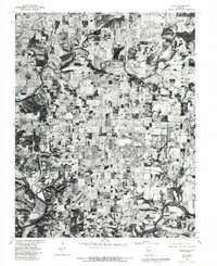 1979 Nixa1981 Print · USGSNixa and the Christian County countryside appear in this late-seventies orthophoto just as suburban growth began to meet traditional Missouri farmland. Genealogists and historians can trace old property lines and the early footprints of Nixa, Battlefield, and the water's edge at Lake Springfield.
 - 1979 Map of Ozark, 1981 Print
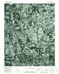 1979 Ozark1981 Print · USGSChristian County, Missouri, at the end of the seventies shows a landscape defined by traditional farming and the emerging growth of Ozark. Genealogists and local historians can trace the property lines and rural crossroads around Mentor, Cassidy, and the banks of Finley Creek.
 - 1982 Map of Springfield, 1983 Print
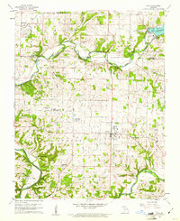
 1982 Springfield1983 Print · USGSSpringfield and the surrounding Ozark plateau are captured in the early eighties as the region balanced urban growth with its agricultural roots. Genealogists and researchers can trace the locations of White Chapel, the State Sanatorium, and older rail stops like Brookline.
End of results
Showing maps 1-11 of 11
Top cities near Fremont Hills
- Springfield historical maps
- Nixa historical maps
- Ozark historical maps
- Republic historical maps
- Willard historical maps
- Battlefield historical maps
See more
Top neighborhoods of Fremont Hills
Frequently asked questions
- What are the different types of historical maps available for Fremont Hills?
- What is the oldest map of Fremont Hills?
- Where can I purchase historical maps of Fremont Hills for my home or office?
- Where can I download high-res historical maps of Fremont Hills?
- Are there historical topographic maps available for Fremont Hills?
- Is there historical aerial imagery available for Fremont Hills?
- Where are historical maps of Fremont Hills sourced from?